
| Area | Caspar Creek |
| Topic | Sediment: V* from NF Caspar above the weir, 1992 |
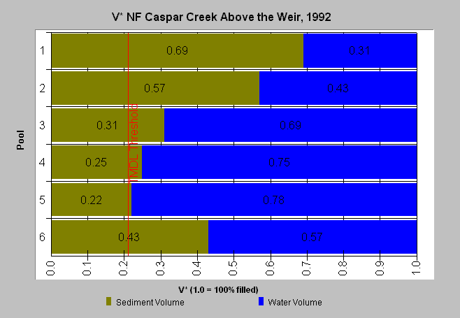
| Caption: This chart shows Knopp's (1993) individual pool V* values which have a weighted average value (V*w) of 0.4. In the preceding year, Redwood Sciences Lab researchers expressed V*w as 0.25, and in the following year 0.33. Values from Knopp (1993). V* is in decimal percent. A V* of 0.5 indicates that half of the pool is filled with fine sediment. See Info Links for more information. Click Picture tab to see the location of fifteen V* study sites from within Hydrologic Unit 13 near the Big River. Data provided by the North Coast Regional Water Quality Control Board. | |
 |
To learn more about this topic click here .
To view the table with the chart's data, click Chart Table web page.
To download the table with the chart's data, click vstar_nfcaspar_above.dbf (size 672 bytes) .
To see meta information about the data table used for this topic click here
To view the table with the chart's source data, click Source Table web page.
To download the table with the chart's source data, click knopp.dbf (size 12,582 bytes)
| www.krisweb.com |