
| Area | Caspar Creek |
| Topic | Sediment: V* from Caspar Cr and nearby streams, 1993 |
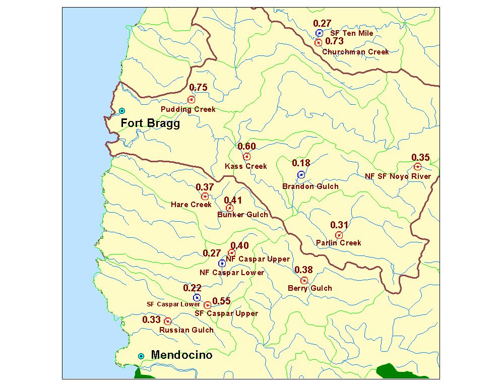
The map above shows fifteen V* study sites from within Hydrologic Unit 13 near the Big River. Knopp (1993) collected data on the amount of fine sediment in pools, pebble counts, large wood and pool frequency statistics for 60 north coast streams. V* values are shown in decimal percent (0.27 = 27% of the residual pool is filled with fine sediment). Blue bulls-eyes are for sites below the TMDL threshold of 0.27, while red bulls-eyes are for sites above the TMDL threshold.
 Click on image to enlarge (151K).
To learn more about this topic click here
| www.krisweb.com |