| Area |
Caspar Creek |
| Topic |
USFS VegTypes: Casper Cr CalWater 1994 |
 Click on image to enlarge (124K). Click here to display a larger version (428K).
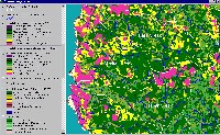
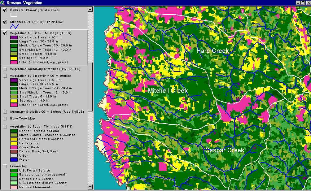
The image above shows USFS vegetation stand types for the Caspar Creek Calwater planning watershed based on a 1994 Landsat image. The stand types are only accurate at the one-hectare scale. Large patches of upper North Fork Caspar Creek show as Non-Forest and Saplings (<5" diameter trees) as a result of recent clear cuts. Medium-Large Trees (20-29.9") occur in large patches along the South Fork and north side of lower Caspar Creek. Patches of young forest show as Small and Small/Medium trees. See Info Links for more information. Taken from the KRIS Big River Map project.
To learn more about this topic click here

 Click on image to enlarge (124K). Click here to display a larger version (428K).
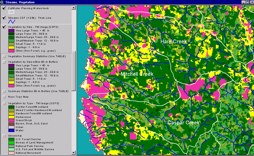