
| Area | Coastal Tribs |
| Topic | Habitat: Maximum Pool Depth for Surveyed Coastal Tributaries |
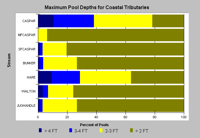
| Caption: The above chart shows the percent of pools by maximum pool depth for each stream in coastal tributaries for which this type of data were available. Maximum pool depth was not always reported in stream reports. Data provided by California Department of Fish and Game, Sacramento. Click on Info Links for more information. | |
 |
To learn more about this topic click here .
To view the table with the chart's data, click Chart Table web page.
To download the table with the chart's data, click dfg_ct_pdpth.dbf (size 4,033 bytes) .
To see meta information about the data table used for this topic click here
To view the table with the chart's source data, click Source Table web page.
To download the table with the chart's source data, click habraw_big.dbf (size 5,051,928 bytes)
| www.krisweb.com |