
| Area | Coastal Tribs |
| Topic | Maps of Coastal Tribs Basin |
The image above shows the Caspar Creek KRIS sub-basin as well as those for Hare Creek and adjacent coastal tributaries in shaded relief showing elevation. Caspar and Hare have some rolling hills to the east that rise to over 300 meters or 1000 feet. From the KRIS Big River Map project.
This image from the KRIS Big River Map project shows USFS vegetation and stand types for the coastal watersheds derived from a 1994 Landsat (see USFS VegType Topics for more information). Non-Forest and Saplings in the eastern portion of the Caspar Creek basin are associated with recent timber harvest. Non Forest components in the western part of other basins are the grassy coastal marine terrace and rural residential development. Scale of accuracy for stands is one hectare.
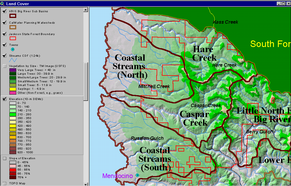
The image above is a map of Caspar Creek and adjacent watersheds showing slopes of 45% and over on a USGS Topo backdrop. Most of the western basin is flat coastal, marine terrace but slopes increase in the hills to the east. Increased slope can also be seen in inner gorge areas immediately above Caspar and Hare Creeks as well as Russian Gulch. Derived from 10 meter DEMs.
The image above is from the EPA Land Cover project, which is included in the KRIS Big River Map project. Patches of mixed forest and shrubland in NF Caspar Creek and in Hare Creek reflect early seral conditions after timber harvest. This cover is particularly focused on urban impacts and areas of increasing rural density are showing as low intensity residential in Hare Creek and the Mitchell Creek CalWater.
The image above comes from the KRIS Big River Map project and shows timber harvests as mapped by the California Department of Forestry by year from 1986 to 1999. Timber harvest have occurred in upper and lower Caspar Creek within Jackson Demonstration State Forest and west of the JDSF boundary in the riparian of lower Caspar Creek as well as in upper Hare Creek and lower Russian Gulch on private land.
The image above comes from the KRIS Big River Map project and shows changes in vegetation between 1994 and 1998 according to CDF FRAP change scene detection. Patches clear cut in the late 1980s and early 1990s in the North Fork Caspar Creek showed increases in canopy cover while upper Hare Creek showed a decrease in canopy. Smaller patches in the Mitchell Creek CalWater and in the west of Hare Creek are likely related to increasing development and urbanization.
The image above is a map of Caspar and Hare Creek and adjacent watersheds showing slopes of with varying classes of risk of shallow debris slides. Most of the western basins are gently flat coastal terraces with no risk but the hills to the east are sufficiently steep to show substantial risk of shallow landslides. Steep areas next to streams, known as inner gorges, also show high risk.
The image above shows the tree size class and vegetation types of riparian zones within 90 meters of streams in the Caspar Creek and Hare Creek sub-basins as well as adjacent watersheds. Non-Forest conditions right at the mouths of streams is where they pass through the grassy coastal plain. Riparian zones in Caspar Creek and Hare Creek show mostly maturing, larger diameter trees but there are patches in the North Fork Caspar and on tribs to Hare that show Non Forest and Sapling components as a result of logging activity. Although these areas may have slow recruitment rates for large wood, they are unlikely to be negatively effected by temperature because the entire watersheds lie within the coastal fog belt.
 Click on image to enlarge (169K).
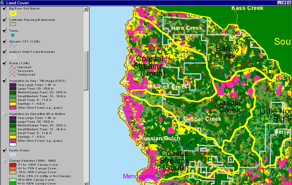 Click on image to enlarge (101K).
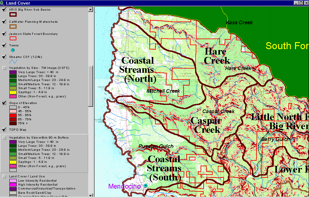 Click on image to enlarge (222K).
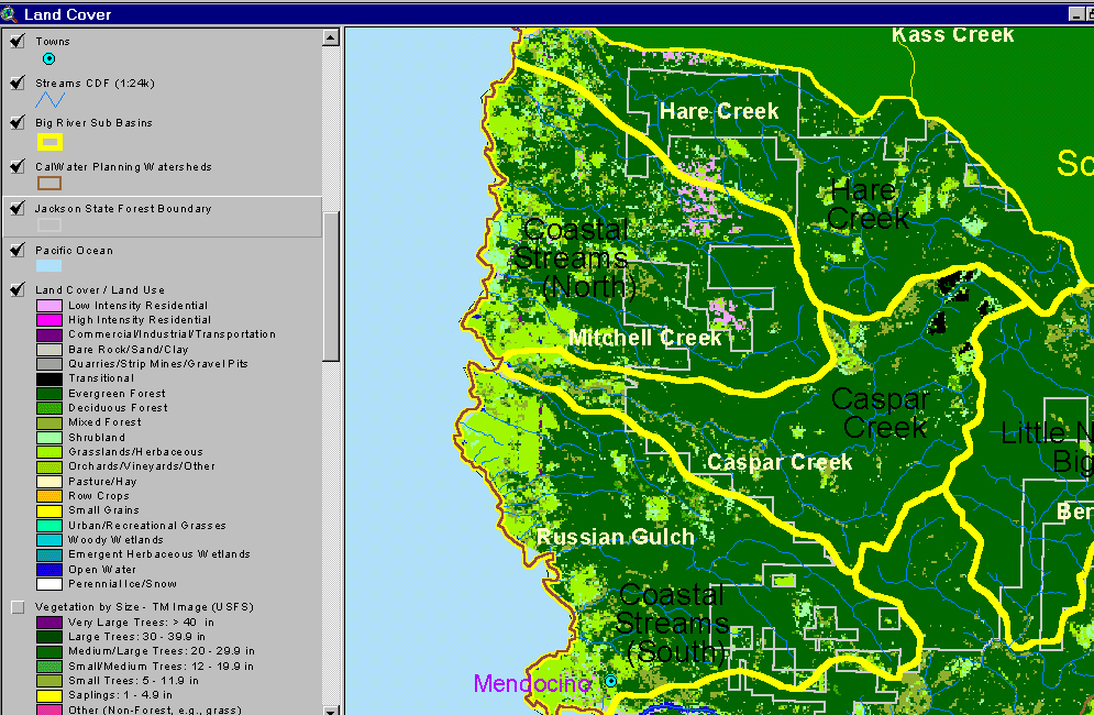 Click on image to enlarge (75K).
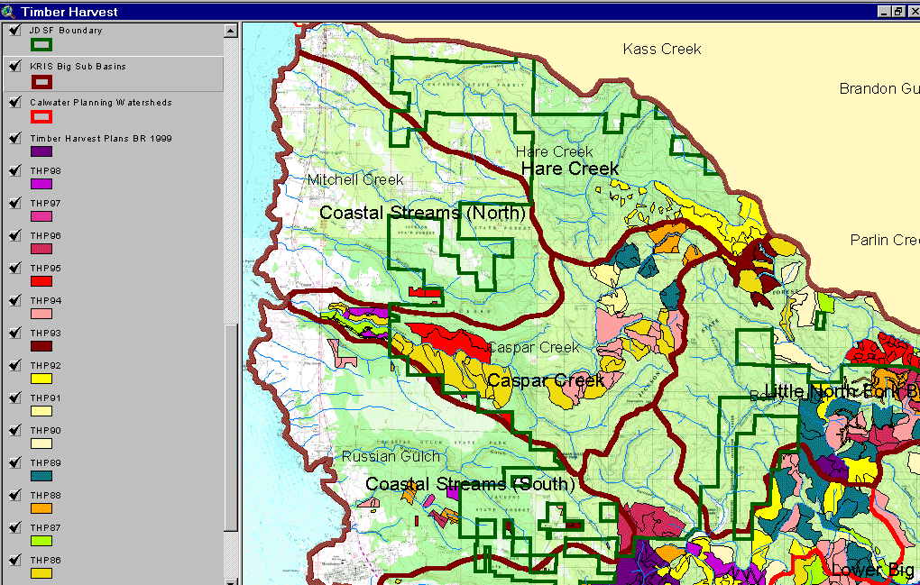 Click on image to enlarge (206K).
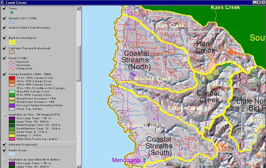 Click on image to enlarge (134K).
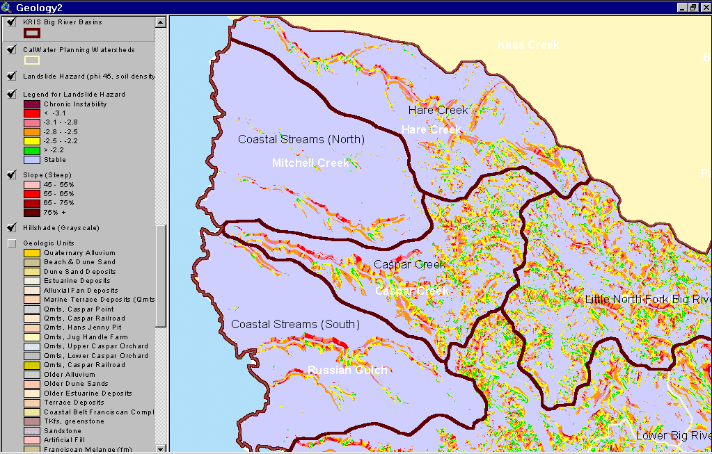 Click on image to enlarge (85K).
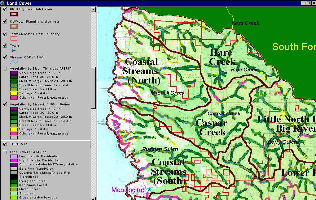 Click on image to enlarge (203K).
To learn more about this topic click here
| www.krisweb.com |