
| Area | Coastal Tribs |
| Topic | Timber Harvest: KRIS Map Image Coastal Tribs Sub-basin |
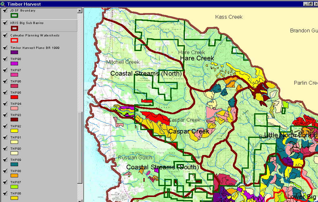
The image above comes from the KRIS Big River Map project and shows timber harvests as mapped by the California Department of Forestry by silvicultural type from 1986 to 1999. Only one timber harvest occurred in the Mitchell Creek Calwater but several have taken place in the Russian Gulch Calwater to the south, Although timber harvest may not be rapid in these basins, change scene detection indicates that sub-urbanization may be leading to land clearance (see next Picture).
The image above comes from the KRIS Big River Map project and shows changes in vegetation between 1994 and 1998 according to CDF FRAP change scene detection. Patches clear cut in the late 1980s and early 1990s in the North Fork Caspar Creek showed increases in canopy cover while upper Hare Creek showed a decrease in canopy. Smaller patches in the Mitchell Creek CalWater and in the west of Hare Creek are likely related to increasing development and urbanization.
 Click on image to enlarge (206K).
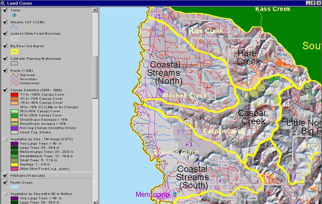 Click on image to enlarge (134K).
To learn more about this topic click here
| www.krisweb.com |