
| Area | Lower Big River |
| Topic | Maps of Lower Big River Basin |
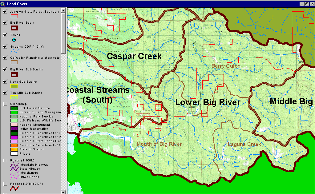
The image above shows the location of the Lower Big River sub-basin and the CalWater units which comprise it. From the KRIS Big River Map project.
This image from the KRIS Big River Map project shows USFS vegetation and stand types for the Lower Big River watershed derived from a 1994 Landsat (see USFS VegType Topics for more information). Non-Forest and Saplings in this basin are mostly associated with recent timber harvest. Scale of accuracy for stands is one hectare.
The image above comes from the KRIS Big River Map project and shows timber harvests as mapped by the California Department of Forestry by year from 1986-1999. The Lower Big River watershed has been logged intensively since 1986.
The image above is from the EPA Land Cover project, which is included in the KRIS Big River Map project. Patches of mixed forest and shrubland disbursed throughout the Lower Big River watershed reflect early seral conditions after timber harvest. Jackson Demonstration State Forest's boundary is shown in red with more contiguous evergreen forest within its boundaries reflecting less harvest than on adjacent private lands. The green areas outside of the Big River Watershed are not part of the EPA Landsat image but are masks for surrounding basins.
The image above from the KRIS Big River Map project shows slopes in the Lower Big River sub-basin. The primary steep areas in the watershed are in inner gorge areas above streams.
The image above comes from the KRIS Big River Map project and shows changes in vegetation between 1994 and 1998 according to CDF FRAP change scene detection. Reductions of vegetation associated with timber harvest show in the eastern part of the Berry Gulch and in patches within the Laguna Creek and Mouth of the Big planning areas as well. The green area showing outside of the Big River Watershed are masks for surrounding basins.
This image, from the KRIS Big River Map project, shows USFS vegetation and stand types within 90-meters buffers surrounding the Lower Big River sub-basin tributaries. Derived from a 1994 Landsat image (see USFS VegType Topics for more information).
This figure shows geological units mapped by California Department of Conservation, Division of Mines and Geology and stream gradients in percent. The eastern portion of the Lower Big River is dominated by the Coastal Belt Franciscan Complex, while the western portion is more recent Quaternary alluvium and marine deposits. Taken from the KRIS Big River Map project.
 Click on image to enlarge (231K).
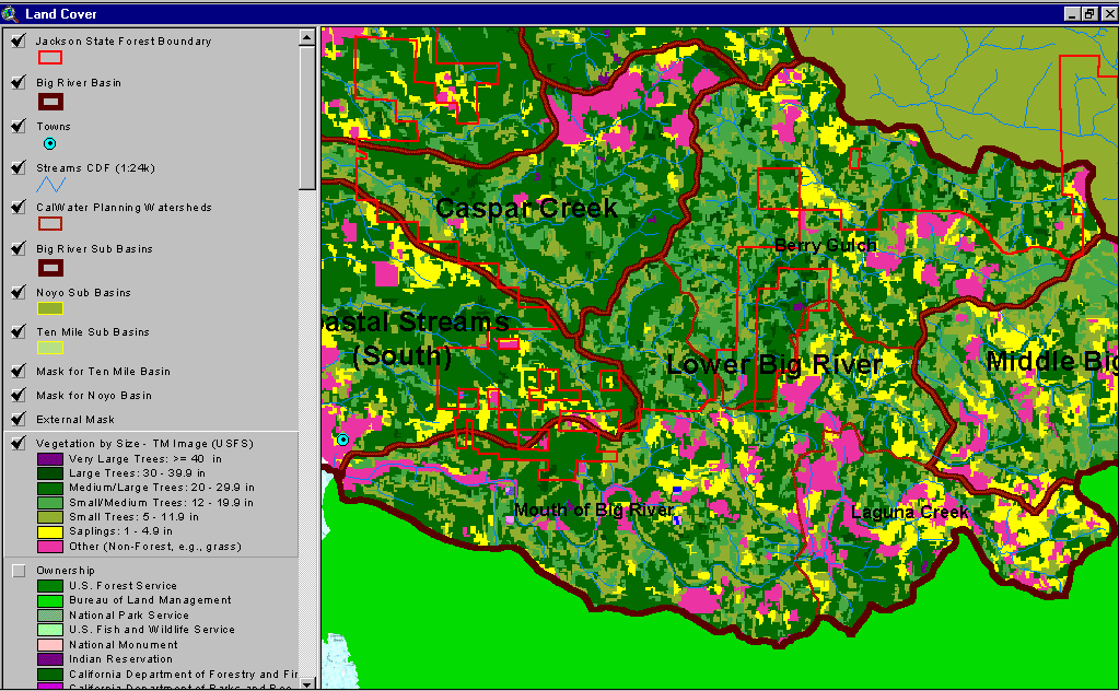 Click on image to enlarge (88K).
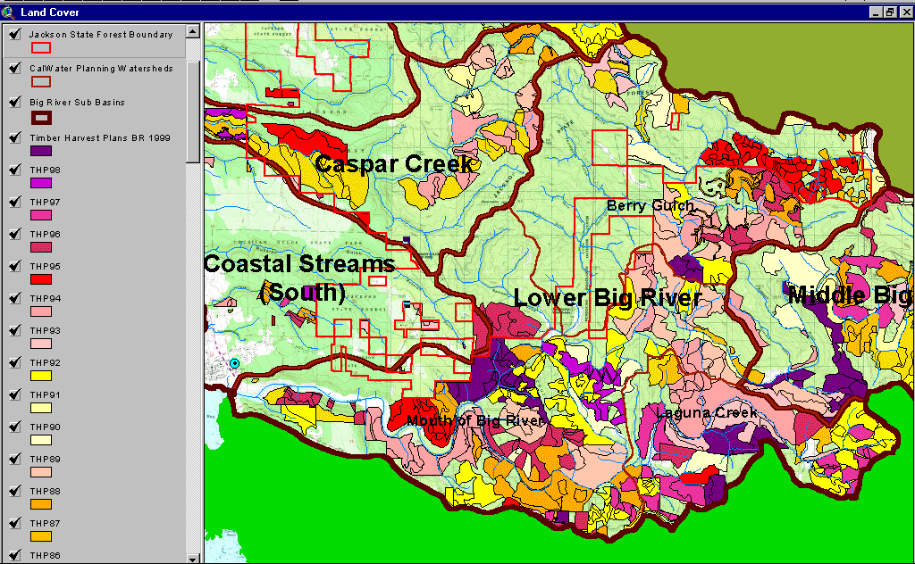 Click on image to enlarge (192K).
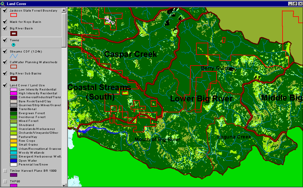 Click on image to enlarge (77K).
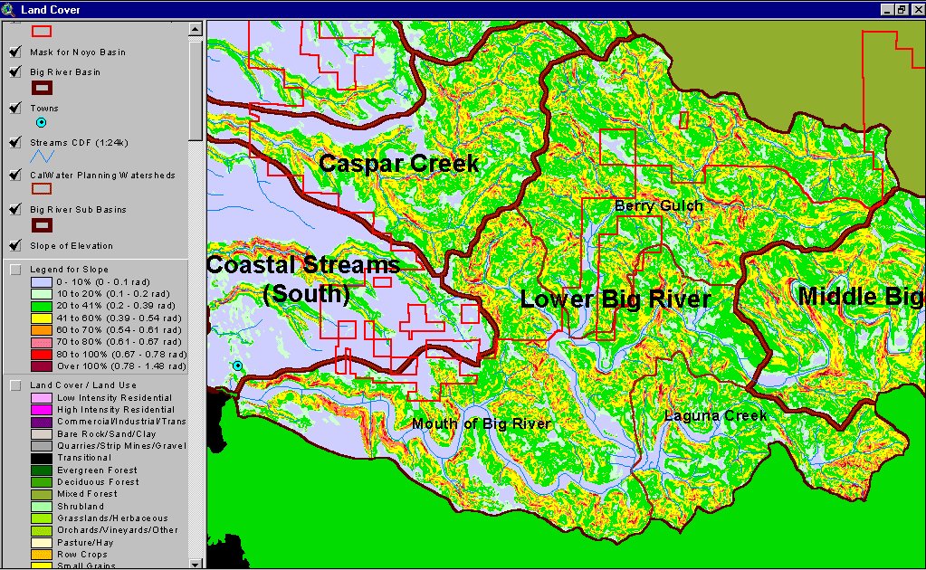 Click on image to enlarge (116K).
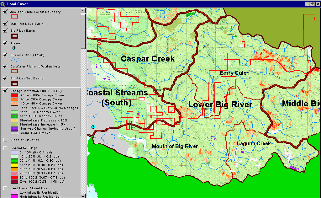 Click on image to enlarge (209K).
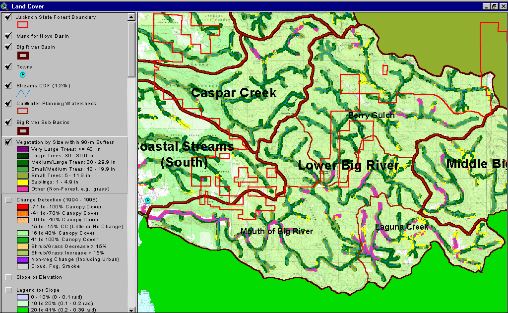 Click on image to enlarge (192K).
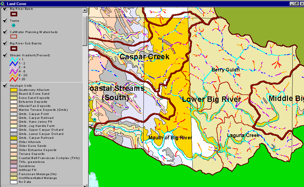 Click on image to enlarge (64K).
To learn more about this topic click here
| www.krisweb.com |