| Area |
Lower Big River |
| Topic |
Sediment: Matthews Road Locations & Types for the Little NF 2000 |
 Click on image to enlarge (86K). Click here to display a larger version (160K).
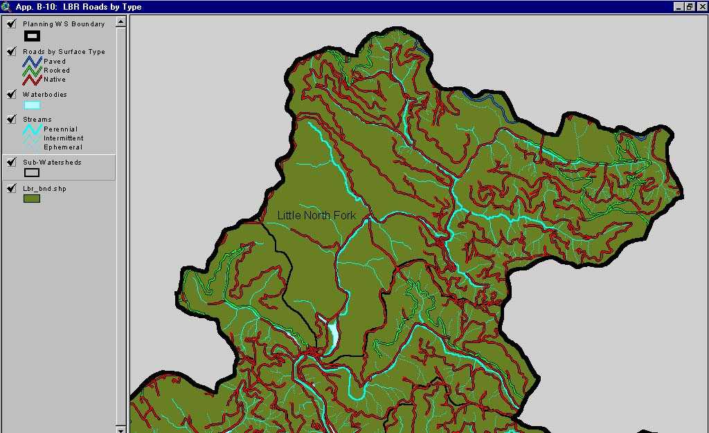
This image, from Matthews and Associates (2001) Appendix B-15, shows road surface type in the Lower Big River Planning Watershed. The Lower Big River Planning Watershed is the western portion of the Lower Big River CalWater sub-basin and also contains the Little North Fork CalWater sub-basin.
To learn more about this topic click here

 Click on image to enlarge (86K). Click here to display a larger version (160K).
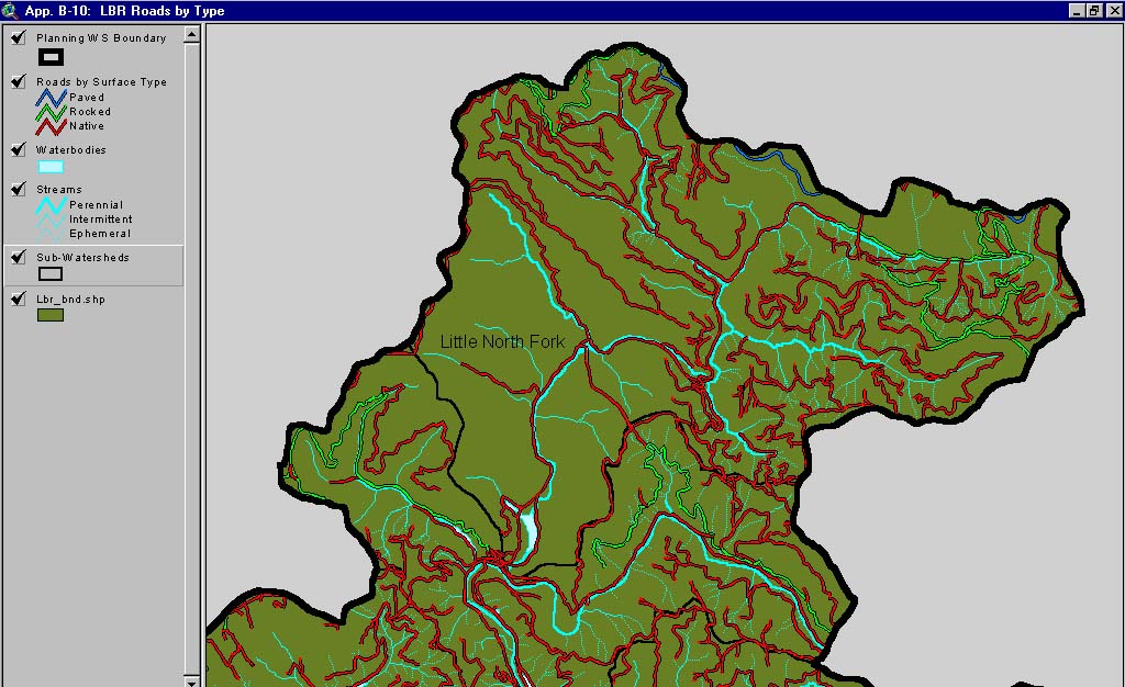