
| Area | Lower Big River |
| Topic | Timber Harvest: KRIS Map Image Lower Big River Sub Basin |
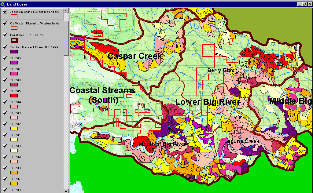
The image above comes from the KRIS Big River Map project and shows timber harvests as mapped by the California Department of Forestry by year from 1986-1999. Much of the Lower Big River sub-basin was logged between 1986 and 1999. Logging has been conducted on both private lands and Jackson Demonstration State Forest with the basin. Mendocino Woodlands lies within the Little North Fork watershed (Berry Gulch Calwater) and represents a substantial portion of the unlogged portion of the basin.
 Click on image to enlarge (192K).
To learn more about this topic click here
| www.krisweb.com |