| Area |
Lower Big River |
| Topic |
Tour: Contemporary Aerial Photos (Mendocino/Lower River) #1 |
 Click on image to enlarge (106K). Click here to display a larger version (191K).
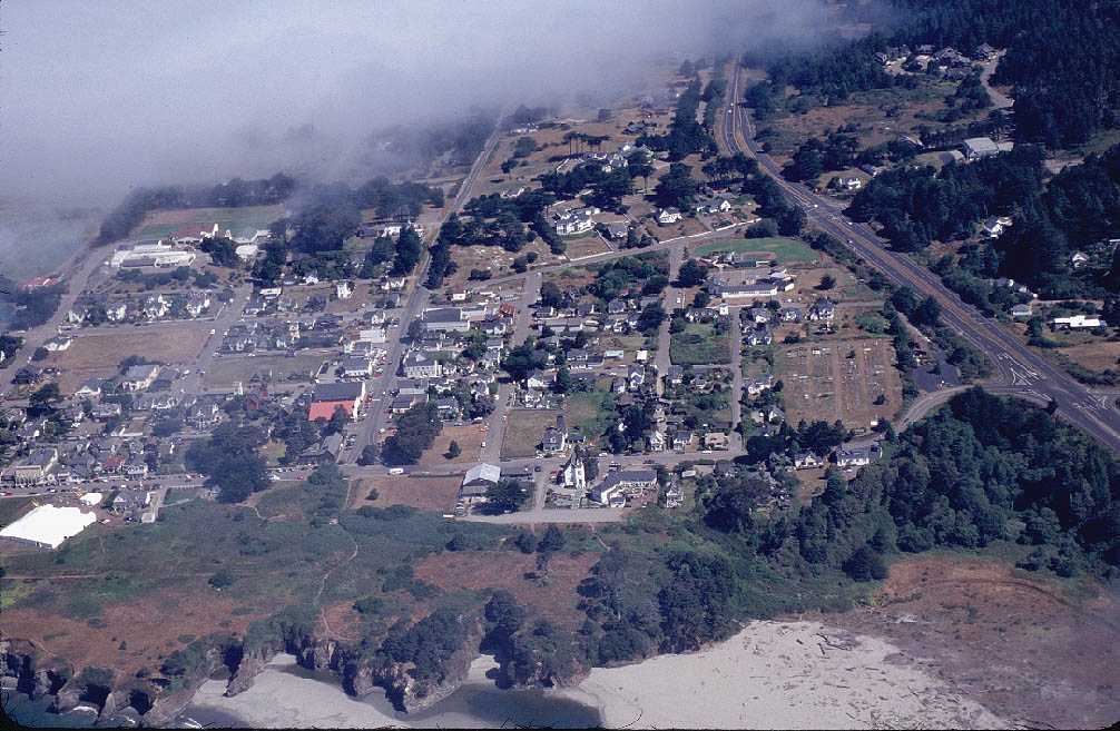
This photo shows the summer fog breaking up over the town of Mendocino. The edge of the Big River estuary is barely visible at lower center of the image, as is the ocean at lower left. Photo by David Russell.
 Click on image to enlarge (130K).
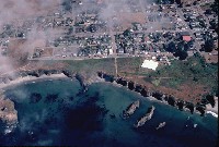
Wisps of fog hover over the town of Mendocino. The large white tent is set up for the Mendocino Music Festival. Water clarity in the ocean appears excellent on the day that the photo was taken. By David Russell.
 Click on image to enlarge (103K). Click here to display a larger version (181K).
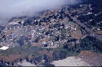
This photo shows the summer fog breaking up over the town of Mendocino. The Big River estuary is at lower center of the photo spilling into the Pacific at left. Photo by David Russell.
 Click on image to enlarge (92K).
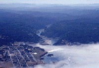
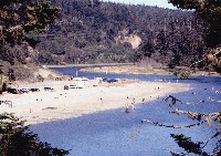
Looking east into the Big River watershed with the town of Mendocino in the foreground. The entire lower river visible in the center of the photo is estuarine. The Big River State Beach extends upstream of Highway 1. Photo by David Russell.
 Click on image to enlarge (103K). Click here to display a larger version (266K).
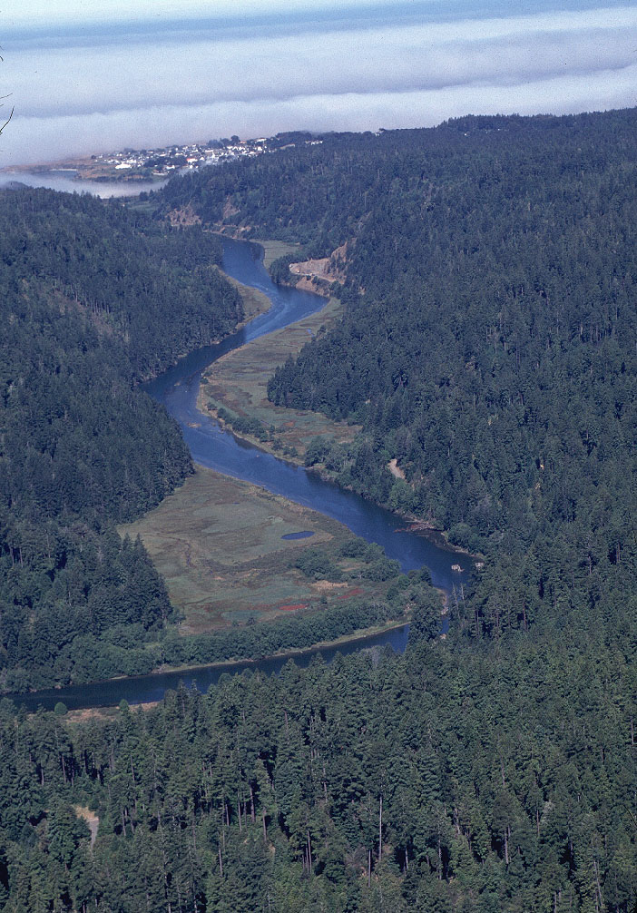
Looking west down the estuary of Big River with the town of Mendocino just appearing from beneath the morning fog. Photo by David Russell.
 Click on image to enlarge (100K). Click here to display a larger version (260K).
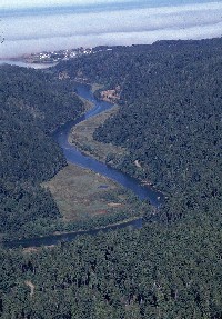
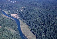
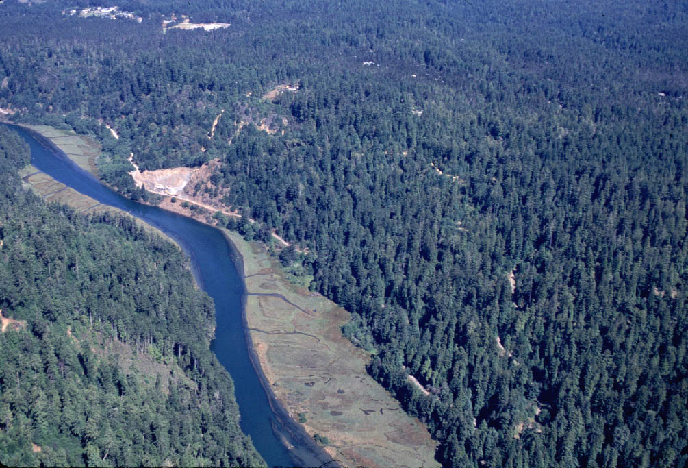
Lower Big River looking upstream to the east, still in the zone of tidal influence. Near the center of the photo on the left of the river is a gravel quarry, which shows up in the next photo. Photo by David Russell.
 Click on image to enlarge (111K). Click here to display a larger version (197K).
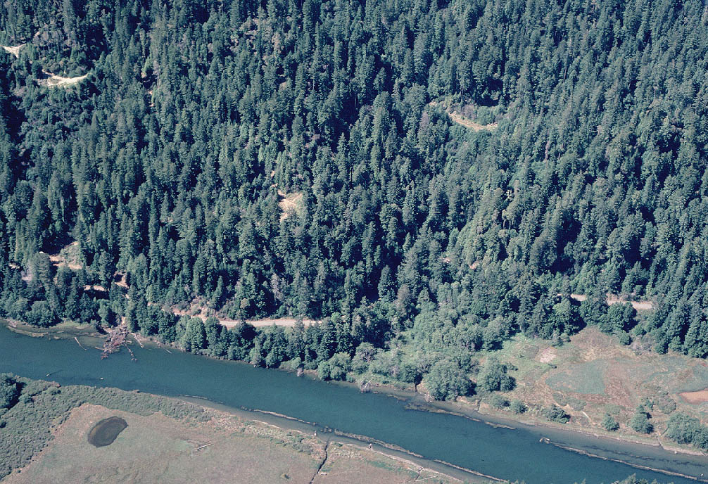
Close up of lower Big River reach looking downstream. The tidally influenced flats are partially submerged during summer but would be completely covered by water during high flows in winter. Photo by David Russell.
 Click on image to enlarge (163K). Click here to display a larger version (295K).
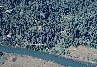
Close up of lower Big River reach showing marsh areas in the lower portion of the photo. A logging haul road can be seen in the riparian zone of the far bank. Forests in the picture appear to be young. Photo by David Russell.
To learn more about this topic click here

 Click on image to enlarge (106K). Click here to display a larger version (191K).
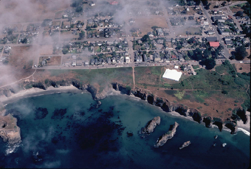 Click on image to enlarge (130K).
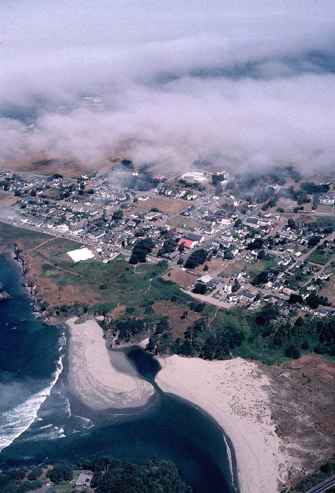 Click on image to enlarge (103K). Click here to display a larger version (181K).
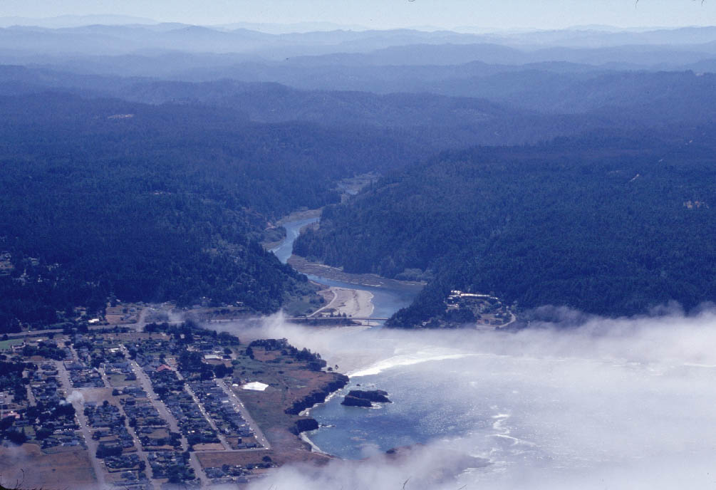 Click on image to enlarge (92K).
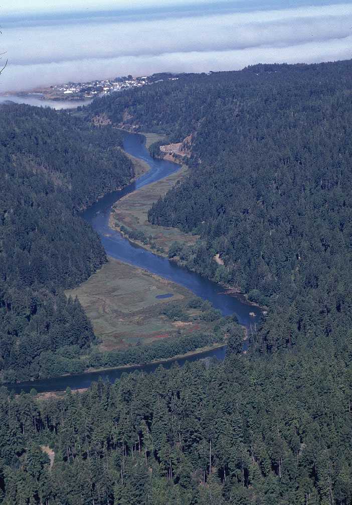 Click on image to enlarge (103K). Click here to display a larger version (266K).
 Click on image to enlarge (100K). Click here to display a larger version (260K).
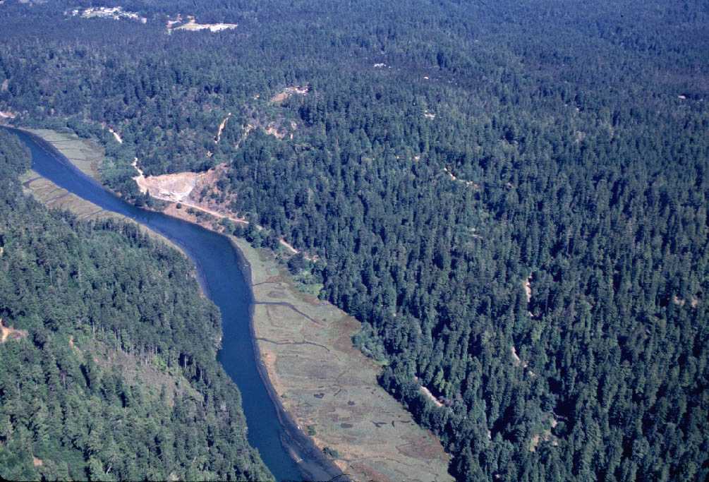 Click on image to enlarge (111K). Click here to display a larger version (197K).
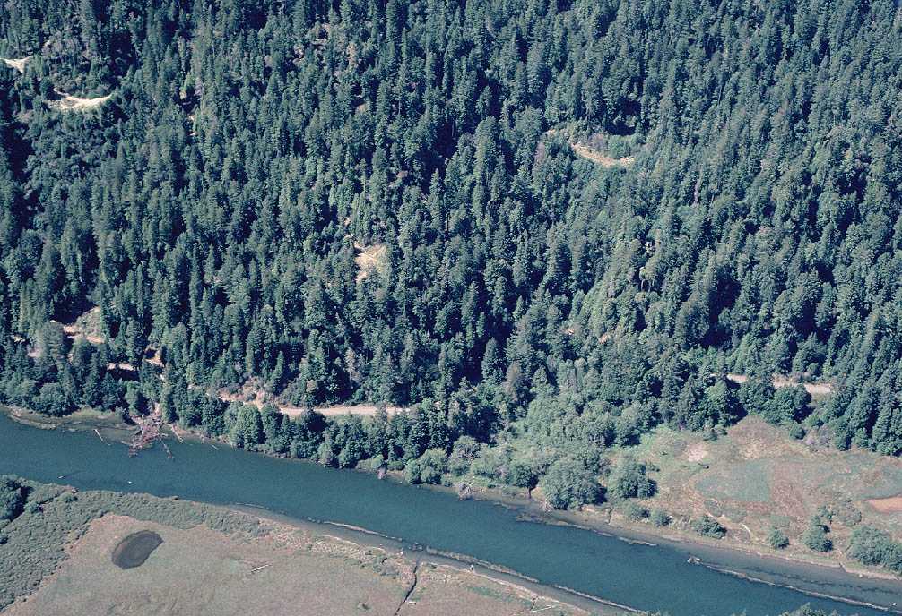 Click on image to enlarge (163K). Click here to display a larger version (295K).
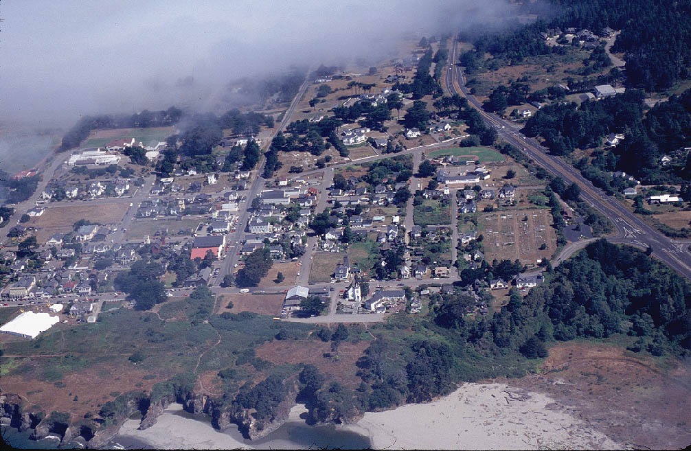