| Area |
Lower Big River |
| Topic |
Tour: Contemporary Aerial Photos Lower River #2 |
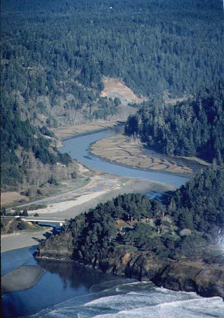
 Click on image to enlarge (72K). Click here to display a larger version (511K).
Looking east at the mouth of Big River with the Highway 1 Bridge visible at lower left. Tidal flats are clearly in evidence adjacent to the river (see Picture #3 and #4 for close ups). By Rixanne Wehren.
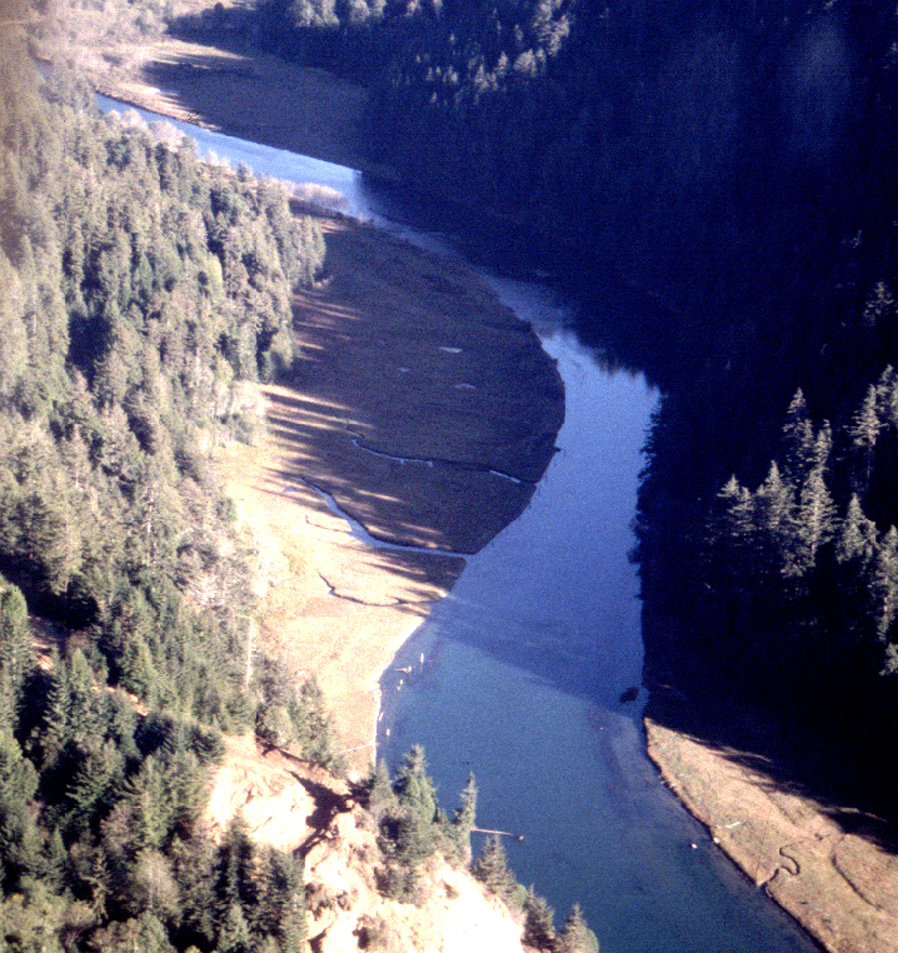
 Click on image to enlarge (99K). Click here to display a larger version (264K).
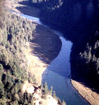
This aerial photo shows lower Big River, still in the zone of tidal influence, looking downstream. Photo courtesy of Rixanne Wehren.
 Click on image to enlarge (113K). Click here to display a larger version (309K).
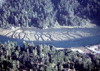
Tidal flats just up from the mouth of Big River show branched patterns as a result of tidal flux. Photo by Rixanne Wehren.
 Click on image to enlarge (78K). Click here to display a larger version (206K).
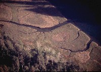
Close up of tidal marsh in the lower Big River from the air. Photo by Rixanne Wehren.
 Click on image to enlarge (77K). Click here to display a larger version (539K).
Tidal flats on lower Big River, similar to Picture #4 but from a slightly higher altitude. Photo by Rixanne Wehren.
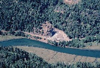
 Click on image to enlarge (106K). Click here to display a larger version (186K).
Looking north across the lower Big River with the gravel quarry visible at upper right, as are tidal flats on the far bank. Upstream is to the right. Photo by David Russell.
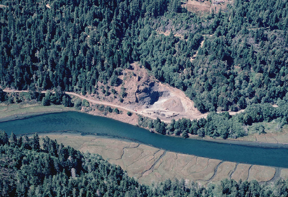
 Click on image to enlarge (156K). Click here to display a larger version (283K).
Close up of gravel quarry looking north across lower Big River. Trees above the quarry look very young, and the track of an old debris torrent shows below the road at upper right in the photo. Picture by Russell Davis. See Picture #8 for the same location during a different season. Photo by David Russell.
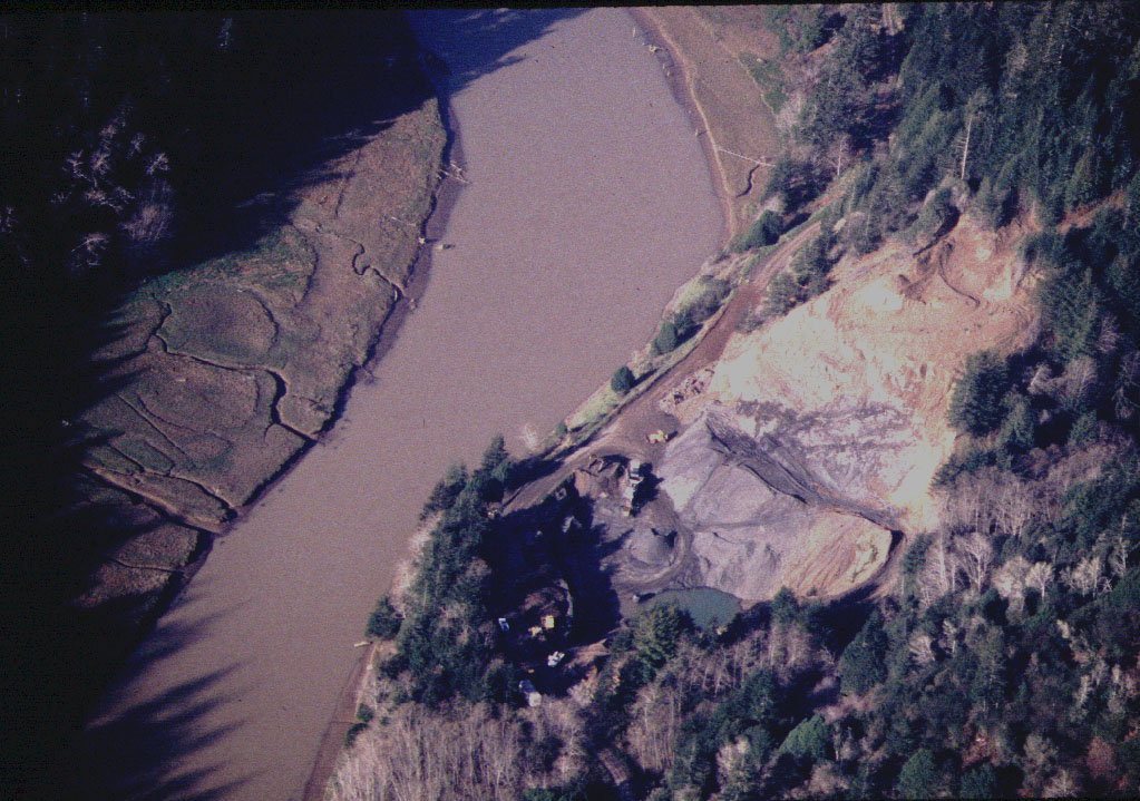
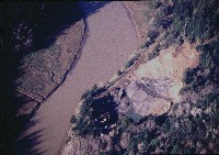 Click on image to enlarge (76K). Click here to display a larger version (223K).
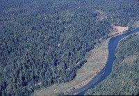
This photo shows the lower Big River and gravel quarry from directly overhead during winter in March 1998. Note that the river is highly turbid. Photo by Rixanne Wehren.
To learn more about this topic click here

 Click on image to enlarge (72K). Click here to display a larger version (511K).
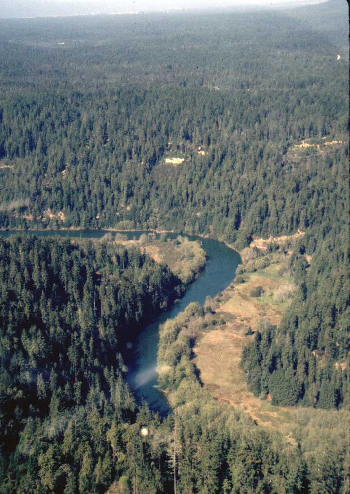 Click on image to enlarge (99K). Click here to display a larger version (264K).
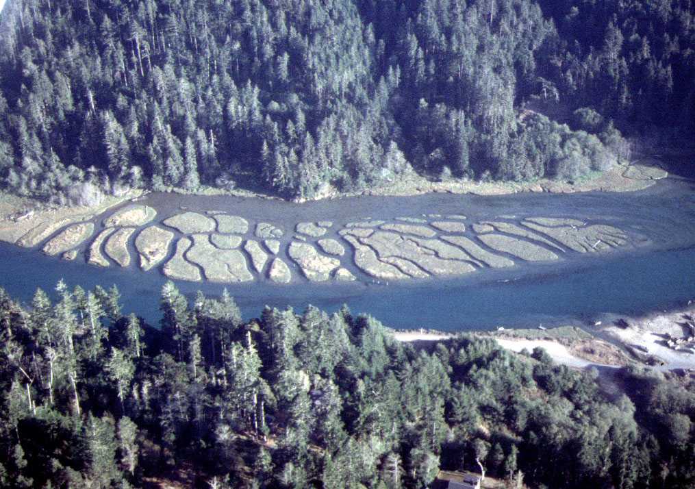 Click on image to enlarge (113K). Click here to display a larger version (309K).
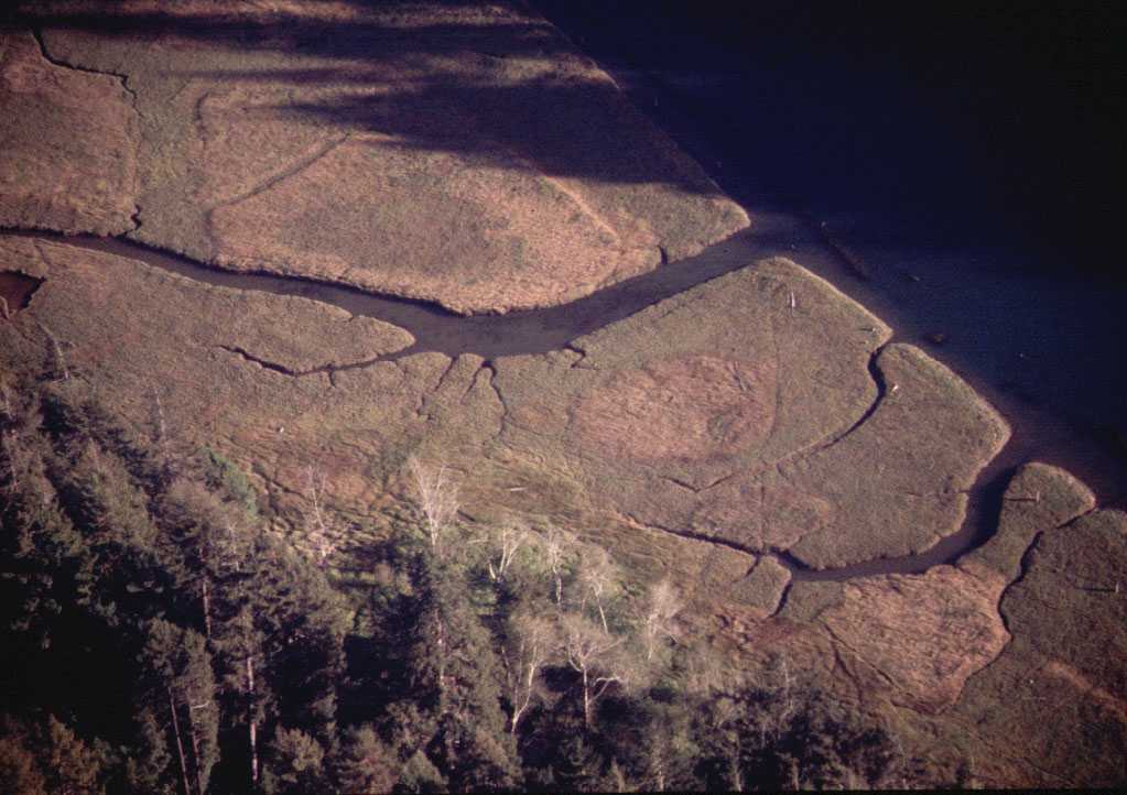 Click on image to enlarge (78K). Click here to display a larger version (206K).
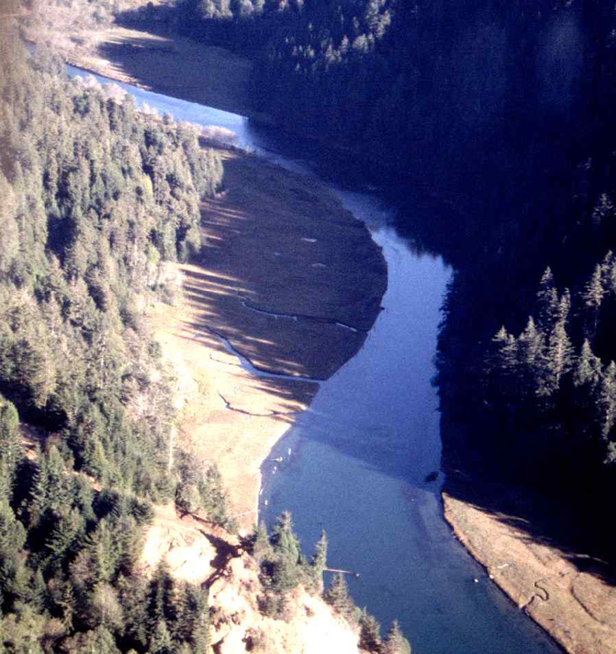 Click on image to enlarge (77K). Click here to display a larger version (539K).
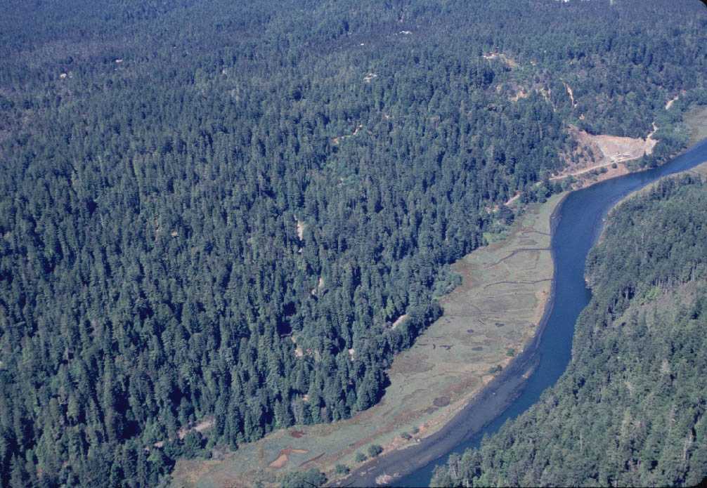 Click on image to enlarge (106K). Click here to display a larger version (186K).
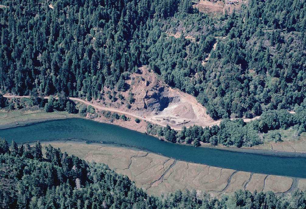 Click on image to enlarge (156K). Click here to display a larger version (283K).
 Click on image to enlarge (76K). Click here to display a larger version (223K).