| Area |
Lower Big River |
| Topic |
Tour: Laguna Creek Contemporary Aerial Photos & Maps |
 Click on image to enlarge (144K).
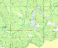
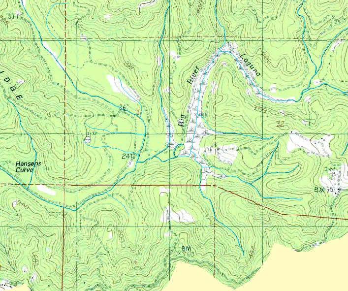
The Big River Laguna is a large marsh area approximately 3 miles upstream of the mouth of Big River and the town of Mendocino. The river itself curves back to the left in the photo above. See Pictures 2-5 for aerial photos and Picture #6 for a map of recent timber harvests in the vicinity of the Laguna. USGS Topo taken from KRIS Big River Map project.
 Click on image to enlarge (70K). Click here to display a larger version (822K).
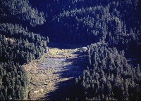
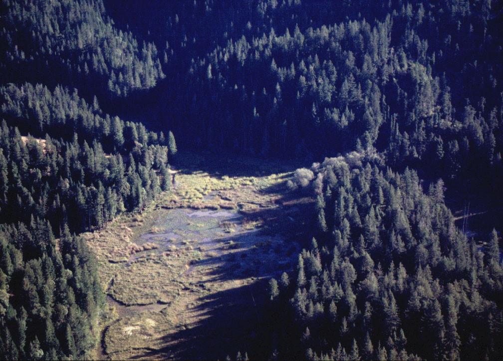
This aerial photo shows the Big River Laguna at center with the Drinkwater Ranch on the right. The North Branch of Laguna is off to the left while the South Branch extends back towards the lower center of the image. Photo by Rixanne Wehren.
 Click on image to enlarge (98K). Click here to display a larger version (254K).
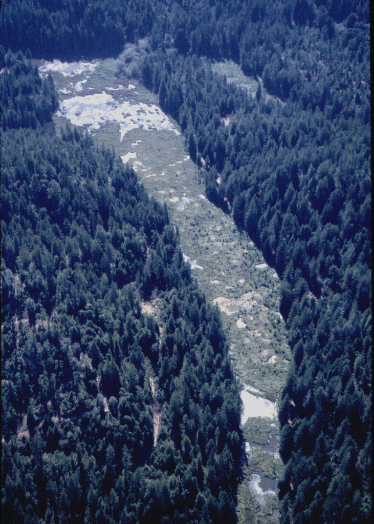
Looking down Big River Laguna towards the mouth, which is at the top of the photo. Photo by Rixanne Wehren.
 Click on image to enlarge (86K). Click here to display a larger version (232K).
Close up of the lower end of the Big River Laguna in October 1995. Photo courtesy of Rixanne Wehren.
 Click on image to enlarge (114K). Click here to display a larger version (286K).
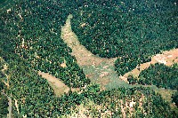
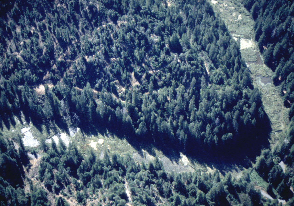
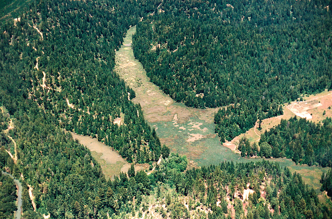
Bend in Big River Laguna in a photo taken from immediately overhead. Note the young forests in areas immediately behind the riparian buffers, resulting from recent timber harvest. See Picture #6 for a map of recent harvest.
 Click on image to enlarge (103K).
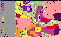
This map view shows the same area as Picture #1 with an overlay of timber harvests. The colors on the map are related to the year of harvest (i.e., THP98 = Timber Harvest Permit issued in 1998). Image from KRIS Big Map project based on data from the California Department of Forestry.
 Click on image to enlarge (81K). Click here to display a larger version (434K).
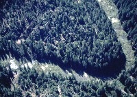
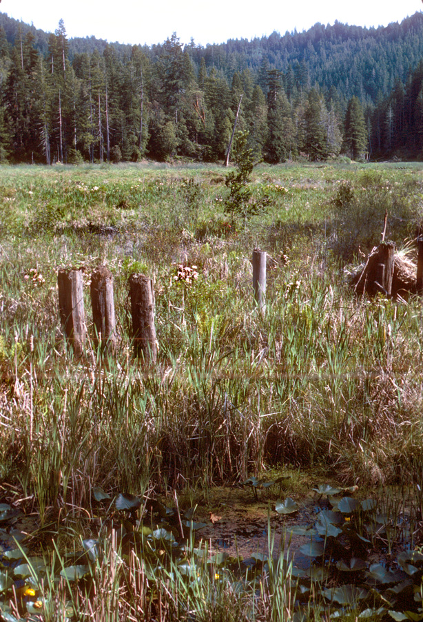
NW 38 May86 - Big River Laguna, Laguna Cr tributary to Big River. Pilings once supported logging railroad tracks crossing this natural wetland. Note lily pads in foreground. Mature second growth Coast Redwood forest populated the surrounding slopes when this photo was made in May 1986. Photo # Nicholas Wilson, 707-937-0137, P.O. Box 943, Mendocino CA. Scanned from 35mm transparency.
 Click on image to enlarge (115K). Click here to display a larger version (596K).
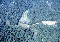
NW48 Jun90 - Aerial view of Big River Laguna wetland looking NNE. Big River visible at lower left corner; Homer & Lil Drinkwater ranch is cleared area at right center. Logging by Georgia Pacific. Photo # Nicholas Wilson, 707-937-0137, P.O. Box 943, Mendocino CA 95460. Scanned from 4x6 print Jun 90 L8.
To learn more about this topic click here

 Click on image to enlarge (144K).
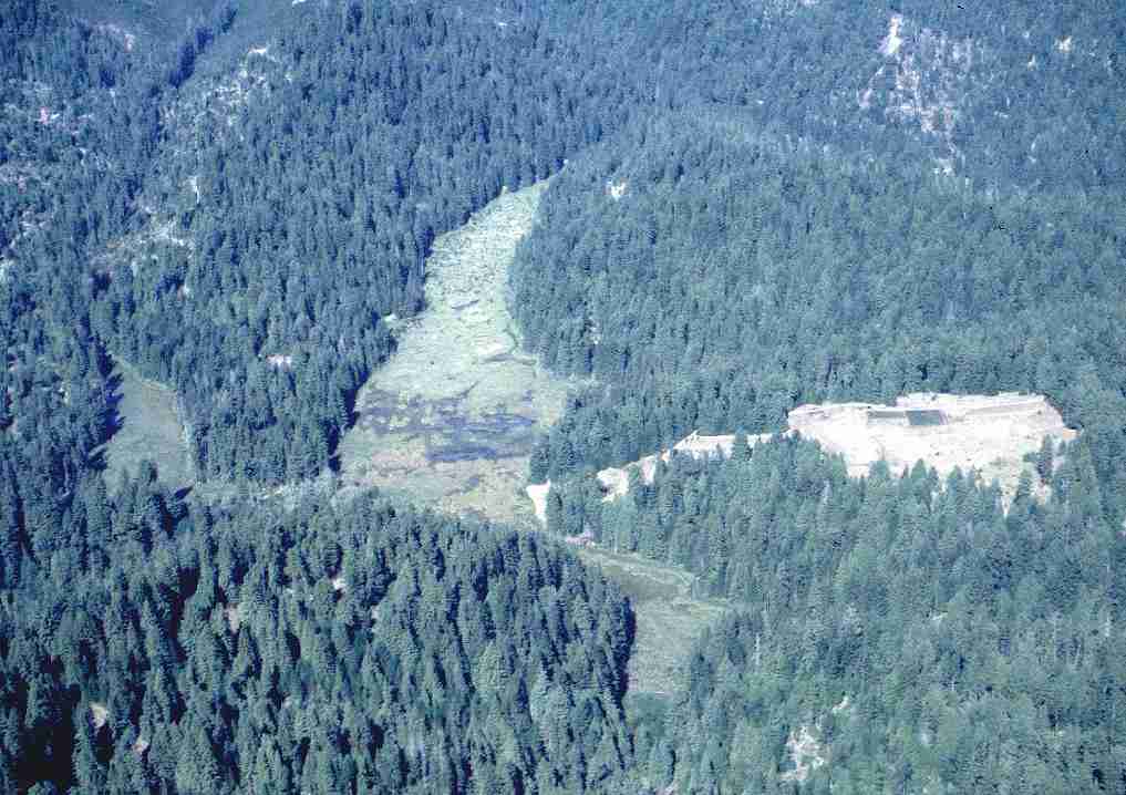 Click on image to enlarge (70K). Click here to display a larger version (822K).
 Click on image to enlarge (98K). Click here to display a larger version (254K).
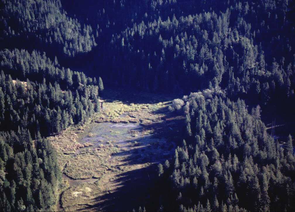 Click on image to enlarge (86K). Click here to display a larger version (232K).
 Click on image to enlarge (114K). Click here to display a larger version (286K).
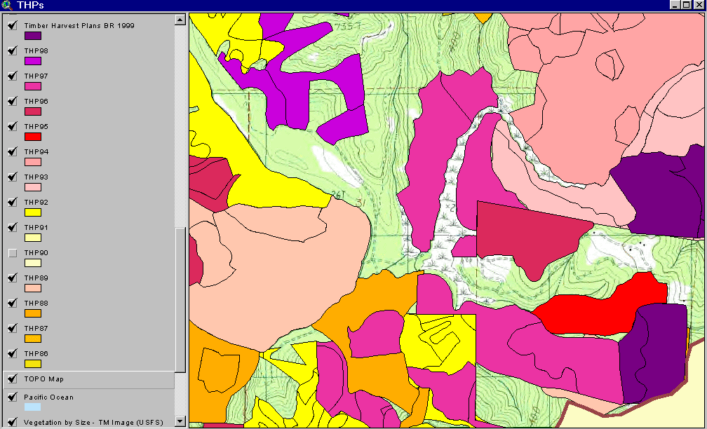 Click on image to enlarge (103K).
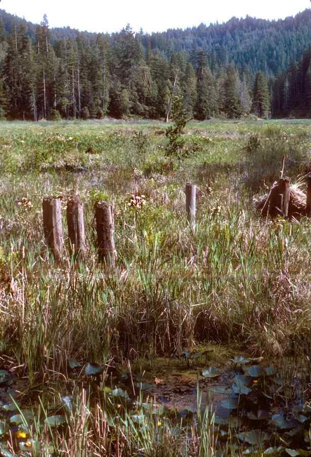 Click on image to enlarge (81K). Click here to display a larger version (434K).
 Click on image to enlarge (115K). Click here to display a larger version (596K).
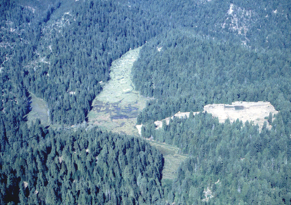