
| Area | Middle Big River |
| Topic | Sediment: Gravel Permeability Mainstem Big River 2000 |
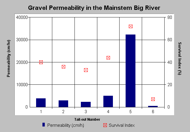
| Caption: This chart displays gravel permeability from the Mainstem Big River in 2000. Mean gravel permeability in the Mainstem Big River ranged from 400 to 5000 cm/hr with the exception of one pool tail-out location, T5 where the mean gravel permeability measured 32,000 cm/hr. T5 may be indicative of the potential for the reach to regain suitable habitat values. The red markers display predicted values for percent egg-to-fry survival. See Info Links for more information. Click on Picture for a map of MRC study segment locations. Data from Mendocino Redwood Company. | |
 |
To learn more about this topic click here .
To view the table with the chart's data, click Chart Table web page.
To download the table with the chart's data, click mrc_perm_lb.dbf (size 548 bytes) .
To see meta information about the data table used for this topic click here
To view the table with the chart's source data, click Source Table web page.
To download the table with the chart's source data, click mrc_perm_source.dbf (size 10,008 bytes)
| www.krisweb.com |