
| Area | North Fork Big River |
| Topic | Sediment: Fines <0.85mm from North Fork Big River 2000 |
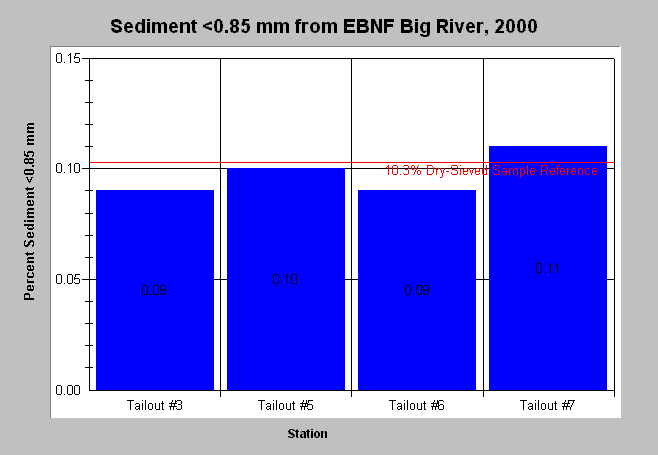
| Caption: The chart above shows percent fine sediment levels <0.85mm from dry-sieved McNeil samples in the East Branch North Fork Big River in 2000. Data provided by the Mendocino Redwood Company. Fine sediment was above the adjusted dry-sieve target of 10.3% in tailout 7. See Info Links for more information. Click on Picture to see a map of MRC Big River monitoring locations. | |
 |
To learn more about this topic click here .
To view the table with the chart's data, click Chart Table web page.
To download the table with the chart's data, click ebnf_mcneil.dbf (size 2,046 bytes) .
To see meta information about the data table used for this topic click here
To view the table with the chart's source data, click Source Table web page.
To download the table with the chart's source data, click big_mcneil.dbf (size 6,218 bytes)
| www.krisweb.com |