
| Area | North Fork Big River |
| Topic | Maps of North Fork Big River Basin |
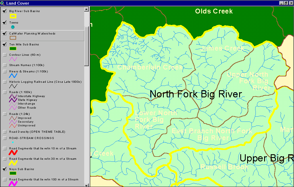
The image above shows the location of the North Fork Big River sub-basin and the Calwater planning units which comprise it. From the KRIS Big River Map project.
This image from the KRIS Big River Map project shows USFS vegetation and stand types for the North Fork watershed derived from a 1994 Landsat (see USFS VegType Topics for more information). Non-Forest and Saplings in this basin are mostly associated with recent timber harvest. Scale of accuracy for stands is one hectare. Notice that tree diameters are larger within Jackson Demonstration State Forest than on private lands to the south and east.
The image above is from the KRIS Big River Map project and shows timber harvest between 1986 and 1999 in the North Fork watershed Big River sub-basin. Jackson Demonstration State Forest's boundary is shown in green and JDSF extends to the west. Note that far less timber harvest has taken place on JDSF than on adjacent private lands.
The image above is from the EPA Land Cover project, which is included in the KRIS Big River Map project. Patches of mixed forest and shrubland disbursed throughout the North Fork watershed reflect early seral conditions after timber harvest (mixed forest/shrubs). Jackson Demonstration State Forest's boundary is shown in red and JDSF extends to the west. Note that most of JDSF is in evergreen forest according to the EPA analysis.
The image above comes from the KRIS Big River Map project and shows slopes in the NF Big River watershed that are over 45%. This sub-basin has the most percent area of its watershed in steep slopes of any Big River basin. Generated from 10 meter DEM data.
The image above comes from the KRIS Big River Map project and shows changes in vegetation between 1994 and 1998 according to CDF FRAP change scene detection. Reductions of vegetation associated with timber harvest show in the Upper North Fork and James Creek on private land east of Jackson Demonstration State Forest. JDSF shows no loss of canopy cover during this period.
This image from the KRIS Big River Map project shows USFS vegetation and stand types for 90 meters surrounding the North Fork Big River and its tributaries. The riparian is in large trees (30-39.9"), Medium Large Trees (20-29.9") or at least Small/Medium Trees (12-19.9") on most of Jackson Demonstration State Forest. High prevalence of Saplings (< 5" diameter) on the East Brach of the NF and Upper North Fork represent substantial, recent riparian timber harvests. Derived from a 1994 Landsat image (see USFS VegType Topics for more information).
The map image above shows the bedrock geology of the North Fork Big River sub-basin provided by the California Division of Mines and Geology. The dominant formation here is Coastal Belt Franciscan. To the east the Central Belt Franciscan Formation intrudes and quaternary alluvium represents stream channel deposits.
 Click on image to enlarge (54K).
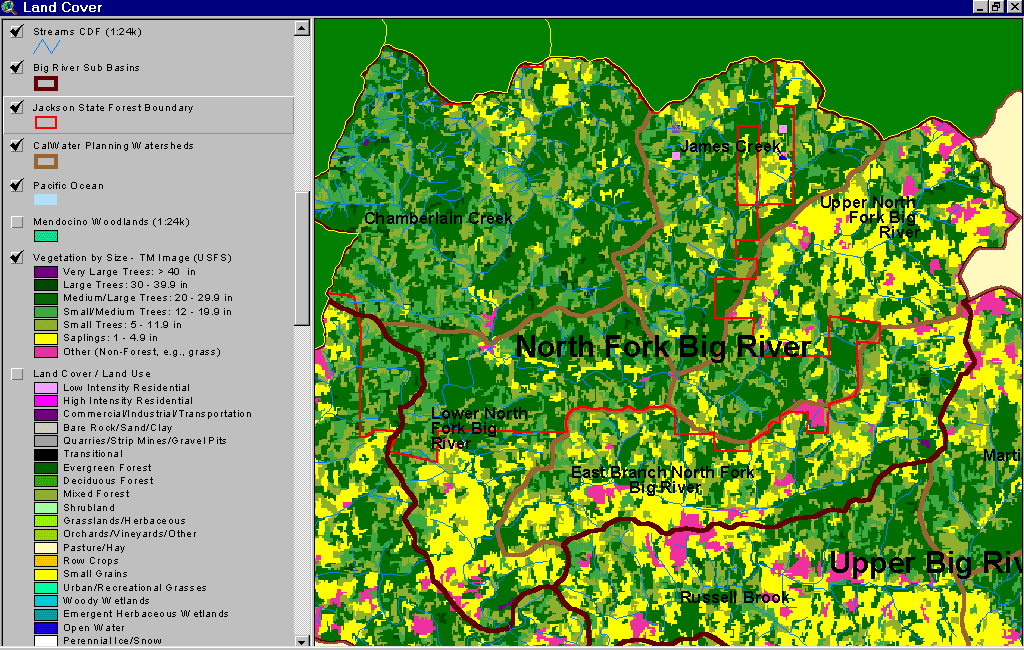 Click on image to enlarge (95K).
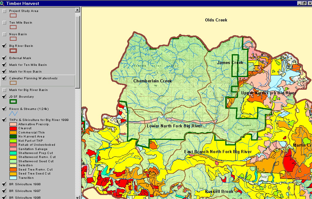 Click on image to enlarge (168K).
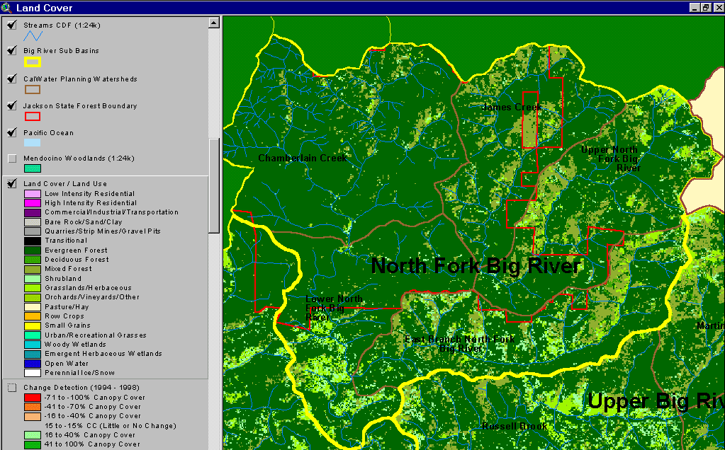 Click on image to enlarge (80K).
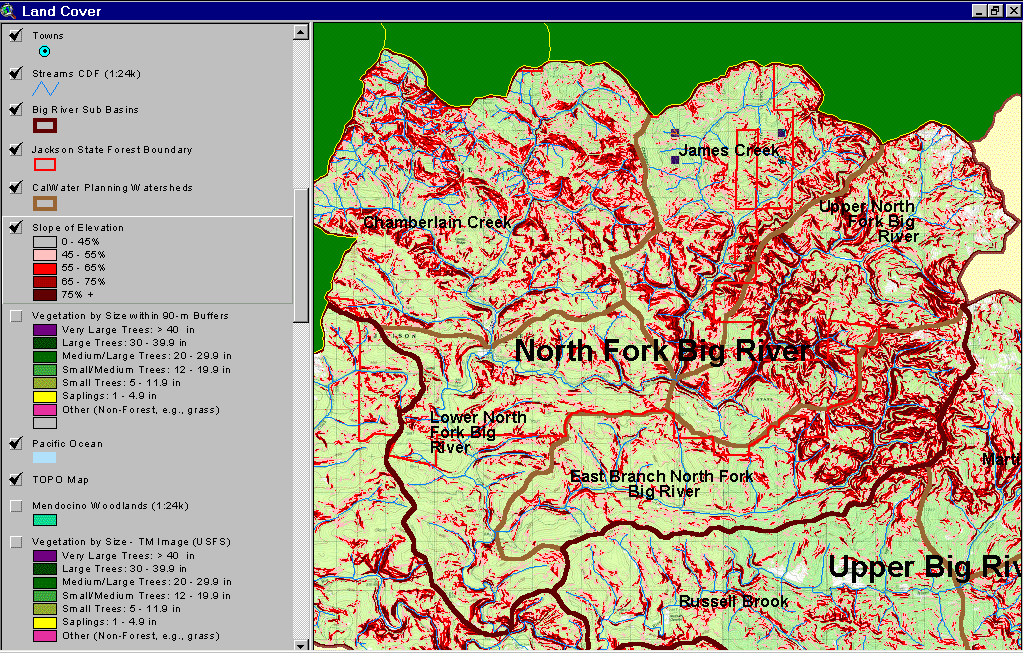 Click on image to enlarge (233K).
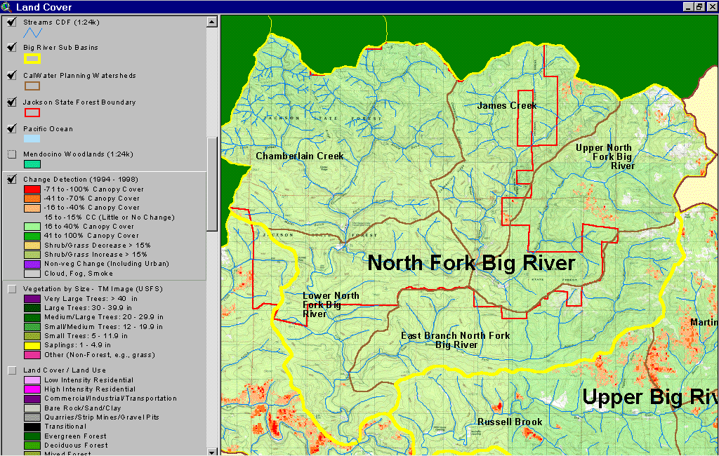 Click on image to enlarge (270K).
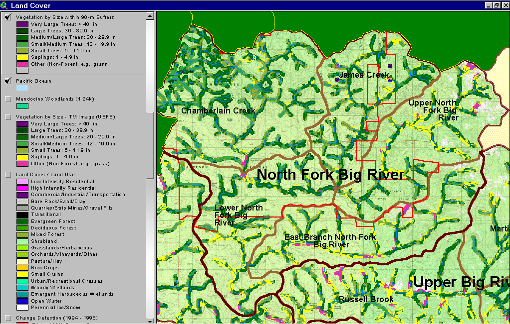 Click on image to enlarge (223K).
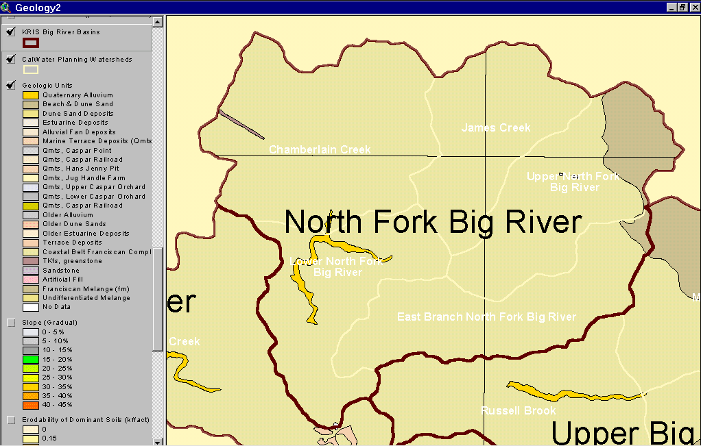 Click on image to enlarge (40K).
To learn more about this topic click here
| www.krisweb.com |