
| Area | North Fork Big River |
| Topic | Timber Harvest: KRIS Map Image NF Big River Sub Basin |
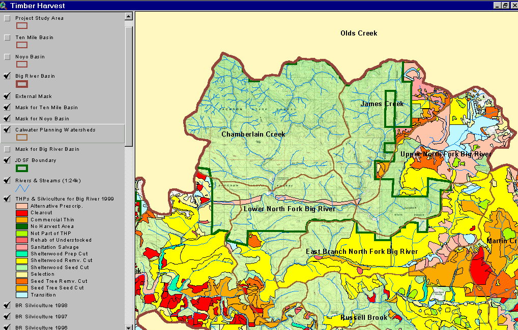
The image above comes from the KRIS Big River Map project and shows timber harvests as mapped by the California Department of Forestry by silvicultural prescription from 1986-1999. Very little of Jackson Demonstration State Forest was logged between 1986 and 1999 but considerable logging took place on private lands in the East Branch and Upper North Fork CalWater planning units.
The image above comes from the KRIS Big River Map project and shows changes in vegetation between 1994 and 1998 according to CDF FRAP change scene detection. Reductions of vegetation associated with timber harvest show in the Upper North Fork and James Creek on private land east of Jackson Demonstration State Forest. JDSF shows no loss of canopy cover during this period.
 Click on image to enlarge (168K).
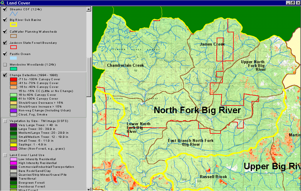 Click on image to enlarge (270K).
To learn more about this topic click here
| www.krisweb.com |