| Area |
North Fork Big River |
| Topic |
USFS VegTypes: Chamberlain Creek CalWater 1994 |
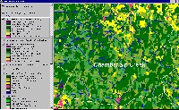 Click on image to enlarge (133K). Click here to display a larger version (362K).
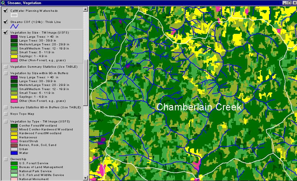
The image above shows USFS vegetation stand types for the Chamberlain Creek Calwater planning watershed based on a 1994 Landsat image. The stand types are only accurate at the one-hectare scale. Young forest shows as extensive patches of Small and Small/Medium trees. See Info Links for more information. Taken from the KRIS Big River Map project.
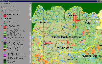
 Click on image to enlarge (175K). Click here to display a larger version (364K).
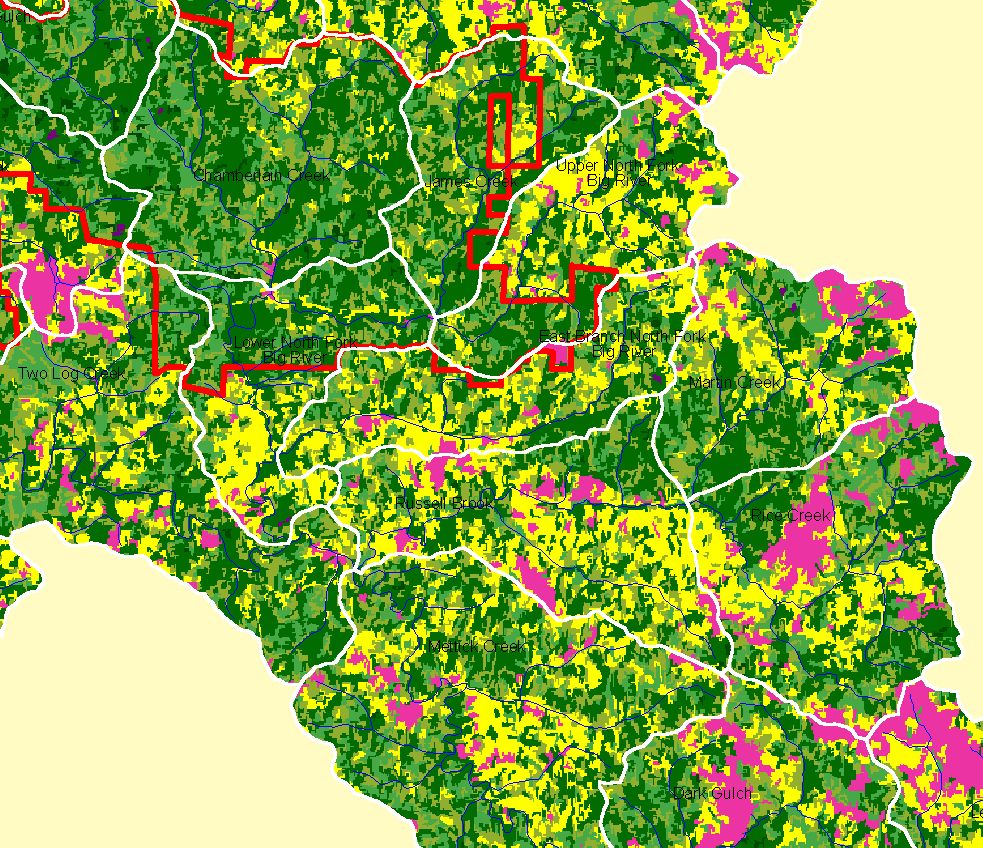
This map view from the KRIS Big River project shows the Chamberlain Creek Calwater watershed. The watershed is almost entirely within Jackson Demonstration State Forest for which the boundary is shown. See the previous Picture for a key to colors representing forest size and vegetation types.
 Click on image to enlarge (270K).
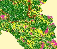
The image above comes from the KRIS Big River Map project and shows changes in vegetation between 1994 and 1998 according to CDF FRAP change scene detection. Reductions of vegetation associated with timber harvest show in the Upper North Fork and James Creek on private land east of Jackson Demonstration State Forest. JDSF shows no loss of canopy cover during this period.
 Click on image to enlarge (80K).
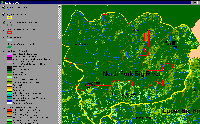
The EPA Land Cover/Land Use theme shows Chamberlain Creek as mostly evergreen forest with some patches of mixed forest, deciduous forest and grasslands/herbaceous. The latter types of vegetation are very prevalent to the east where recent logging activity has been greater.
To learn more about this topic click here

 Click on image to enlarge (133K). Click here to display a larger version (362K).
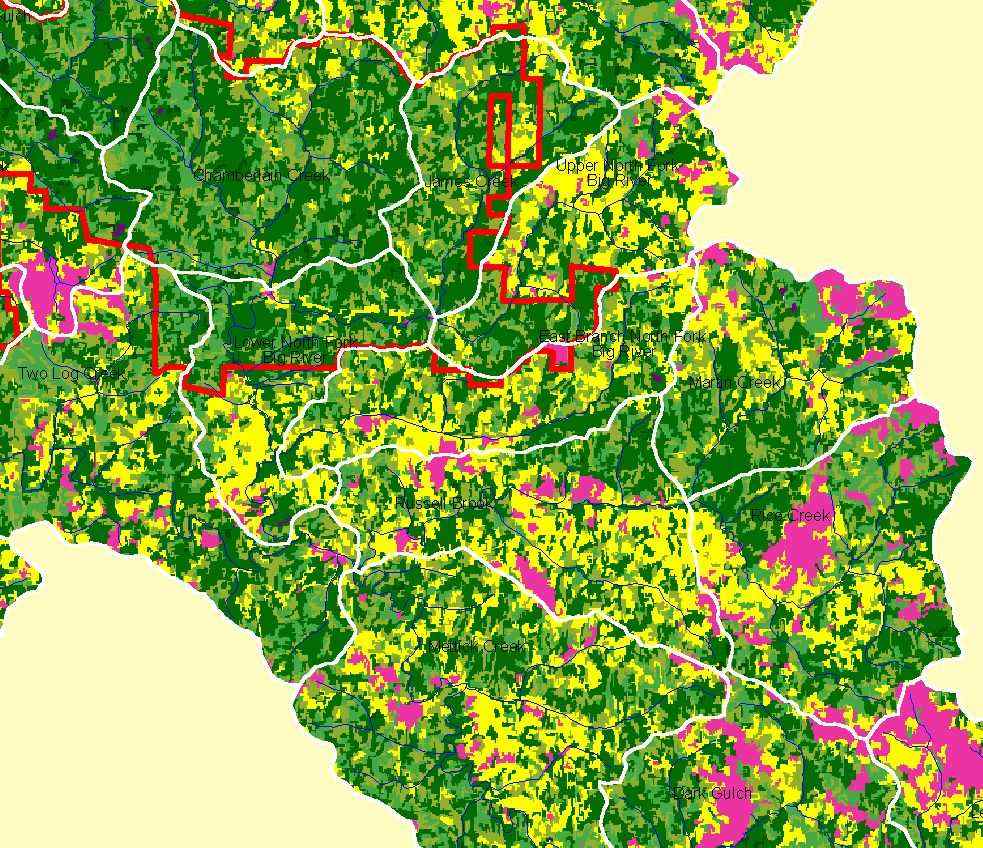 Click on image to enlarge (175K). Click here to display a larger version (364K).
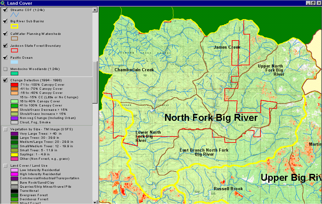 Click on image to enlarge (270K).
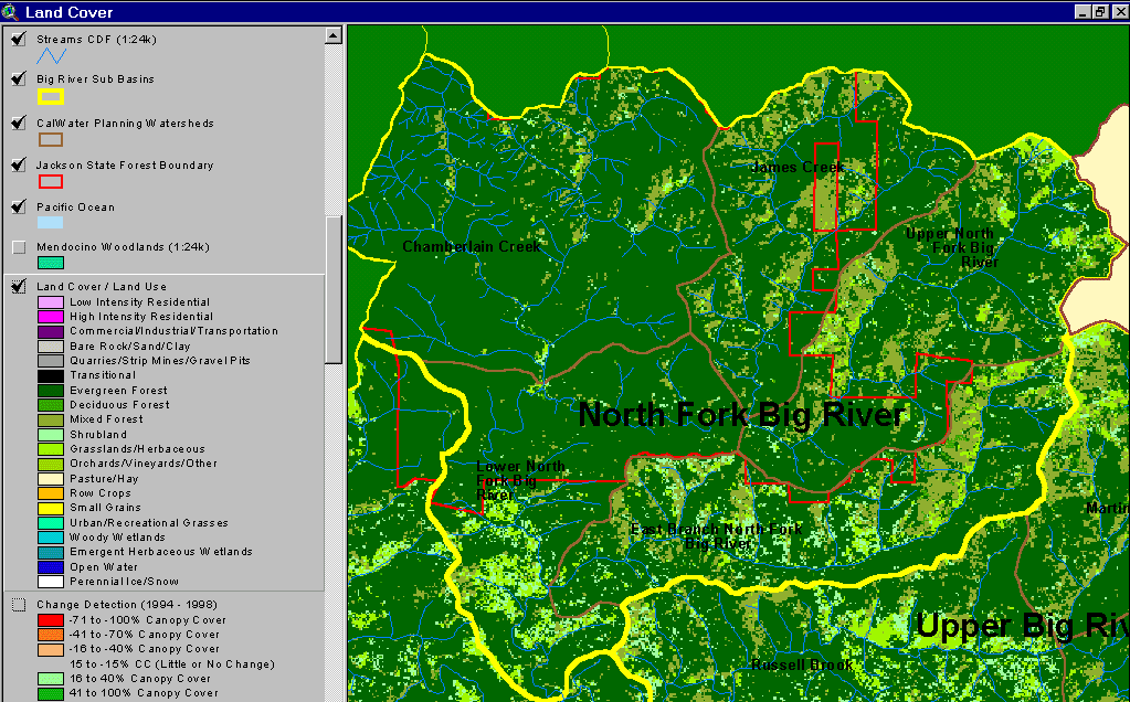 Click on image to enlarge (80K).
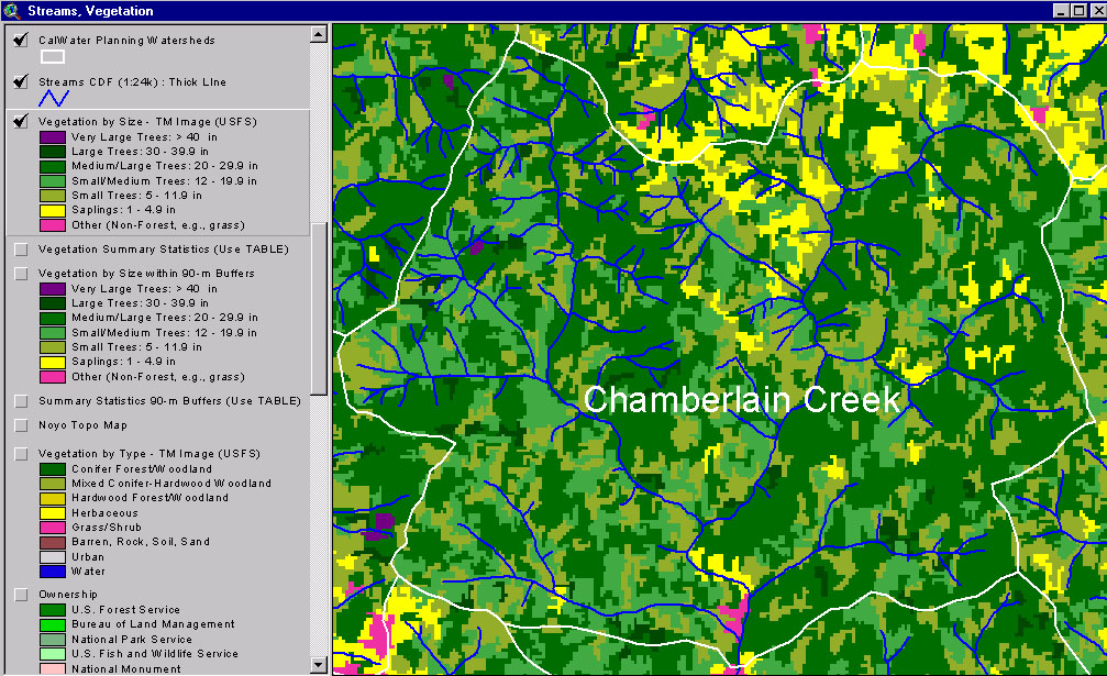