
| Area | South Fork Big River |
| Topic | Timber Harvest: KRIS Map Image SF Big River Sub Basin |
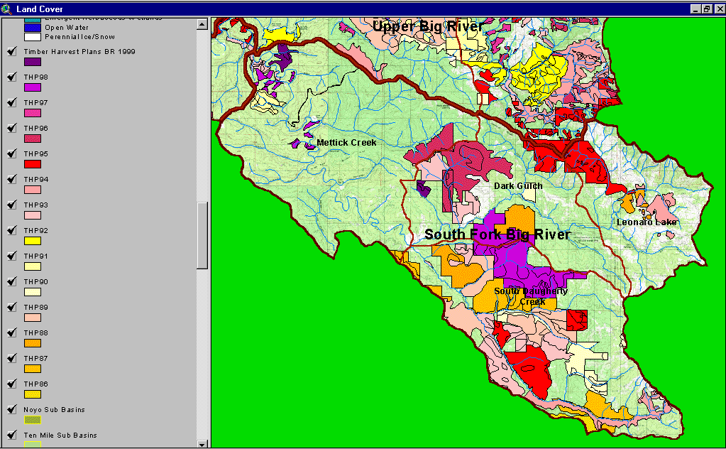
The image above comes from the KRIS Big River Map project and shows timber harvests as mapped by the California Department of Forestry by year from 1986-1999. Very little of the Mettick Creek Calwater was logged between 1986 and 1999 but some logging took place in the Dark Gulch and Leonaro Lake CalWater planning units. More than half of the Daugherty Creek Calwater was logged during this period.
The image above comes from the KRIS Big River Map project and shows changes in vegetation between 1994 and 1998 according to CDF FRAP change scene detection. Not much of the South Fork Big River watershed experienced appreciable loss of canopy except for the western Mettick Creek CalWater.
 Click on image to enlarge (146K).
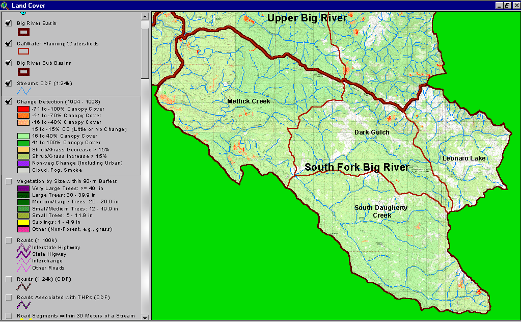 Click on image to enlarge (174K).
To learn more about this topic click here
| www.krisweb.com |