| Area |
South Fork Big River |
| Topic |
USFS VegTypes: South Daugherty Cr CalWater 1994 |
 Click on image to enlarge (118K). Click here to display a larger version (337K).
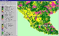
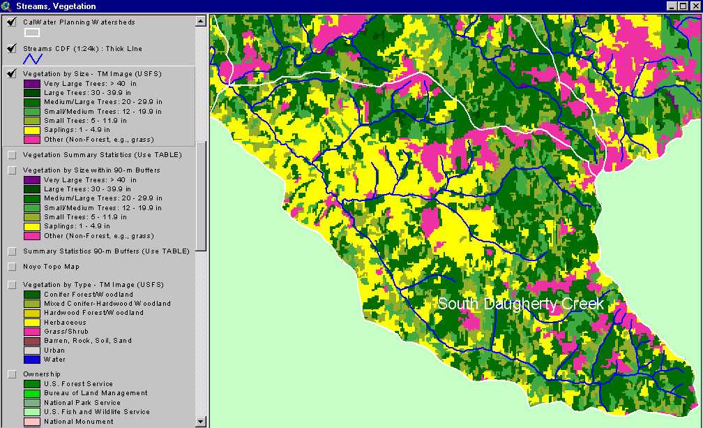
The image above shows USFS vegetation stand types for the South Daugherty Creek Calwater planning watershed based on a 1994 Landsat image. The stand types are only accurate at the one-hectare scale. Large patches of Non-Forest and Saplings (<5" diameter trees) occur throughout the basin areas are likely the result of timber harvest. Medium-Large Trees (20-29.9") occur in patches in upper Daugherty and upper Johnson Creek. Patches of young forest show as extensive patches of Small and Small/Medium trees. See Info Links for more information. Taken from the KRIS Big River Map project.
 Click on image to enlarge (144K). Click here to display a larger version (263K).
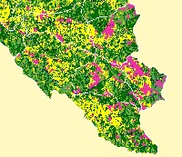
This map view from the KRIS Big River project shows the Daugherty Creek watershed but also Calwaters to the north. See the previous Picture for a key to colors representing forest size and vegetation types.
 Click on image to enlarge (145K).
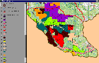
The map image above shows timber harvests by year according to CDF. Early seral conditions of 1994 Landsat can be correlated to timber harvest history.
To learn more about this topic click here

 Click on image to enlarge (118K). Click here to display a larger version (337K).
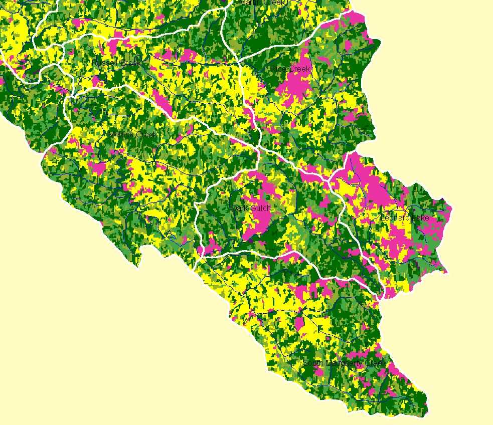 Click on image to enlarge (144K). Click here to display a larger version (263K).
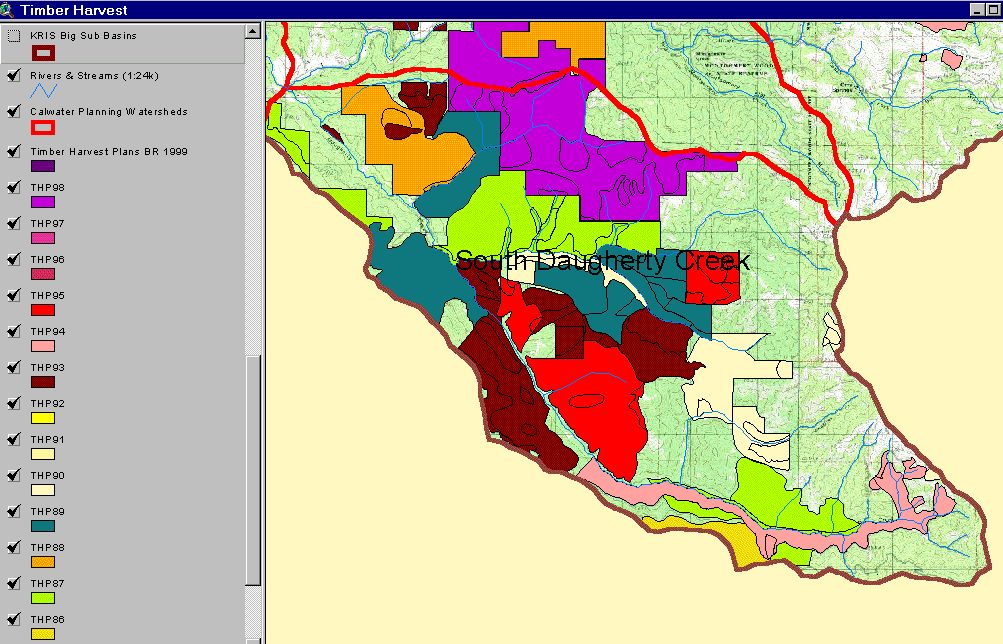 Click on image to enlarge (145K).
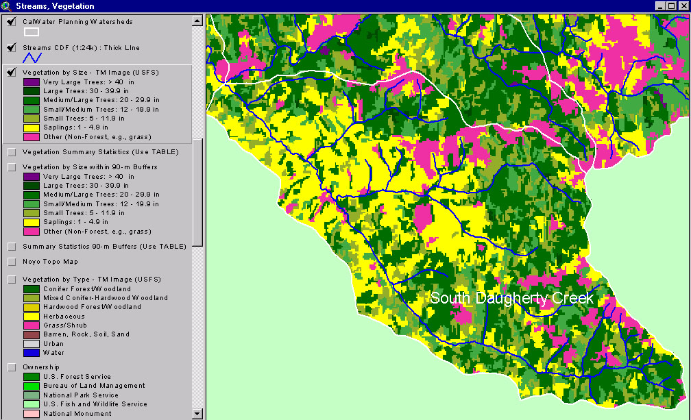