
| Area | Upper Big River |
| Topic | Maps of Upper Big River Basin |
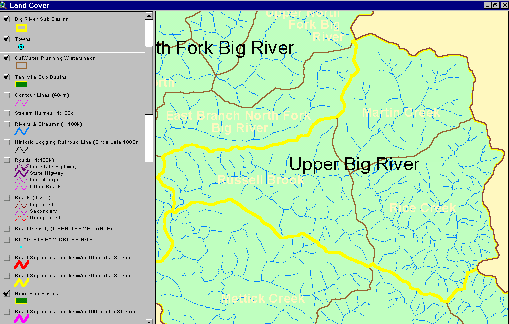
The image above shows the Upper Big River KRIS sub-basin with the three CalWater planning units it contains. From the KRIS Big River Map project.
This image from the KRIS Big River Map project shows USFS vegetation and stand types for the SF Big River watershed derived from a 1994 Landsat (see USFS VegType Topics for more information). Non-Forest and Saplings in the eastern part of the basin are in part in response to Central Belt Franciscan geology. In other areas of the sub-basin these patterns are mostly associated with recent timber harvest. Scale of accuracy for stands is one hectare.
The image above is a map of Upper Big River showing slopes of with varying classes of risk of shallow debris slides. Most of the western basin is in gently sloping hills but the eastern boundary rises steeply and risk of this type of landsliding increases.
The image above is from the EPA Land Cover project, which is included in the KRIS Big River Map project. Patches of mixed forest and shrubland disbursed throughout the Daugherty Creek watershed reflect early seral conditions after timber harvest.
The image above comes from the KRIS Big River Map project and shows timber harvests as mapped by the California Department of Forestry by year from 1986 to 1999. Over 50% of the basin was logged in this period.
The image above comes from the KRIS Big River Map project and shows changes in vegetation between 1994 and 1998 according to CDF FRAP change scene detection. .
The map above shows the geology of the upper Big River watershed with the contact between the Coastal Belt Franciscan and the Central Belt Franciscan showing prominently. Data from the California Division of Mines and Geology. Image from KRIS Big River Map project.
This image from the KRIS Big River Map project shows USFS vegetation and stand types for 90 meters surrounding the Upper Big River and its tributaries. There are some headwater tributaries with riparian showing Medium Large Trees (20-29.9") or at least Small/Medium Trees (12-19.9") but there is a high prevalence of Saplings (< 5" diameter) on the main Upper Big River and mainstem Russel Brook, representing substantial recent riparian timber harvests. Areas in natural grasslands due to bedrock geology are shown in white on the USGS Topo backdrop and are naturally in Non-Forest conditions. Derived from a 1994 Landsat image (see USFS VegType Topics for more information).
 Click on image to enlarge (53K).
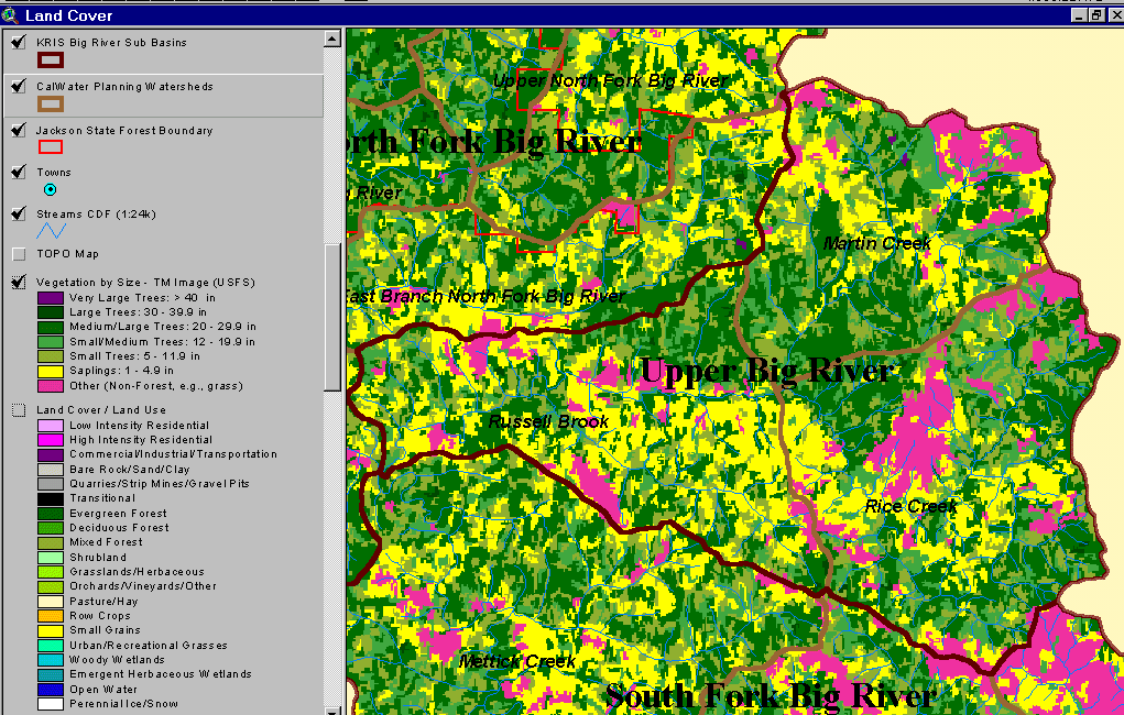 Click on image to enlarge (103K).
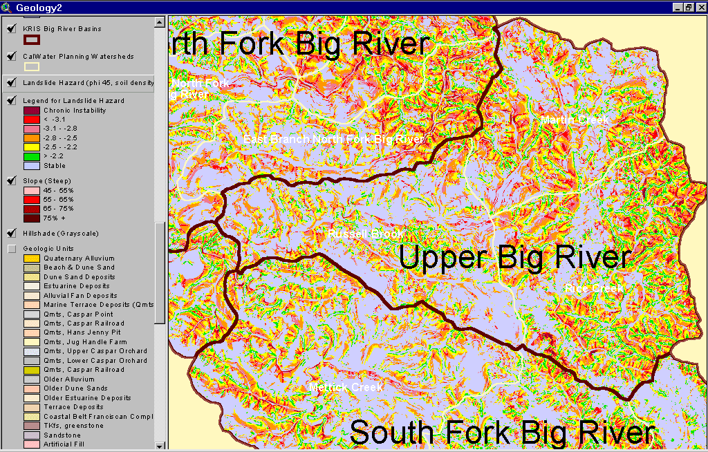 Click on image to enlarge (144K).
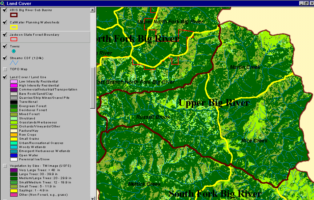 Click on image to enlarge (96K).
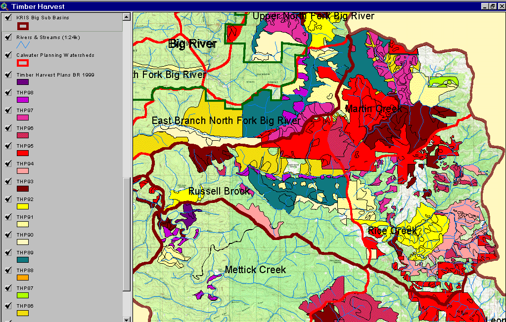 Click on image to enlarge (216K).
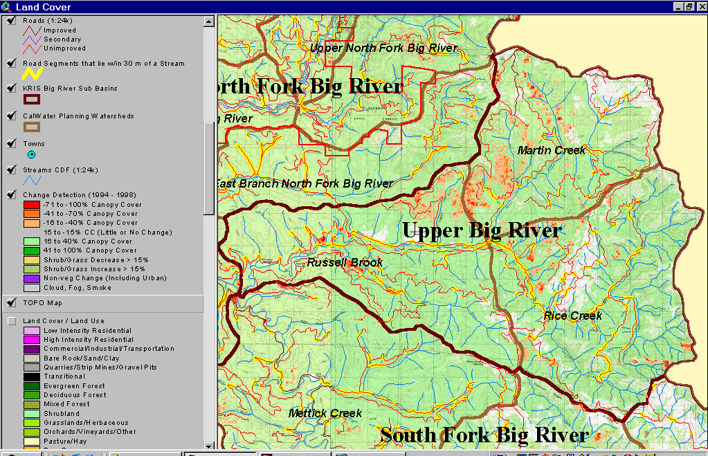 Click on image to enlarge (269K).
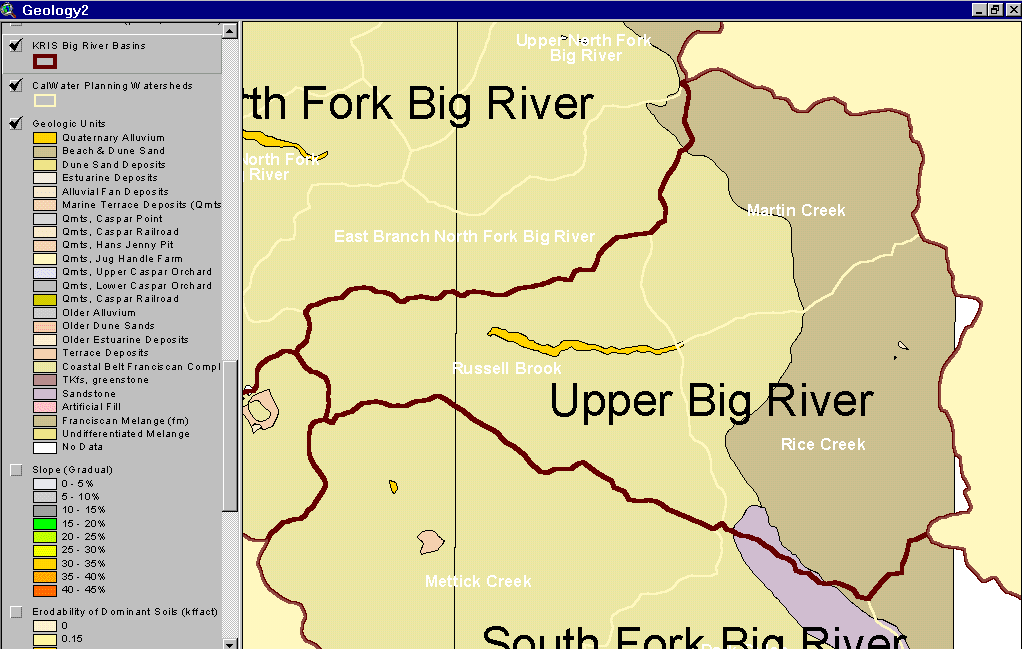 Click on image to enlarge (46K).
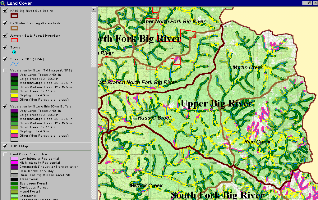 Click on image to enlarge (231K).
To learn more about this topic click here
| www.krisweb.com |