
| Area | Upper Big River |
| Topic | Sediment: Matthews Landslides Delivered, Upper Big 1921-2000 |
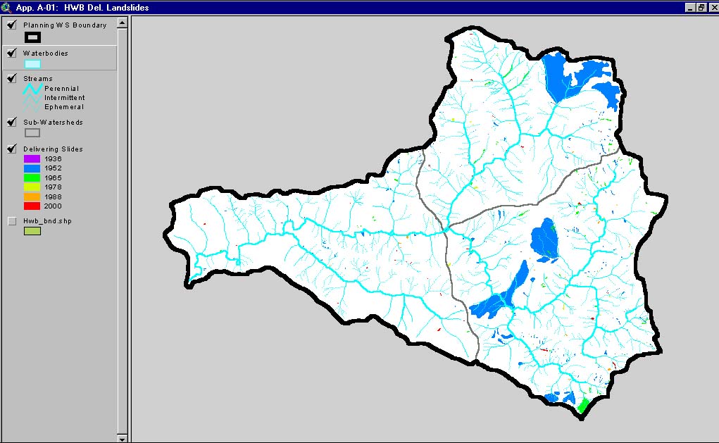
This image, from Matthews and Associates (2001) Appendix A-1, shows delivered slides mapped in the Headwaters Planning Watershed. This watershed is the Upper Big River CalWater sub-basin.
This image, from the KRIS Big River Map project, shows slope stability for the Upper Big River Basin. Slope stability was determined from the Model SHALSTAB. Darker shades of red indicate increasing instability.
 Click on image to enlarge (118K).
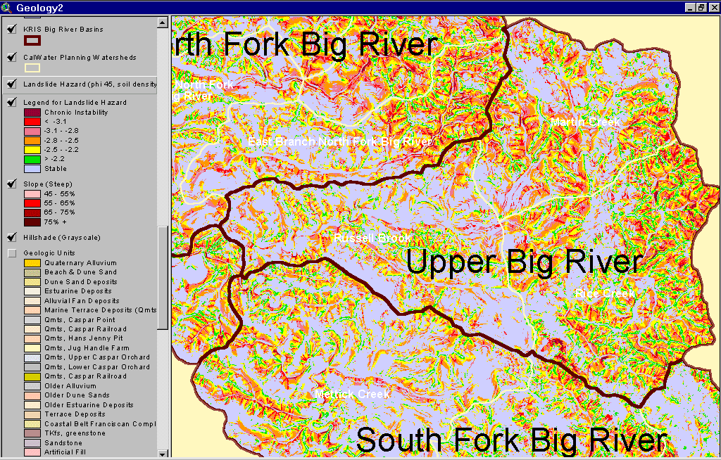 Click on image to enlarge (144K).
To learn more about this topic click here
| www.krisweb.com |