
|
Area/Topic | Bibliography | Background | Hypotheses | Home |
|
Map Page.
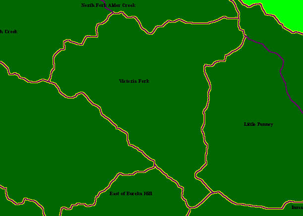
You selected the area Blue Waterhole Creek and the topic Map: 1A Calwater Planning Watersheds, Blue Waterhole Cr. Sub-basin |
| This is a map of the Victoria Fork Calwater Planning Watershed, which is actually the Blue Waterhole Creek watershed. The KRIS Garcia sub-basin is named after the creek but its boundaries are the same as the Calwater. Boundaries in purple are Calwater Planning Watersheds, yellow are KRIS Garcia sub-basins and blue lines are 1:100K hydrology from USGS.. Scale = 1:61,046 . | |||
|
|
||
To view metadata about a map layer, click on a link in the table below.
| Name of Layer in Map Legend | Metadata File Name |
|---|---|
| Calwater PWS (big labels) | calw22.shp.txt |
| Sub-basins (no labels) | subbasins.shp.txt |
| Project Frame | Unavailable |
| www.krisweb.com |