
|
Area/Topic | Bibliography | Background | Hypotheses | Home |
|
Map Page.
You selected the area Blue Waterhole Creek and the topic Map: 1F Geology and Landslides for Blue Waterhole Creek |
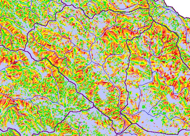
| This is a map of geology layers in the Blue Waterhole Creek sub-basin in the KRIS Garcia project area. The theme highlighted here is the shallow landslide stability model (SHALSTAB), which indicates risk of shallow debris torrents. The KRIS IFR team made this theme using the conventions of Dietrich and Montgomery (1998). Some areas of Blue Waterhole Creek have high risk for these types of slides, particularly inner gorge areas. | |||
|
|
||
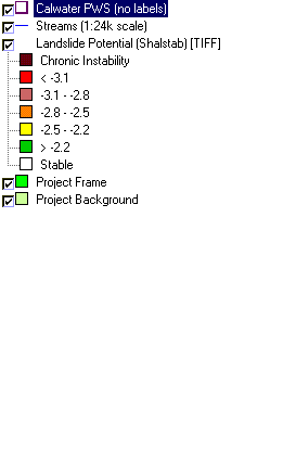
To view metadata about a map layer, click on a link in the table below.
| Name of Layer in Map Legend | Metadata File Name |
|---|---|
| Calwater PWS (no labels) | calw22.shp.txt |
| Streams (1:24k scale) | streams24.shp.txt |
| Landslide Potential (Shalstab) [TIFF] | garciaqt.tif.txt |
| Percent Slope (TIFF) | garciaslp.tif.txt |
| Percent Slope, Hillshade (TIFF) | slope1.tif.txt |
| Elevation (10 m resolution)(TIFF) | elev10.tif.txt |
| Relative Landslide Potential (Shalstab) [TIFF] | garciaqt2.tif.txt |
| Topo Map (1:24k scale)(USGS) | Unavailable |
| Project Frame | Unavailable |
| Project Background | Unavailable |
| www.krisweb.com |