|
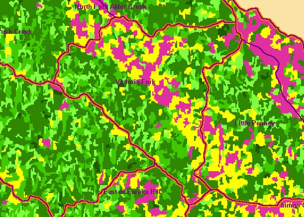
This is a map of 1994 vegetation size data in the Blue Waterhole Creek sub-basin, overlaid on top of KRIS sub-basins, Calwater
Planning Watersheds and 1:24,000 streams. The tree size classifications were derived from Landsat multi-spectral images taken in
1994. Stand conditions are accurately represented at the one hectare scale. The western and eastern parts of the watershed are
in coniferous forest which shows as larger diameter trees, but a swath of grassland and oak woodlands cuts across the interior,
showing as non-forest and saplings. This is likely as a result of a change in bedrock type to Central Belt Franciscan terrain. Data
were provided by the U.S. Forest Service Pacific Southwest Region Remote Sensing Lab, in cooperation with the California
Department of Forestry. Scale = 1:63,772 .
|
|