
| Area | Basin-wide/General |
| Topic | Flow: Garcia River - Annual Peaks 1952-1991 |
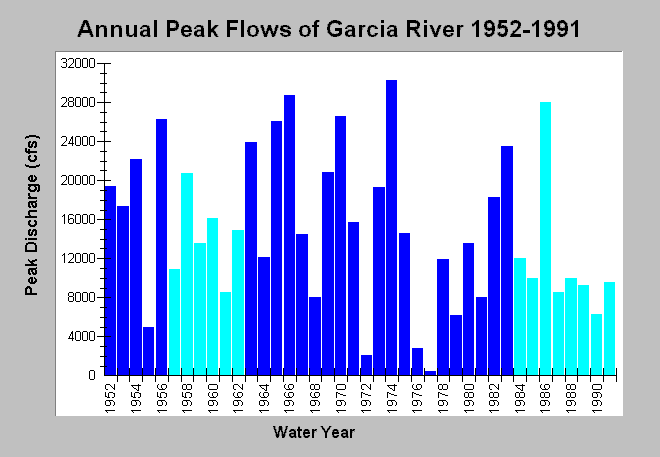
| Caption: This chart displays annual peak discharge of the Garcia River between water years 1952 to 1991. Annual peak flows were measured at USGS Gauge #11467600 between years 1952-1956 and 1963-1983 (royal blue). Peaks in other years were determined through a regression analysis with flows on the Navarro River near Navarro, CA, USGS gage #11468000 by Mathews (light blue). The highest measured flow was 30,300 cubic feet per second in 1974. See InfoLinks for more Information. | |
 |
To learn more about this topic click Info Links .
To view additional information (data source, aquisition date etc.) about this page, click Metadata .
To view the table with the chart's data, click Chart Table web page.
To download the table with the chart's data, click flow_garcia_annualpeak_matthews.dbf (size 858 bytes) .
| www.krisweb.com |