
| Area | Basin-wide/General |
| Topic | Flow: Garcia River - Daily Average 1974-1983 |
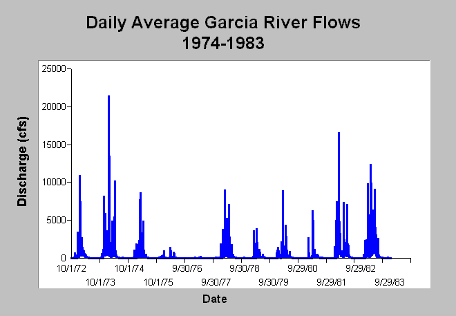
| Caption: This chart displays daily average Garcia River flows (cfs) for water years 1974 to 1983. Flow data were measured by the US Geological Survey at gauging station #11467600. The USGS flow gage was discontinued after 1983. This period includes the 1976-1977 drought where the highest Garcia River flows were 1100 cfs in the two year period. See InfoLinks for more information. | |
 |
To learn more about this topic click Info Links .
To view additional information (data source, aquisition date etc.) about this page, click Metadata .
To view the table with the chart's data, click Chart Table web page.
To download the table with the chart's data, click flow_garcia_daily_1974_1983.dbf (size 72,404 bytes) .
To view the table with the chart's source data, click Source Table web page.
To download the table with the chart's source data, click flow_garcia_daily_1963_1983.dbf (size 138,158 bytes)
| www.krisweb.com |