|
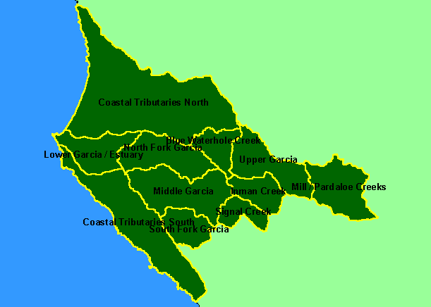
This is a map of the KRIS sub-basins in the KRIS Garcia project area, which includes the Coastal Tributaries South and Coastal
Tributaries North sub-basins, which are comprised of watersheds that lie outside but adjacent to the Garcia watershed. The Lower
Garcia/Estuary sub-basin encompasses the mainstem Garcia to above Allen Creek and was defined to coincide with the Hathaway
Creek Calwater. The North Fork Garcia Calwater Planning Watershed is also synonymous with the North Fork KRIS sub-basin,
including a section of the mainstem Garcia and the Olsen Gulch and Olsen Creek watersheds. The Middle Garcia KRIS Garcia
sub-basin runs from the North Fork upstream to above Inman Creek. The Coastal Tributaries North sub-basin includes Mallo
Pass Creek, Alder Creek, and Brush Creek. The Coastal Tributaries South sub-basin contains Schooner Gulch, Moat Creek, Point
Arena Creek and others. Scale = 1:328,604 .
|
|