

|
Area/Topic | Bibliography | Background | Hypotheses | Home |
|
Map Page.
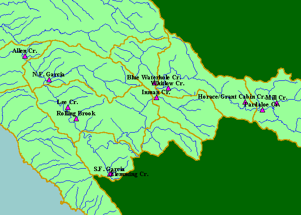
You selected the area Basin-wide/General and the topic Habitat: Large Woody Debris Volumes in Garcia R. Watershed, 1999 |
| This is a map of monitoring points from the 1999 Garcia River Instream Monitoring Project (Maahs and Barber, 2001), overlaid on top of 1:100,000 scale steams and KRIS sub-basins. The points on the map represent the upstream end of the study reaches. Points were hand digitized from a coarse-scale map, so are not precise locations. Data collected in the study reaches includes water temperatures, large woody debris, gravel permeability, and gravel size-distributions. | |||
|
|
||
To view metadata about a map layer, click on a link in the table below.
| Name of Layer in Map Legend | Metadata File Name |
|---|---|
| Instream Monitor Pts, upstream ends | grimpsites2.shp.txt |
| Sub-basins (no labels) | subbasins.shp.txt |
| Streams (1:100k scale)(no labels) | streams100.shp.txt |
| Topo Map (1:24k scale)(USGS) | Unavailable |
| Grayscale Hillshade ((TIFF) | grayscale_light.tif.txt |
| Project Background | Unavailable |
| Frame Project Outline | Unavailable |
| www.krisweb.com |