

|
Area/Topic | Bibliography | Background | Hypotheses | Home |
|
Map Page.
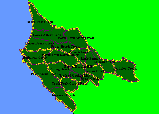
You selected the area Basin-wide/General and the topic Map: 1C Calwater Planning Watersheds, Garcia Project Area |
| This is a map of the Calwater Planning Watersheds (purple outlines with black labels) in the KRIS Garcia project area, overlaid on top of KRIS sub-basins (yellow outlines). Some KRIS sub-basins are identical to Calwaters while others encompass several Calwater Planning Watersheds. Data from the California Department of Forestry. Scale = 1:330,190 . | |||
|
|
||
To view metadata about a map layer, click on a link in the table below.
| Name of Layer in Map Legend | Metadata File Name |
|---|---|
| Calwater PWS (small labels) | calw22.shp.txt |
| Sub-basins (no labels) | subbasins.shp.txt |
| Project Frame | Unavailable |
| www.krisweb.com |