
|
Area/Topic | Bibliography | Background | Hypotheses | Home |
|
Map Page.
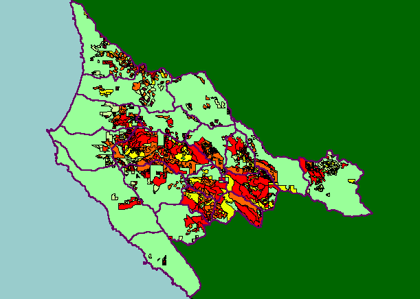
You selected the area Basin-wide/General and the topic Timber Harvest: Percent Harvested by Garcia Calwater 1987-2001 |
| This is a map of timber harvest layers in the KRIS Garcia project area. Data were provided by the California Department of Forestry and show only harvests permitted between 1987 and 2001. Harvests were highest in the North Fork Garcia, North of Gualala Mountain (Middle Garcia), Inman Creek and Signal Creek watersheds. Data were contributed by the California Department of Forestry (CDF) and United States Geologic Survey (USGS). | |||
|
|
||
To view metadata about a map layer, click on a link in the table below.
| Name of Layer in Map Legend | Metadata File Name |
|---|---|
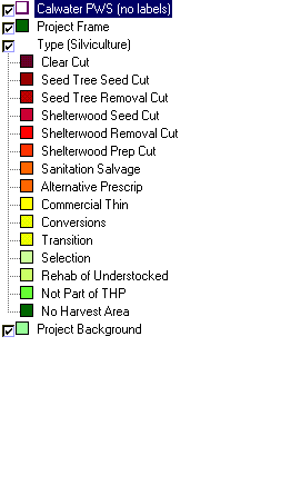
| Calwater PWS (no labels) | calw22.shp.txt |
| Project Frame | Unavailable |
| Type (Silviculture) | thpcwrgns.shp.txt |
| Topo Map (1:24k scale)(USGS) | Unavailable |
| Grayscale Hillshade (TIFF) | grayscale_light.tif.txt |
| Landslide Potential (Shalstab) [TIFF] | garciaqt.tif.txt |
| Relative Landslide Potential (Shalstab) [TIFF] | garciaqt2.tif.txt |
| Percent Slope, Hillshade (TIFF) | slope1.tif.txt |
| Elevation (10 m resolution)(TIFF) | elev10.tif.txt |
| Project Background | Unavailable |
| www.krisweb.com |