|
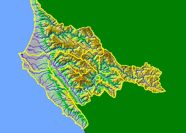
This is a map of the 1:100,000 scale USGS hydrography in the KRIS Garcia project area overlaid on top of an elevation hillshade
and sub-basins. The highest elevations in the project area are located in the headwaters of Larmour and Alder Creeks, at the
middle and eastern edge of the project area. Other prominent features of the project area are the multitude of fault traces, which
includes the San Andreas. Beginning under the upper reaches of the South Fork of the Garcia River, the San Andreas runs
northwest under the Garcia River until the mouth of Allen Creek, where the Garcia River turns westward and the San Andreas
continues to the northwest. The Fault trace passes off shore near the mouth of Alder Creek. Data were contributed by the
California Department of Forestry.
|
|