|
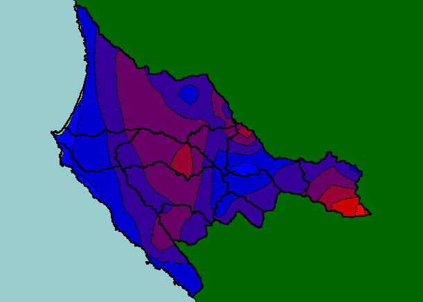
This is a map of annual rainfall in the KRIS Garcia based on work by the Oregon Climate Service at Oregon State University. The
model was based on 1961-1990 rainfall data. The model substantially underestimates annual rainfall in some locations, such as the
north-central portion of the project area, where the model shows 45 inches but the "Point Arena 12 NNE" gage recorded an
average of 68 inches. Note that rainfall patterns are greatest in the east and west of the watershed where elevation is greatest. As
storms pass over higher spots the cool air increases precipitation in what is known as the orographic effect.
|
|