
|
Area/Topic | Bibliography | Background | Hypotheses | Home |
|
Map Page.
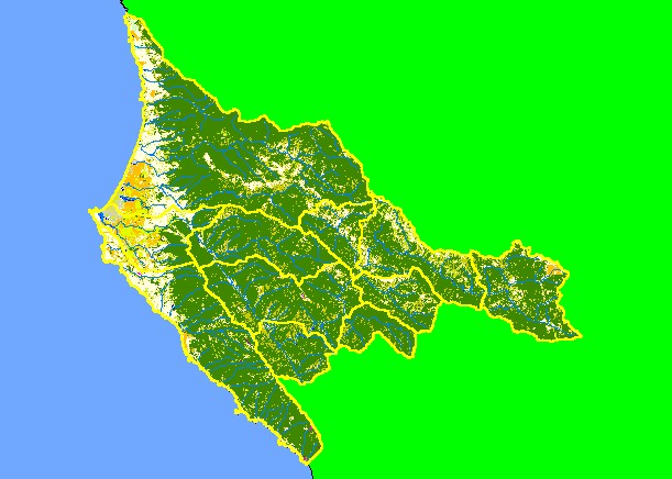
You selected the area Basin-wide/General and the topic Map: 1G EPA Landcover/Landuse, Garcia Project Area |
| This is a map of the 1992 Environmental Protection Agency Landcover/Landuse in the KRIS Garcia project area. These data are derived from a 1992 Landsat image and show that much of the eastern parts of the project are in coniferous forest. The western coastal plain is a flat area mostly covered by grasslands, dunes and farmlands. Some of the grasslands and oak woodlands in the east reflect underlying Central Belt Franciscan mťlange terrain. Scale = 1:338,879 . | |||
|
|
||
To view metadata about a map layer, click on a link in the table below.
| Name of Layer in Map Legend | Metadata File Name |
|---|---|
| Sub-basins (no labels) | subbasins.shp.txt |
| Streams (1:100k scale)(no labels) | streams100.shp.txt |
| Project Frame | Unavailable |
| EPA Landcover (1992 Aggregated) | lndcov2.tif.txt |
| EPA Landcover (1992) | lndcov.tif.txt |
| Topo Map (1:24k scale)(USGS) | Unavailable |
| Project Area Background | Unavailable |
| www.krisweb.com |