|
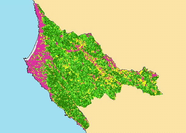
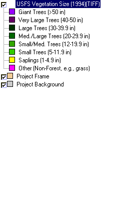
This is a map of 1994 vegetation size data in the KRIS Garcia project area, overlaid on top of KRIS sub-basins. The tree size
classifications were derived from Landsat multi-spectral images taken in 1994. Stand conditions are accurately represented at the
one hectare scale. The large non-forest area to the west is the grassy coastal plain and farmlands. Data were provided by the U.S.
Forest Service Pacific Southwest Region Remote Sensing Lab, in cooperation with the California Department of Forestry. Click
the check box next to a layer to toggle it on/off. Available layers include Riparian Vegetation Size, Topographic Map, Grayscale
Hillshade, and Change in Vegetation (1994-1998). Scale = 1:332,374 .
|
|