|
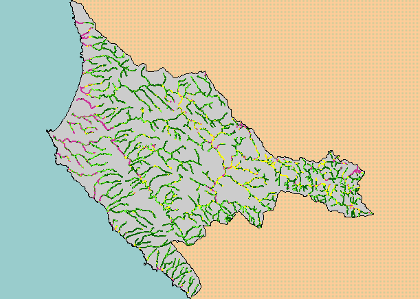
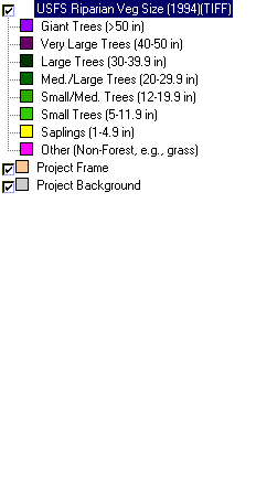
This is a map of vegetation size data within 90-meter riparian buffer zones in the KRIS Garcia project area. The tree size
classifications were derived from Landsat multi-spectral images taken in 1994. Stand conditions are accurately represented at the
one hectare scale. Non-forest riparian conditions in the west are associated with grasslands on coastal terraces and farm lands.
Some non-forest and sapling signatures in the east may be due to grasslands caused by geologic factors. Data were provided by
the U.S. Forest Service Pacific Southwest Region Remote Sensing Lab, in cooperation with the California Department of Forestry.
Available layers include Vegetation Size, Topographic Map, Grayscale Hillshade, and Change in Vegetation (1994-1998). Scale = 1:318,849 .
|
|