| Area |
Basin-wide/General |
| Topic |
Habitat: CDFG Garcia River 1966 Assessment |
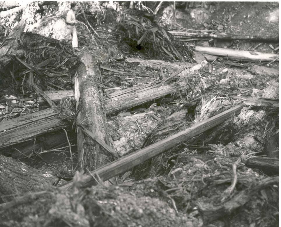
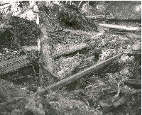 Click on image to enlarge (142K). Click here to display a larger version (304K).
Photo taken by the California Department of Fish and Game shows logging slash in Signal Creek and signs of heavy equipment operation in 1955. The spanning logs may indicate that this may have been a temporary "Humboldt" stream crossing.
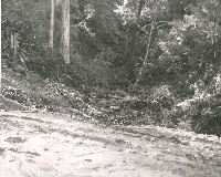 Click on image to enlarge (68K). Click here to display a larger version (255K).
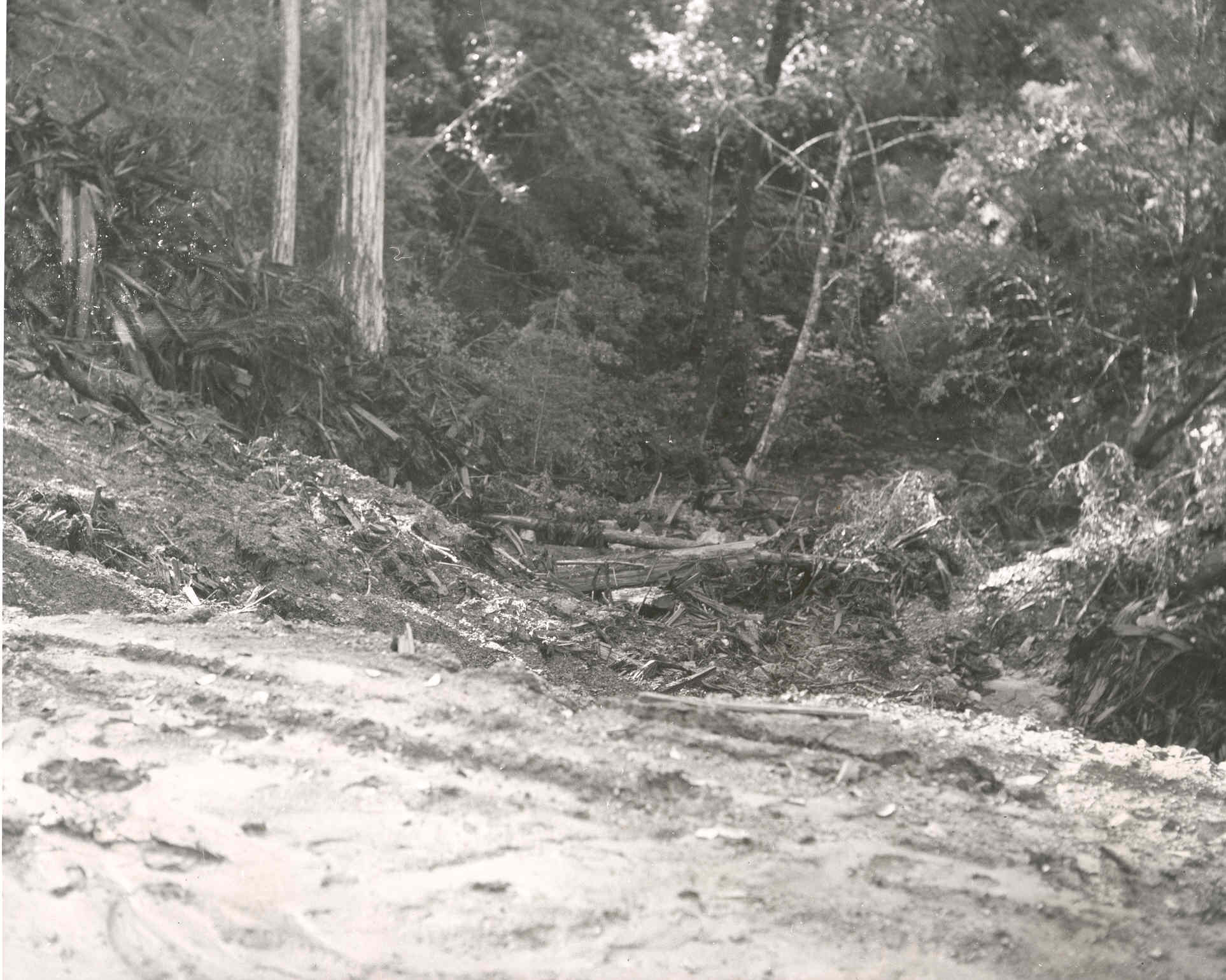
This 1955 photograph of Signal Creek looking downstream from an earth-fill stream crossing, which likely failed in later storm events. Slash clogs the stream channel almost obscuring the flow of the stream. Photo taken by the California Department of Fish and Game.
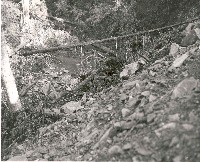 Click on image to enlarge (143K). Click here to display a larger version (296K).
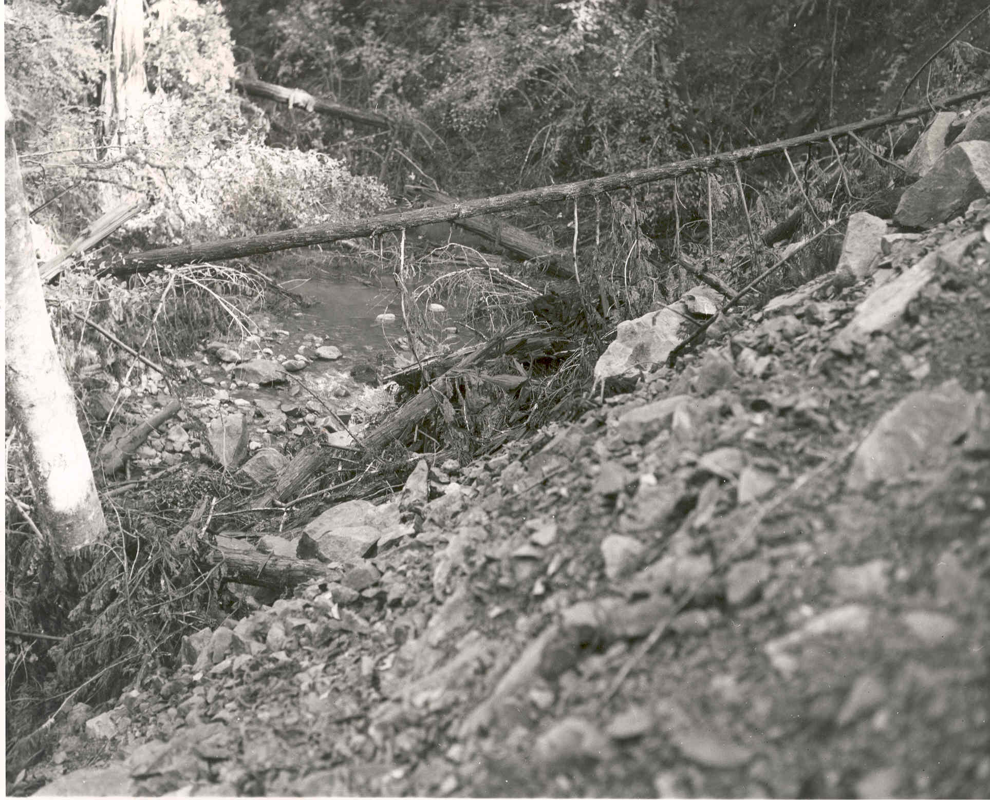
This 1955 photograph by the California Department of Fish and Game shows the edge of a road prism extending down into the stream. The stream is partially displaced by the fill. Logging slash is in evidence in the stream. Angular material in the stream bed indicates recent debris torrent.
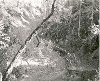 Click on image to enlarge (58K). Click here to display a larger version (363K).
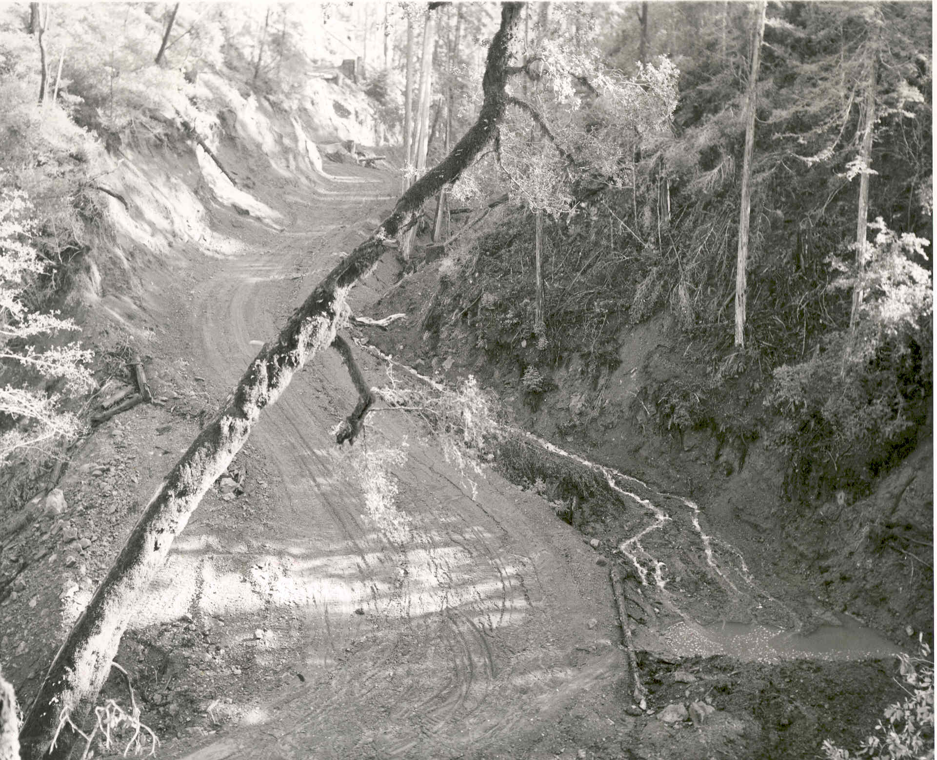
This logging road has displaced a small stream channel in the Signal Creek watershed in 1955. The braided flow across the fill adjacent to the road prism indicates that a small first order or emphemeral stream has been buried. This type land use activities caused massive contributions of sediment during subsequent storm events. This photo was taken by the California Department of Fish and Game.
To learn more about this topic click Info Links
To view additional information (data source, aquisition date etc.) about this page, click Metadata

 Click on image to enlarge (142K). Click here to display a larger version (304K).
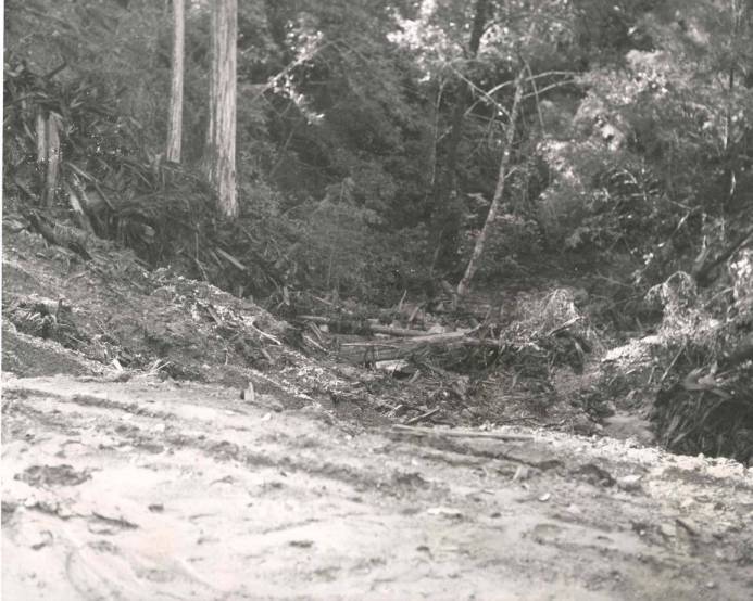 Click on image to enlarge (68K). Click here to display a larger version (255K).
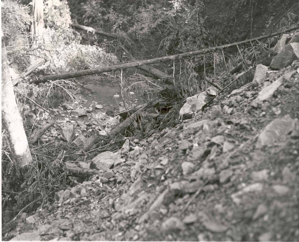 Click on image to enlarge (143K). Click here to display a larger version (296K).
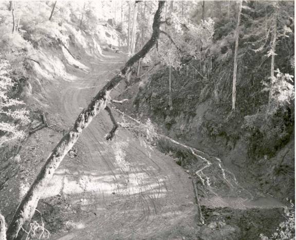 Click on image to enlarge (58K). Click here to display a larger version (363K).
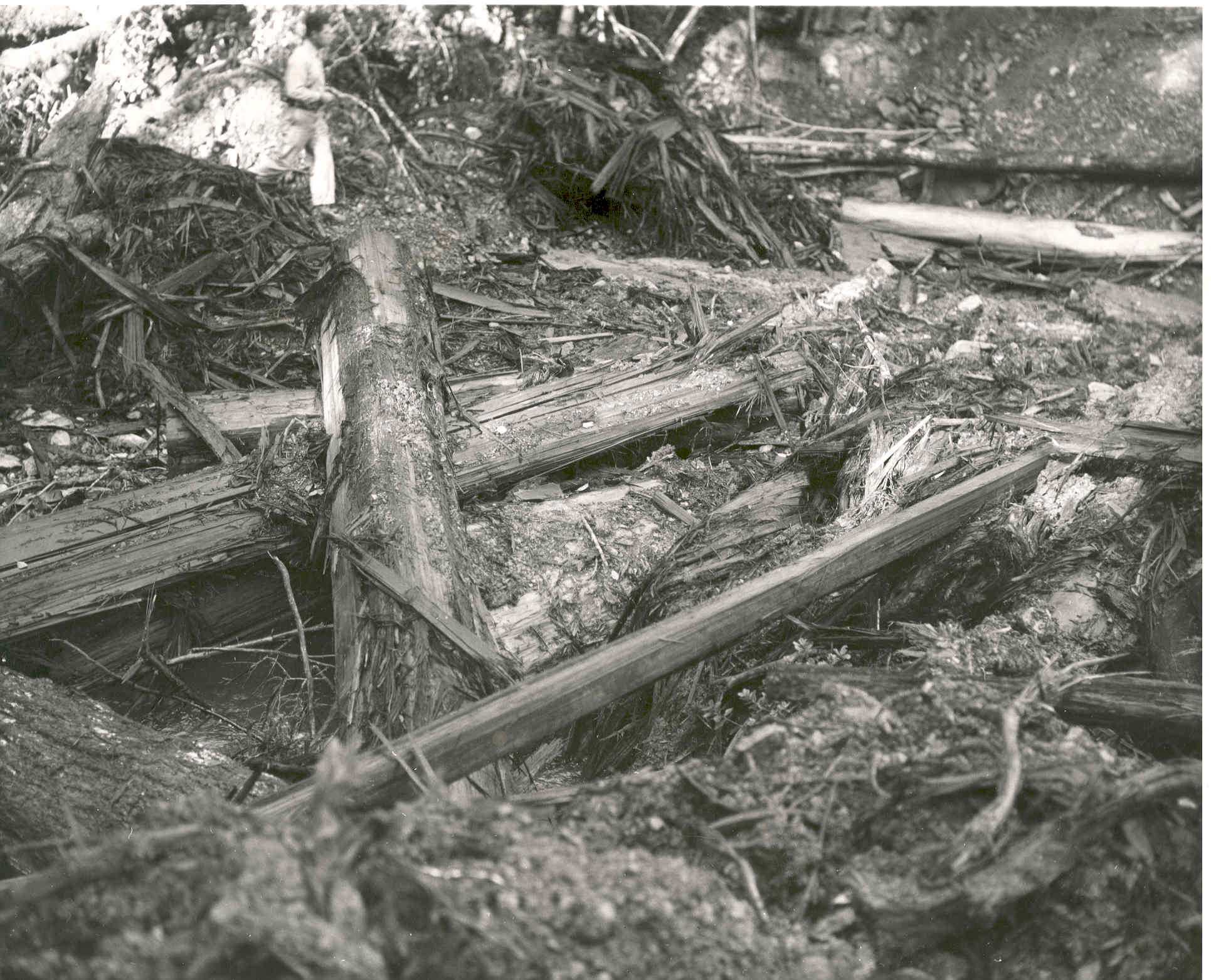