| Area |
Basin-wide/General |
| Topic |
Tour: Sediment Transport Photos 1994-2003 |
 Click on image to enlarge (62K). Click here to display a larger version (305K).
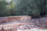
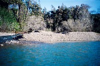
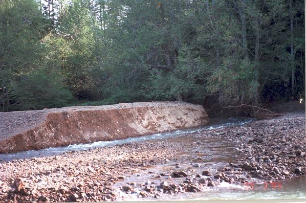
This picture shows Olsen Gulch and a terrace of sediment that formed after the January and March storms of 1995. See Picture #2 to see the same location in 2002 to see a reduction in sediment transport. Photo provided courtesy of Craig Bell. 3/30/95
 Click on image to enlarge (45K). Click here to display a larger version (296K).
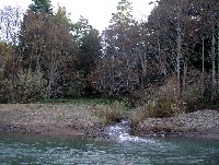
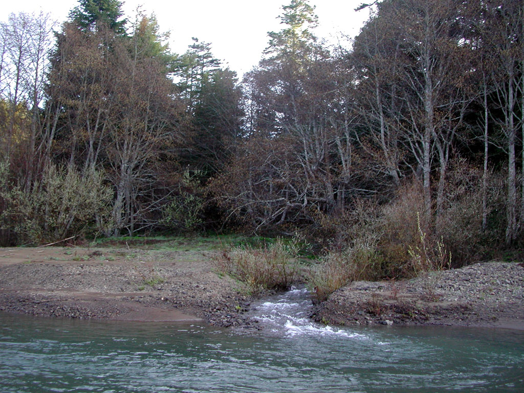
This photo shows the mouth of Olsen Gulch in February 2002. Notice that there is much less sediment deposited and coarser material now in the channel and on the terraces. This indicates a decreased sediment supply from Olsen Gulch compared to the 1994-1995 era. Photo by Pat Higgins.
 Click on image to enlarge (72K). Click here to display a larger version (397K).
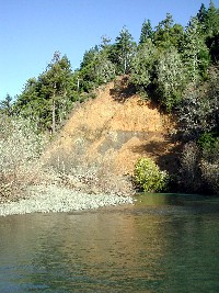
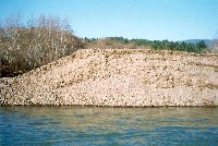
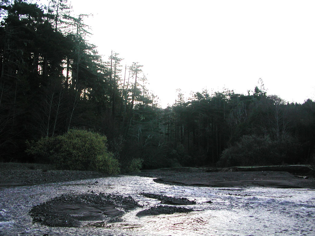
This stream side landslide was re-activated in 1997, causing a substantial contribution of sediment to the lower Garcia River. See Picture #2 to see the proximity of a road to the top of the feature. Photo provided by Pat Higgins.
 Click on image to enlarge (53K). Click here to display a larger version (336K).
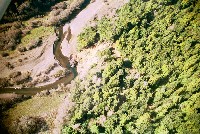
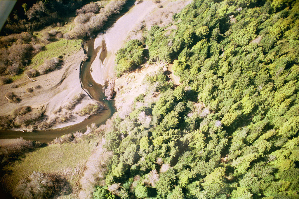
This 2000 aerial photo shows the same slide as in Picture #2 but from directly above. Note the road through the trees at the top of the slide. If the road channeled water onto the top of this feature, it could play a role in re-activating the slide. Photo by Peter Dobbins and Friends of the Garcia River.
 Click on image to enlarge (147K).
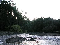
The mouth of the North Fork in March 1997 had a large sediment terrace as a result of evulsions from the North Fork in January of that year in response to a large storm event. Back pressure from the mainstem Garcia at flood helps to create back pressure so that sediment settles in a delta. See Pictures #6 (2000) and #7 (2003) to see how this deposit has changed. Photo provided courtesy of Craig Bell.
 Click on image to enlarge (45K). Click here to display a larger version (401K).
This year 2000 photo of the mouth of the North Fork shows that sediment contributions have diminished as the terraces at the mouth have been reduced in size and the bed and terrace material has become more coarse. Photo courtesy of Craig Bell.
 Click on image to enlarge (42K). Click here to display a larger version (201K).
This February 2002 photo shows the size of the sediment terraces at the mouth of the North Fork Garcia even further diminished from 1997 and 2000 levels (Pictures #5, #6). This indicates a decreased supply from the North Fork. Photo provided courtesy of Pat Higgins.
 Click on image to enlarge (51K). Click here to display a larger version (243K).
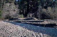
This mid-channel sediment bar formed on the Garcia River at the upstream edge of the Kendall Property and is indicative of the large amount of sediment still being transported by the Garcia River. Photo by Craig Bell.
To learn more about this topic click Info Links
To view additional information (data source, aquisition date etc.) about this page, click Metadata

 Click on image to enlarge (62K). Click here to display a larger version (305K).
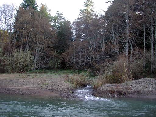 Click on image to enlarge (45K). Click here to display a larger version (296K).
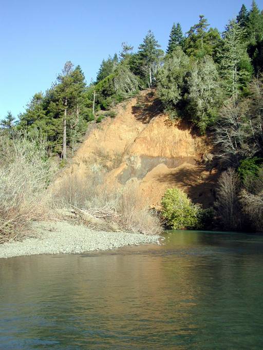 Click on image to enlarge (72K). Click here to display a larger version (397K).
 Click on image to enlarge (53K). Click here to display a larger version (336K).
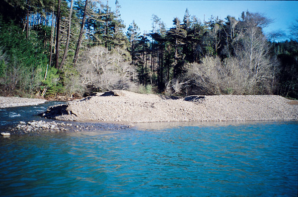 Click on image to enlarge (147K).
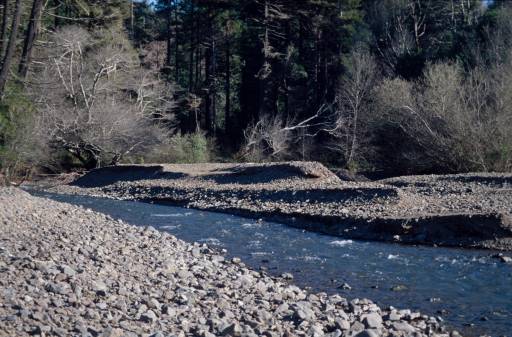 Click on image to enlarge (45K). Click here to display a larger version (401K).
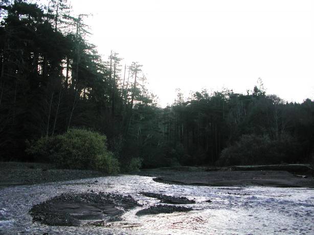 Click on image to enlarge (42K). Click here to display a larger version (201K).
 Click on image to enlarge (51K). Click here to display a larger version (243K).
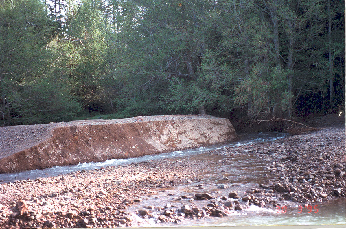