| Area |
Basin-wide/General |
| Topic |
Tour: Sediment Transport and Supply Photos 1994-2003 |
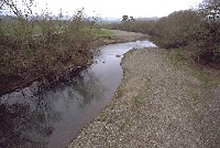 Click on image to enlarge (77K).
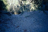
This picture shows the mainstem Garcia River in January 1994. The encroachment of the bars into the pools and the very small particle size distribution of bed materials indicate some recent sediment contributions from the watershed. The drought from 1986 to 1994 postponed transport of sediment, but high flows from 1995 to 1999 helped move this pulse more towards the estuary and ocean. See Picture #3 for the same location in May 2003. Photo provided by Peter Dobbins.
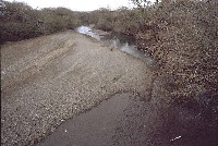 Click on image to enlarge (82K).
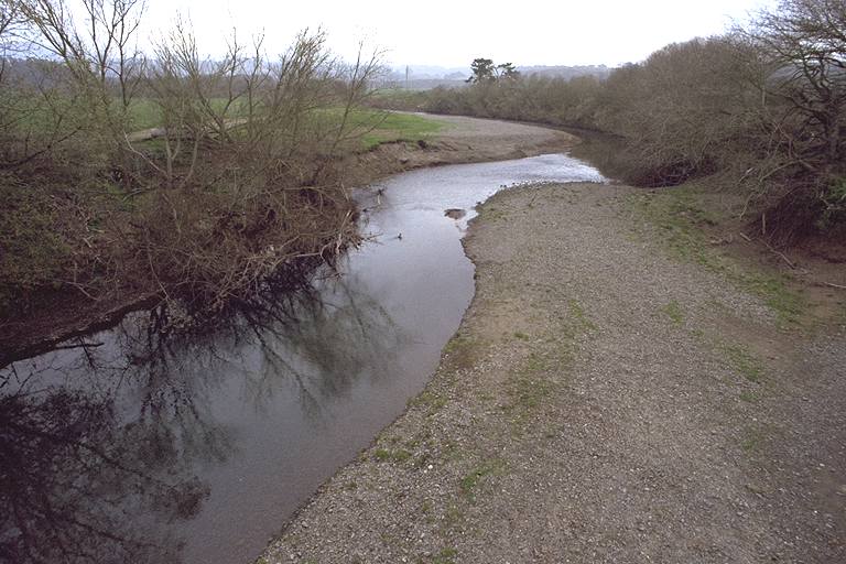
This photo taken looking downstream of Highway 1 in 1994 shows a highly aggraded mainstem Garcia River channel with very small particle size distribution, including patches of surface silt or sand. Note the island of sediment mid-channel at a distance and compare with Picture #4 at the same location in May 2003. Photo by Peter Dobbins.
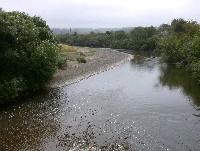 Click on image to enlarge (154K).
This picture shows the mainstem Garcia River in May 2003. The leafy condition of the trees accentuates the addition of substantial riparian canopy on the right bank (use the power pole as a reference). The pool along the riparian at right has become longer, extending all the way into the foreground at right. High flows from 1995 to 1999 appear to have helped move the sediment pulse that resided here in 1994 more towards the estuary and ocean. See Picture #1 for the same location in January 1994. Photo provided by Craig Bell.
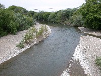 Click on image to enlarge (139K).
This photo taken in May 2003 shows the Garcia River looking downstream from the Highway 1 Bridge. The place where the sediment plug resided mid-channel in 1994 is now a well developed pool. The bar also consists of more gravel sized particles and less fines, indicating a reduction in the amount of sediment of recent origin. Colonization of the gravel bar by willows is also indicative of reduced bed load transport. Photo by Craig Bell.
 Click on image to enlarge (39K). Click here to display a larger version (426K).
This photo shows the mouth of the South Fork Garcia River running underground in the summer of 1995. Widespread logging from 1983-1988 in the South Fork likely unleashed this sediment pulse which buried the active channel and caused loss of surface flow. This plug of sediment has now passed downstream. Photo by Craig Bell.
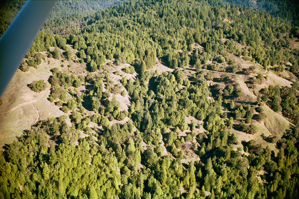
 Click on image to enlarge (57K). Click here to display a larger version (360K).
The interior portion of the Garcia River basin has grasslands which may be susceptible to gully erosion, particularly when road drainage is concentrated in un-armored areas. Gullies are visible off roads in the upper Blue Waterhole Creek basin. Photo by Peter Dobbins and Friends of the Garcia River. 2000.
To learn more about this topic click Info Links
To view additional information (data source, aquisition date etc.) about this page, click Metadata

 Click on image to enlarge (77K).
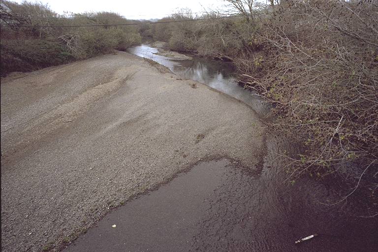 Click on image to enlarge (82K).
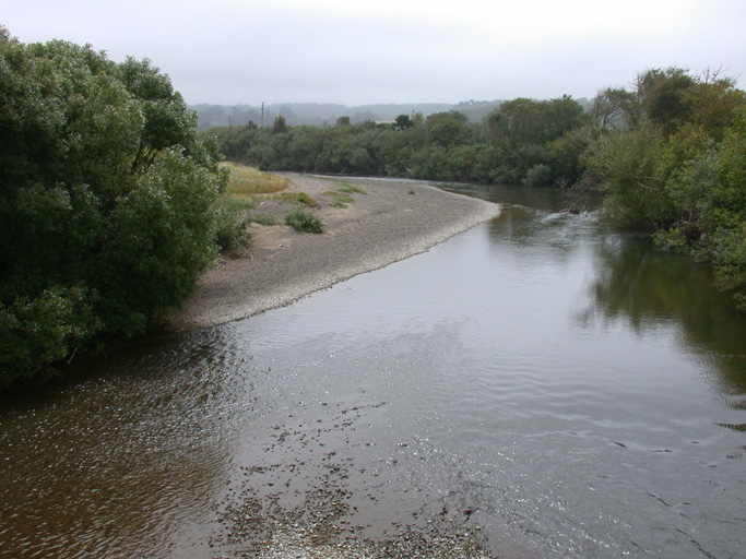 Click on image to enlarge (154K).
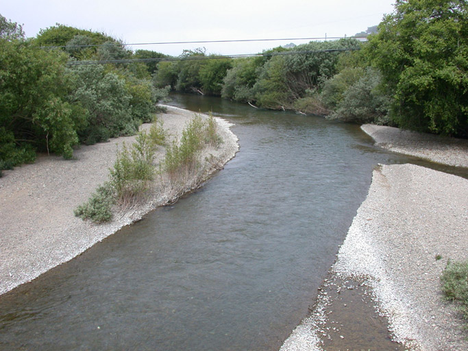 Click on image to enlarge (139K).
 Click on image to enlarge (39K). Click here to display a larger version (426K).
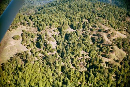 Click on image to enlarge (57K). Click here to display a larger version (360K).
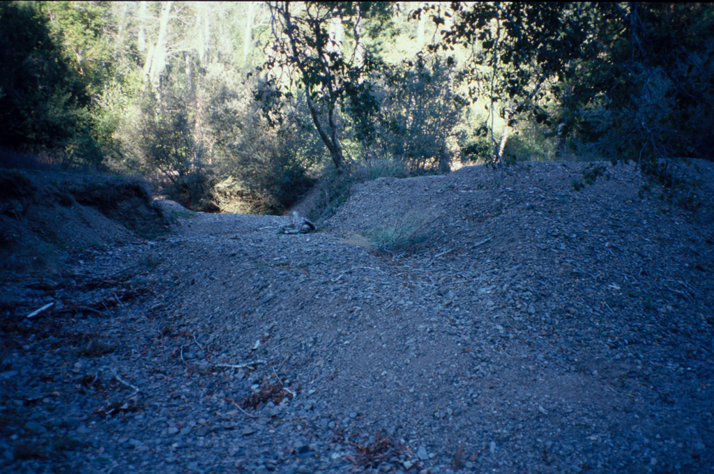