| Area |
Basin-wide/General |
| Topic |
Tour: 1994 Aerials of Garcia Forest Health |
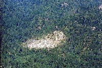
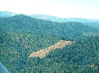 Click on image to enlarge (36K). Click here to display a larger version (173K).
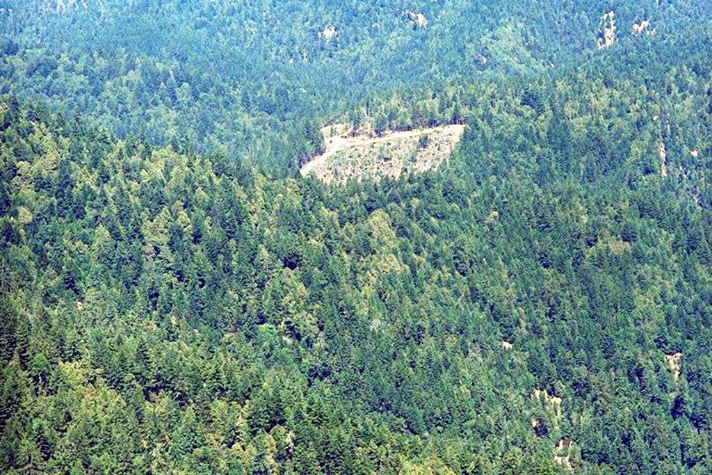
This photo shows a patch clear cut at an unknown Garcia River basin location amongst mixed conifer-hardwood stands. This shows typical stand conditions following old growth logging forty to fifty years ago. Cable corridors from selective logging also show on the ridge to the left of the clear cut. Photo by Friends of the Garcia River and Peter Dobbins.
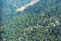 Click on image to enlarge (61K). Click here to display a larger version (350K).
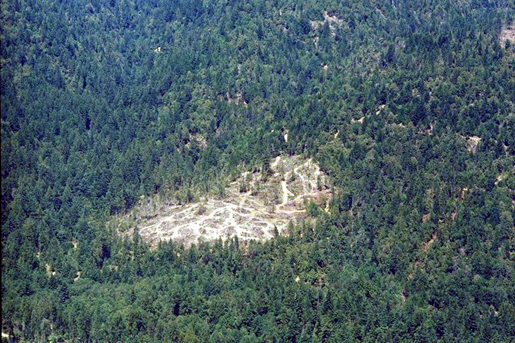
This photo shows a zoom from the previous Picture (#1) with thinning of the forest obvious in the foreground at lower right as opposed to clear cut at top. Photo by Friends of the Garcia River and Peter Dobbins.
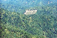 Click on image to enlarge (60K). Click here to display a larger version (342K).
This picture shows a mix hardwood (lighter green) and conifer (dark green) forest following clear cut logging 40-50 years prior. Patches of bare soil in the photo (upper right) show the tracks of past landslides which have not yet re-vegetated. Photo by Friends of the Garcia River and Peter Dobbins.
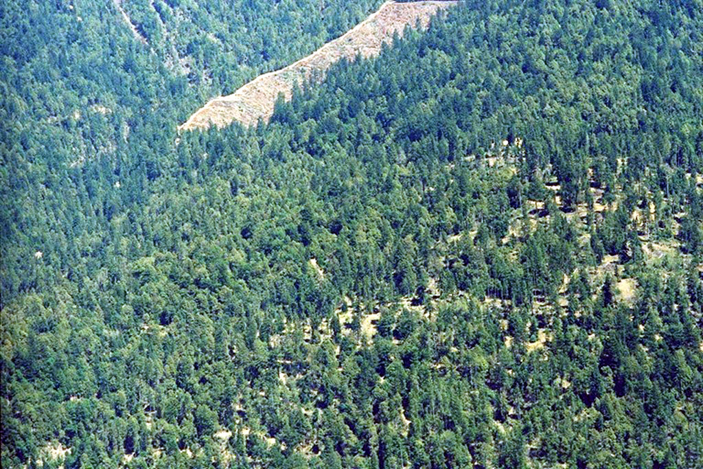
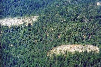 Click on image to enlarge (58K). Click here to display a larger version (332K).
Patch clear cuts and tractor skid trails show up in this low level aerial photo. The areas between the cuts look as if they have been thinned. Photo by Friends of the Garcia River and Peter Dobbins.
 Click on image to enlarge (51K). Click here to display a larger version (308K).
Close up of patch cut and skid trails. Photo by Friends of the Garcia River and Peter Dobbins.
To learn more about this topic click Info Links
To view additional information (data source, aquisition date etc.) about this page, click Metadata

 Click on image to enlarge (36K). Click here to display a larger version (173K).
 Click on image to enlarge (61K). Click here to display a larger version (350K).
 Click on image to enlarge (60K). Click here to display a larger version (342K).
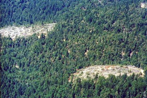 Click on image to enlarge (58K). Click here to display a larger version (332K).
 Click on image to enlarge (51K). Click here to display a larger version (308K).
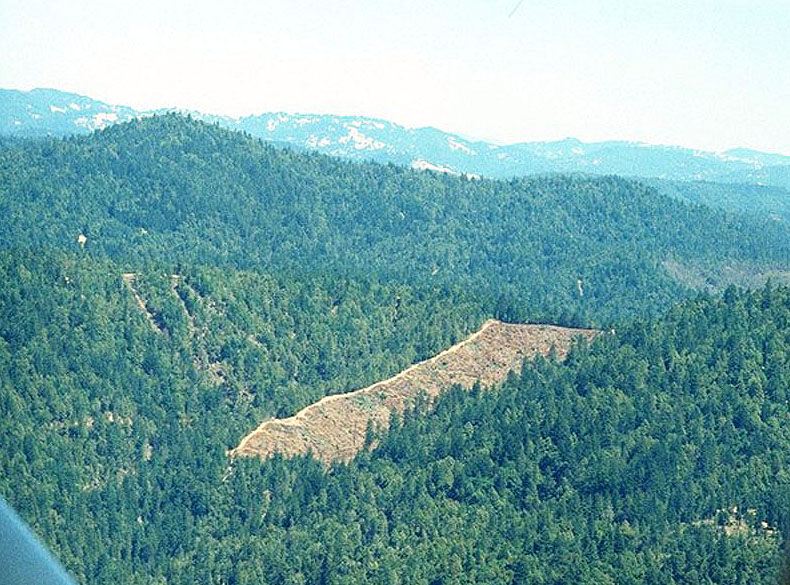