
| Area | Coastal Tributaries North |
| Topic | Climate: Annual Rainfall - Point Arena 12NNE, 1963-1997 |
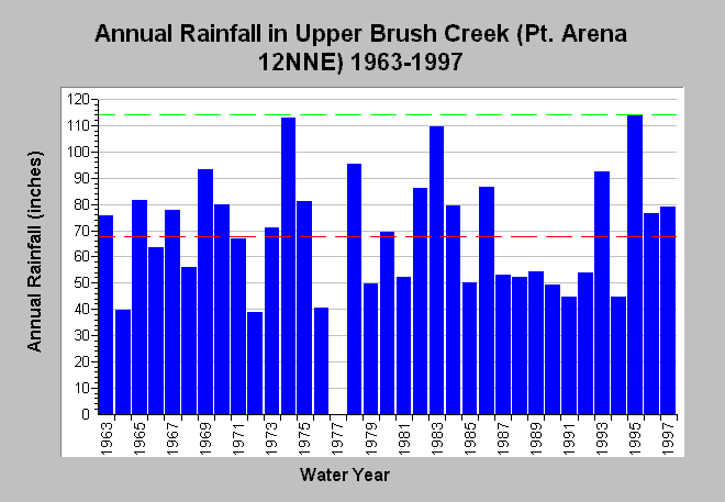
| Caption: This chart shows annual rainfall accumulation recorded at the Point Arena 12NNE rain gage (DWR # F80 7009 50) in upper Brush Creek between 1963 and 1997, but missing water year 1977. Rainfall measurements are by water year. For the period of record, the minimum total rainfall accumulation occurred in 1972 (38.91 inches) and the maximum during 1995 (114.30 inches). The average rainfall is shown as a red dashed line is approximately 69 inches of rain and the maximum in green dashed line. Data are compiled by the California Department of Water Resources. See InfoLinks for more information. | |
 |
To learn more about this topic click Info Links .
To view additional information (data source, aquisition date etc.) about this page, click Metadata .
To view the table with the chart's data, click Chart Table web page.
To download the table with the chart's data, click climate_rainfall_annual_ptareana12nne.dbf (size 763 bytes) .
| www.krisweb.com |