
|
Area/Topic | Bibliography | Background | Hypotheses | Home |
|
Map Page.
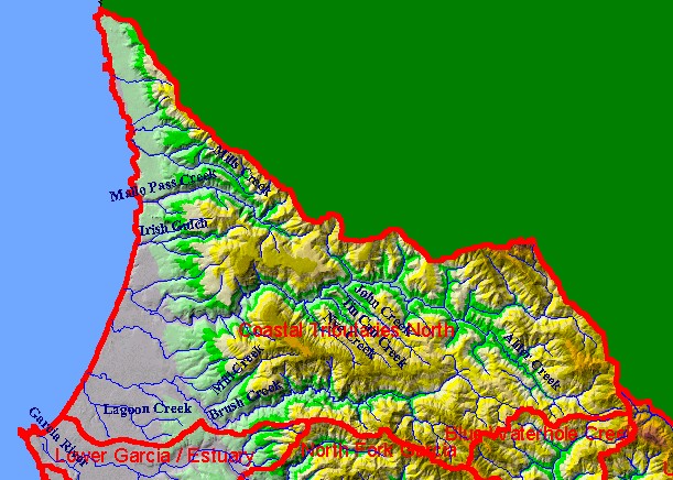
You selected the area Coastal Tributaries North and the topic Map: 1B Hydrography with DEM, Coastal Tribs N. Sub-basin |
| This is a map of the 1:24,000 scale USGS hydrography and elevation map of the KRIS Garcia Coastal Tributaries North sub-basin. The watersheds of Alder Creek and Brush Creek cover most of the sub-basin, although Mallo Pass, for which this Calwater Planning watershed is named, is a major tributary to the north. The headwaters of Alder Creek are one of the highest points in the KRIS Garcia project area. Data were contributed by the California Department of Forestry. Scale = 1:158,267 . | |||
|
|
||
To view metadata about a map layer, click on a link in the table below.
| Name of Layer in Map Legend | Metadata File Name |
|---|---|
| Streams (1:24k scale)(w/ labels) | streams24.shp.txt |
| Sub-basins (w/ labels) | subbasins.shp.txt |
| Project Frame | Unavailable |
| Elevation (10 m resolution)(TIFF) | elev10.tif.txt |
| Topo Map (1:24k scale)(USGS) | Unavailable |
| www.krisweb.com |