|
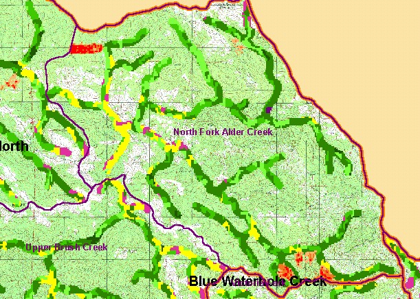
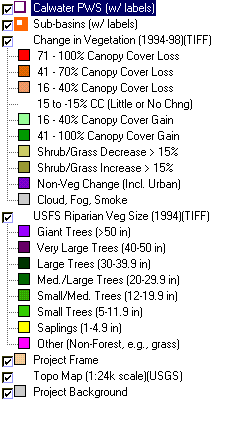
This is a map of vegetation size data within 90-meter riparian buffer zones in the North Fork Alder Creek Calwater Planning
Watershed, overlain on a USGS Topo map. The tree size classifications were derived from Landsat multi-spectral images taken in
1994. Stand conditions are accurately represented at the one hectare scale. The small diameter tree size indicates early seral
stage conditions which may be in part a result of grasslands, which show as white areas on USGS Topo backdrop. The CDF
change scene detection derived from 1994 and 1998 Landsat imagery suggests some timber harvest in that period in this
watershed. Data were provided by the U.S. Forest Service Pacific Southwest Region Remote Sensing Lab, in cooperation with
the California Department of Forestry. Available layers include Vegetation Size, Grayscale Hillshade, and Topographic Map. Scale = 1:61,292 .
|
|