|
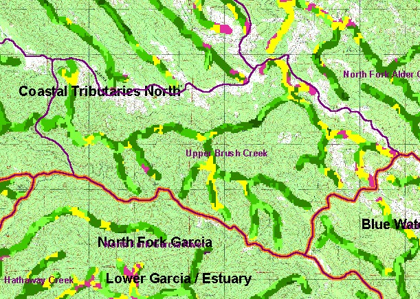
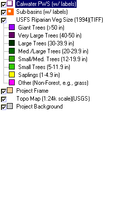
This is a map of vegetation size data within 90-meter riparian buffer zones in the Upper Brush Creek Calwater Planning
Watershed, and a USGS Topo map back drop. The tree size classifications were derived from Landsat multi-spectral images
taken in 1994. Stand conditions are accurately represented at the one hectare scale.Some riparian areas in small trees and saplings
may reflect recent timber harvest. Natural grasslands (shown as white on USGS Topo) may have naturally small diameter riparian.
Data were provided by the U.S. Forest Service Pacific Southwest Region Remote Sensing Lab, in cooperation with the California
Department of Forestry. Available layers include Vegetation Size, Grayscale Hillshade, and Change in Vegetation (1994-1998). Scale = 1:57,630 .
|
|