
|
Area/Topic | Bibliography | Background | Hypotheses | Home |
|
Map Page.
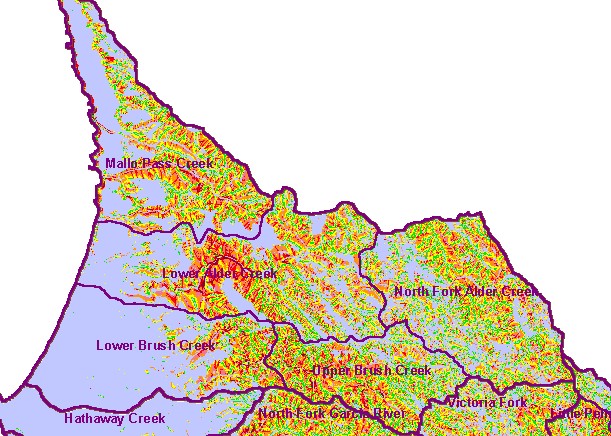
You selected the area Coastal Tributaries North and the topic Map: 1F Geology/SHALSTAB Coastal Tribs North |
| This is a map shows the risk of shallow debris slides (SHALSTAB) for the KRIS Garcia Coastal Tributaries North sub-basin area and Calwater Planning Watersheds. There are moderate and very high risk debris slide areas (>2.5) in the Lower Alder Creek Calwater inner gorge, as well as portions of the Upper North Fork Alder, Upper Brush Creek, the east end of Lower Brush Creek, and areas of the Mallo Pass Creek watershed. | |||
|
|
||
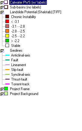
To view metadata about a map layer, click on a link in the table below.
| Name of Layer in Map Legend | Metadata File Name |
|---|---|
| Calwater PWS (w/ labels) | calw22.shp.txt |
| Sub-basins (no labels) | subbasins.shp.txt |
| Landslide Potential (Shalstab) [TIFF] | garciaqt.tif.txt |
| Geolines | geolines.shp.txt |
| Percent Slope (TIFF) | garciaslp.tif.txt |
| Percent Slope, Hillshade (TIFF) | slope1.tif.txt |
| Elevation (10 m resolution)(TIFF) | elev10.tif.txt |
| Relative Landslide Potential (Shalstab) [TIFF] | garciaqt2.tif.txt |
| Topo Map (1:24k scale)(USGS) | Unavailable |
| Project Frame | Unavailable |
| Project Background | Unavailable |
| www.krisweb.com |