
| Area | Coastal Tributaries North |
| Topic | Tour: 2. Alder Creek/San Andreas 1906 Historical Photos |
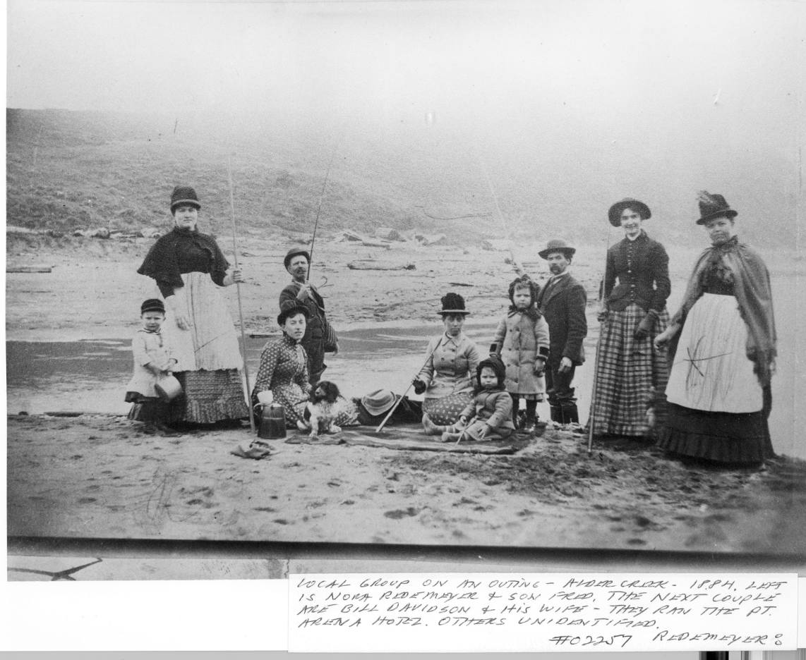
Some early European settlers relied heavily on the fish in the streams of the Point Arena area for subsistence, and this family in 1884 tries a little "trout" fishing on lower Alder Creek. "Trout" were most likely juvenile steelhead of several age classes and coho, both of which thrived in the deep pools of the "unmanaged" watershed. Notes from Robert Lee indicate that Nora Redemeyer and her son Fred are in the picture as well as Mr. and Mrs. Bill Davidson, who ran the Pt Arena Hotel at the time. Photo provided courtesy of the Held-Poage Memorial Home, Ukiah, California, and Robert Lee, #2257 Redemeyer.
Lower Alder Creek crosses the San Andreas Fault just as it passes offshore north of Point Arena. This close up of ground rupture along the San Andreas at the mouth of Alder Creek is typical of the fault trace from Pt. Reyes north. The amount of ground movement here is not known, but a fence near Pt Reyes was displaced 19 feet. Photo provided courtesy of the Held-Poage Memorial Home, Ukiah, California, and Robert Lee, #02258 Hunter.
Not only does this photo show the downed bridge over Alder Creek after the 1906 Earthquake, but the San Andreas Fault rupture. Robert Lee notes that the fault is the line three quarters up the picture on the left side and crosses the picture diagonally, partially obscured by the berm which blocks the creek. This may have been a location of uplift triggered by the quake. Photo provided courtesy of the Held-Poage Memorial Home, Ukiah, California, and Robert Lee. #02263, Hunter.
This picture shows the San Andrea Fault trace after the 1906 Earthquake, in a pasture near Manchester. The small wetland is a slump pond along the fault shear zone, where the water table is near the surface. Photo provided courtesy of the Held-Poage Memorial Home, Ukiah, California, and Robert Lee, #02260 Hunter.
 Click on image to enlarge (128K).
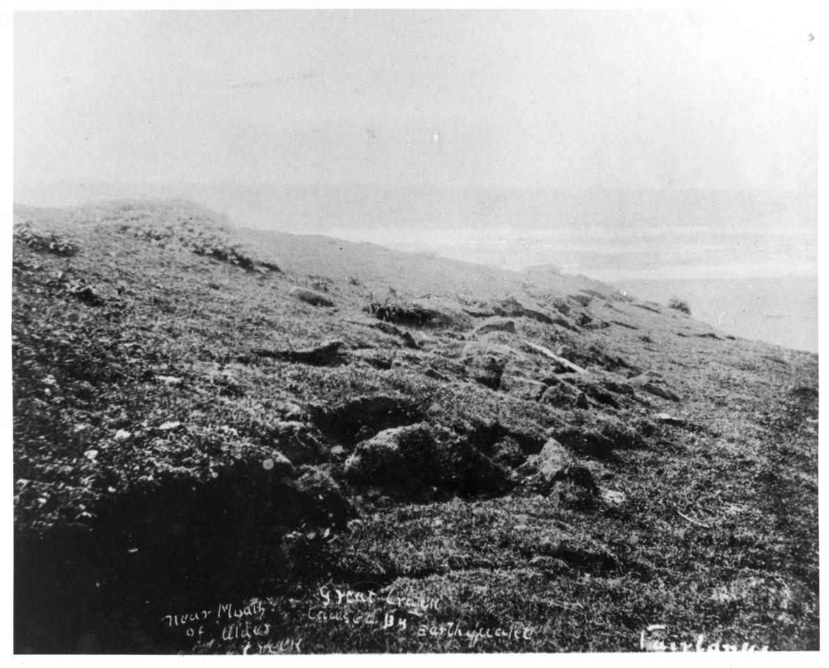 Click on image to enlarge (166K).
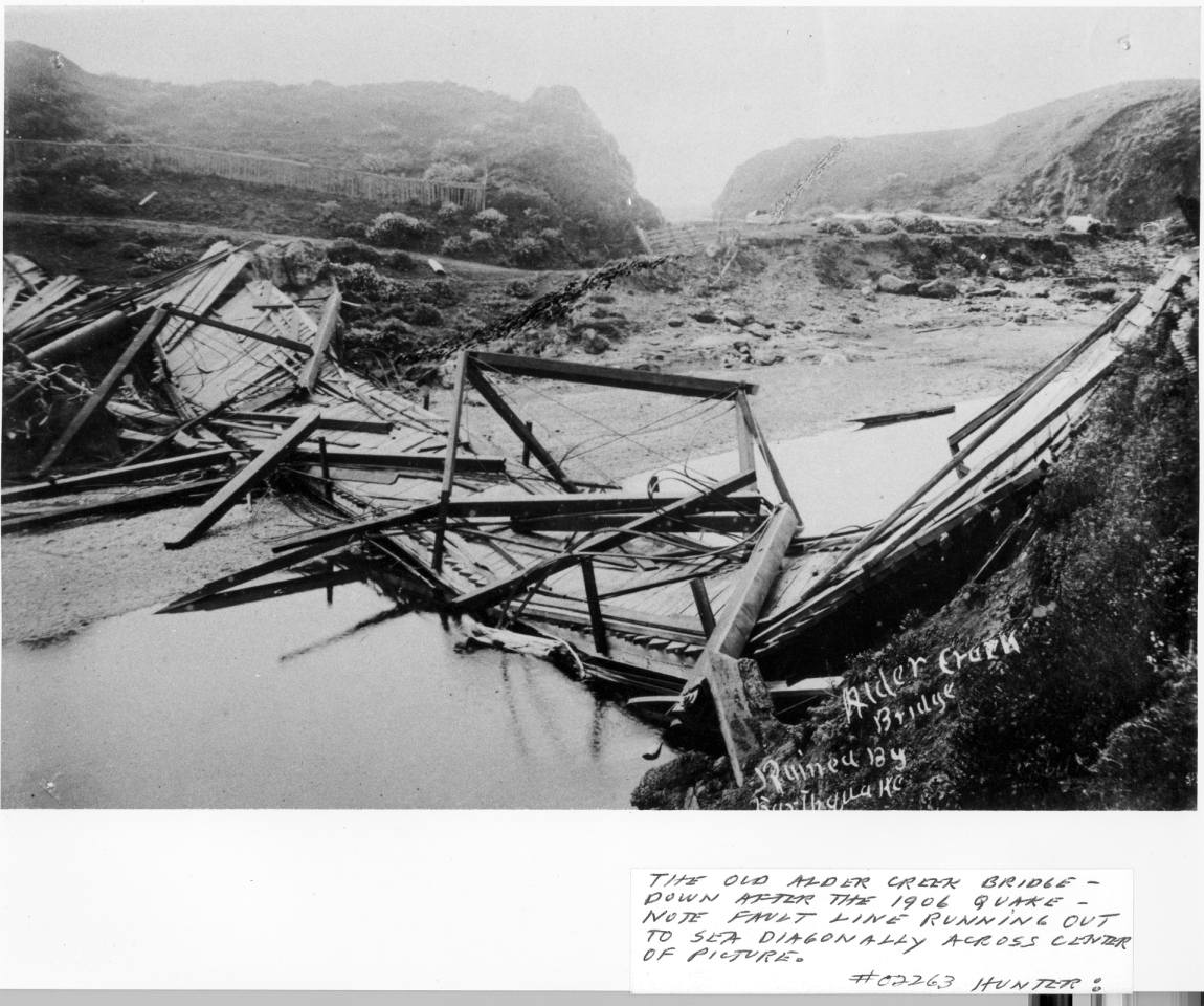 Click on image to enlarge (156K).
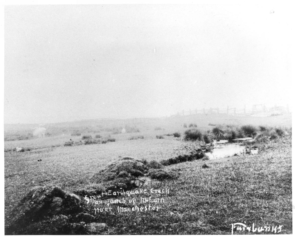 Click on image to enlarge (143K).
To learn more about this topic click Info Links
To view additional information (data source, aquisition date etc.) about this page, click Metadata
| www.krisweb.com |