| Area |
Coastal Tributaries North |
| Topic |
Tour: 3. Brush Creek Stream and Logging Historical Photos |
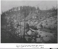 Click on image to enlarge (119K).
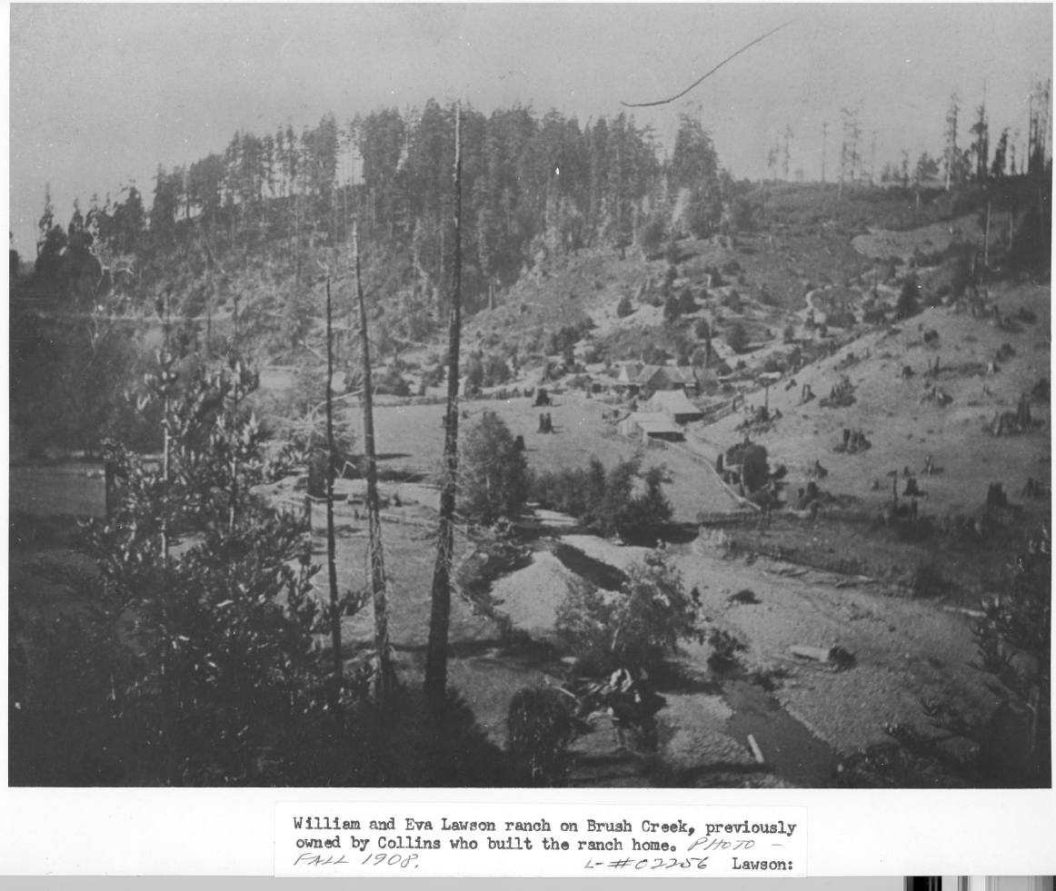
This photo shows Brush Creek on the William and Eva Lawson Ranch in the fall of 1908. Much of the area was clear cut to help supply wood for the rebuilding of San Francisco after the 1906 Earthquake, but the timber harvests on the hills above the ranch may have also been somewhat earlier. This appears to be an attempted conversion of forest to pasture on the hillslopes, not just the valley bottom. Brush Creek appears massively aggraded in response to this intensive land use. This flat stream channel (response reach) is showing signs of becoming braided and the banks of the stream are eroding, causing loss of pasture. The 1906 Earthquake would also help destabilize slopes, and some aggradation could also have been related to landslides triggered by the ground movement. Photo provided courtesy of the Held-Poage Memorial Home, Ukiah, California, and Robert Lee, #02256, Lawson.
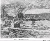 Click on image to enlarge (69K). Click here to display a larger version (176K).
This photo shows the Collin's shingle mill in the Brush Creek basin in 1871. Note the large diameter of trees relative to the horses, wagon and people. Although early timber harvest such as this were very intensive land use, cutting the huge trees was so labor intensive that the scope of geographic disturbance was not as widespread as in later mechanized eras. Notes cabins built in what appears to be a Class III stream. Photo provided courtesy of the Held-Poage Memorial Home, Ukiah, California, and Robert Lee, #02238. Cuthbertson.
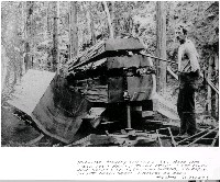 Click on image to enlarge (162K).
Robert Lee notes that the photo shows "Millard Hackley splitting rail road ties, circa 1909." The mechanical devices shown are described as a metal jack screw wooden wedges called gluts. Photo provided courtesy of the Held-Poage Memorial Home, Ukiah, California, and Robert Lee, #02243 Schuler.
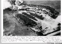 Click on image to enlarge (84K).
This aerial photo shows the "Bojock" Lumber Company in Manchester, which milled 80,000 board feet per day. This mill operated from 1940-1968 and is representative of the intensive wave of land use associated with Post WW II logging. Photo provided courtesy of the Held-Poage Memorial Home, Ukiah, California, and Robert Lee collection. L-#06444 Ohleyer.
 Click on image to enlarge (123K).
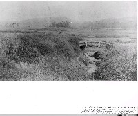
Robert Lee notes that the fisherman is Mr. Fairbanks and the photo is of lower Brush Creek. The date of the photo is unknown. Photo provided courtesy of the Held-Poage Memorial Home, Ukiah, California, from the Robert Lee collection. #02244 Pt Arena Lighthouse Keepers.
 Click on image to enlarge (149K).
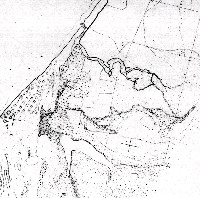
This image of a scanned map of lower Brush Creek and the town site of Manchester before development comes from Peter Dobbins and the Friends of the Garcia River.
To learn more about this topic click Info Links
To view additional information (data source, aquisition date etc.) about this page, click Metadata

 Click on image to enlarge (119K).
 Click on image to enlarge (69K). Click here to display a larger version (176K).
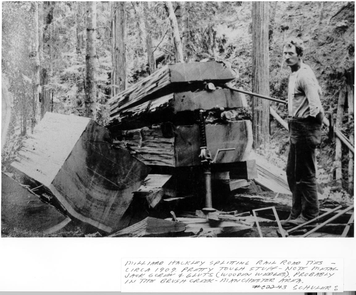 Click on image to enlarge (162K).
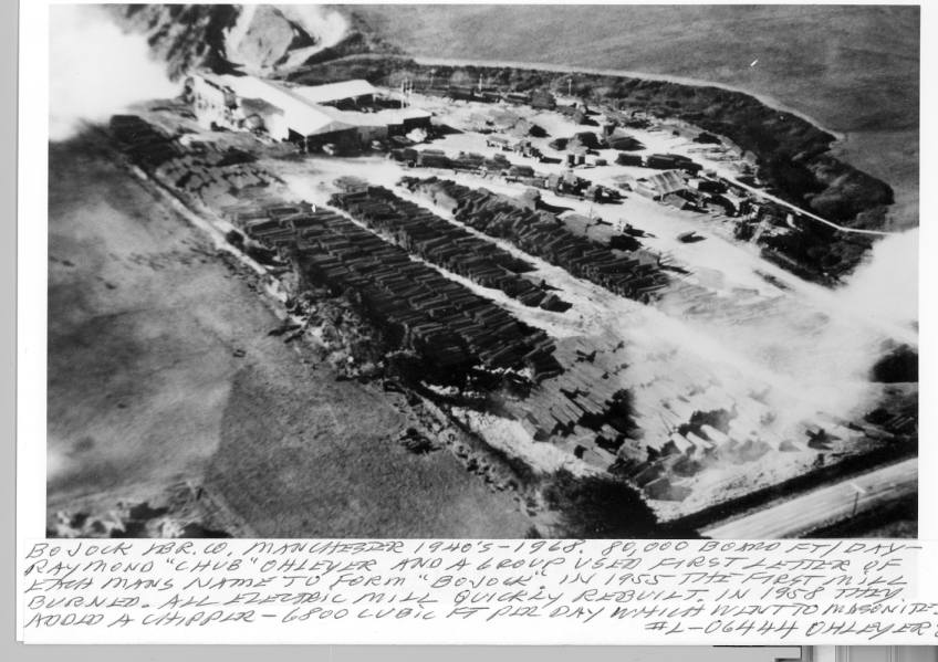 Click on image to enlarge (84K).
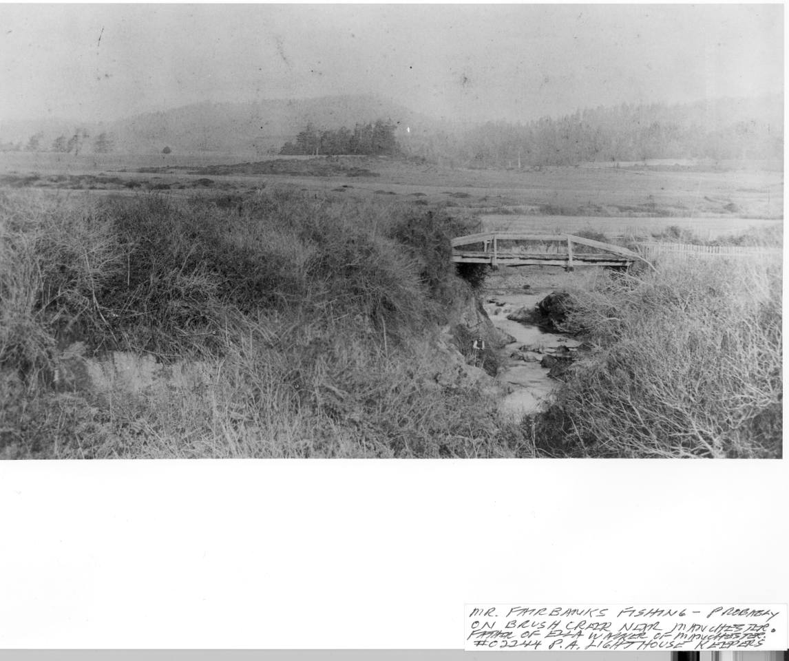 Click on image to enlarge (123K).
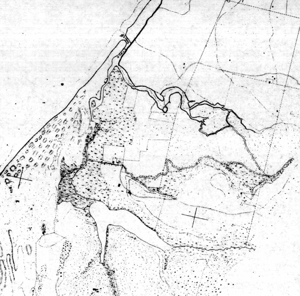 Click on image to enlarge (149K).
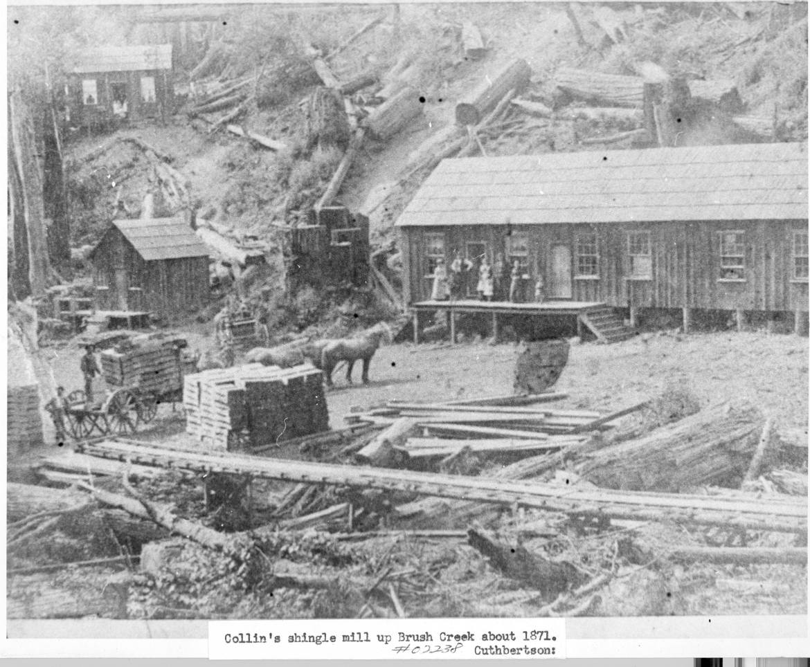