
| Area | Coastal Tributaries South |
| Topic | Climate: Daily Maximum Rainfall - Sail Rock Ranch, 1911-1998 |
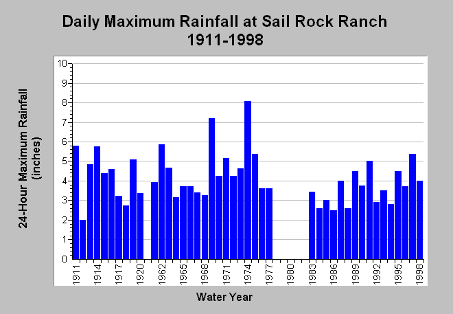
| Caption: This chart shows daily maximum rainfall accumulation at the Sail Rock Ranch rain gage (DWR # F80 7639 50) between 1911 and 1998, missing water years 1921-1960 and 1978-1982. This gage is just outside the South Fork Garcia basin to the west (see Map). For the period of record, the 24-hour rainfall accumulation ranged between 1.98 inches in 1912 to 8.07 inches in 1974. Most recently, January 1, 1997 registered 5.37 inches. Data are compiled by the California Department of Water Resources and were provided by Richard Goodridge. See InfoLinks for more information. | |
 |
To learn more about this topic click Info Links .
To view additional information (data source, aquisition date etc.) about this page, click Metadata .
To view the table with the chart's data, click Chart Table web page.
To download the table with the chart's data, click climate_rainfall_dailymax_sailrockranch.dbf (size 1,029 bytes) .
| www.krisweb.com |