|
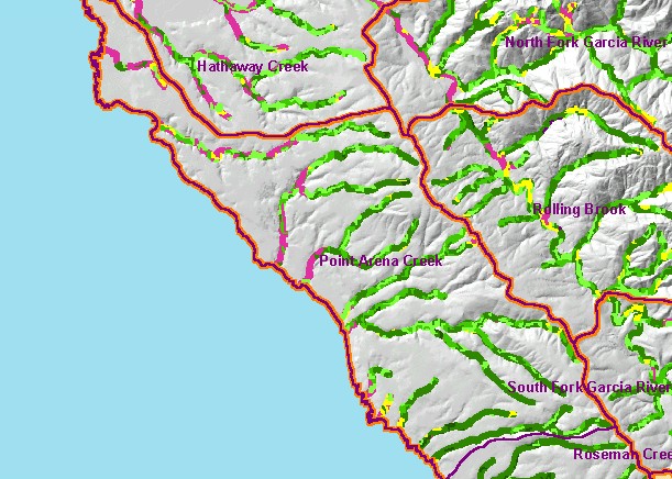
This is a map of vegetation size data within 90-meter riparian buffer zones in the Point Arena Creek Calwater Planning Watershed,
overlaid on top of KRIS sub-basins, and a Grayscale Hillshade. The tree size classifications were derived from Landsat
multi-spectral images taken in 1994. Stand conditions are accurately represented at the one hectare scale. Note that Schooner
Gulch has excellent riparian conditions. The northwestern coastal plain is a flat area shows as non-forest on this map and is mostly
covered by grasslands, hay, and other agricultural lands. While there are more medium/large and larger trees in the riparian zone
of this sub-basin than the rest of the project area, there are still significant areas of early seral stage conditions in much of the
riparian zones in the sub-basin, which may reflect recent timber harvest. Data were provided by the U.S. Forest Service Pacific
Southwest Region Remote Sensing Lab, in cooperation with the California Department of Forestry. Available layers include
Vegetation Size, Topographic Map, and Change in Vegetation (1994-1998). Scale = 1:106,088 .
|
|