
|
Area/Topic | Bibliography | Background | Hypotheses | Home |
|
Map Page.
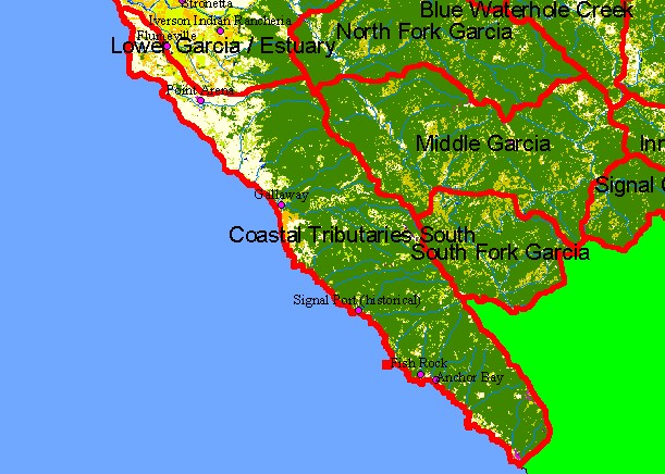
You selected the area Coastal Tributaries South and the topic Map: 1C EPA Landcover/Landuse, Coastal Tribs S. Sub-basin |
| This is a map of the 1992 U.S. Environmental Protection Agency Landcover/Landuse in the Coastal Tributaries South sub-basin. These data are derived from a 1992 Landsat image and show that much of the sub-basin is coniferous forest. Some of the patches of mixed conifer hardwood, grasslands, and herbaceous are likely due to timber harvests and rural residential development. The northwestern coastal plain to the north toward Point Arena is a flat area mostly covered by grasslands and farms. Scale = 1:174,036 . | |||
|
|
||
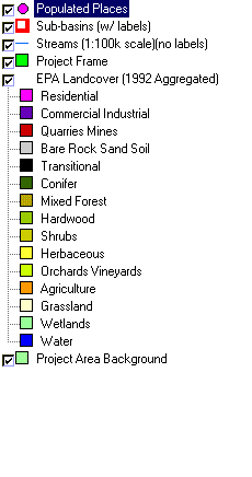
To view metadata about a map layer, click on a link in the table below.
| Name of Layer in Map Legend | Metadata File Name |
|---|---|
| Populated Places | pop_places24.shp.txt |
| Sub-basins (w/ labels) | subbasins.shp.txt |
| Streams (1:100k scale)(no labels) | streams100.shp.txt |
| Project Frame | Unavailable |
| EPA Landcover (1992 Aggregated) | lndcov2.tif.txt |
| EPA Landcover (1992) | lndcov.tif.txt |
| Topo Map (1:24k scale)(USGS) | Unavailable |
| Project Area Background | Unavailable |
| www.krisweb.com |