|
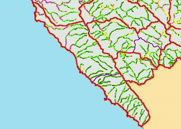
This is a map of vegetation size data within 90-meter riparian buffer zones in the Coastal Tributaries South sub-basin. The tree size
classifications were derived from Landsat multi-spectral images taken in 1994. Stand conditions are accurately represented at the
one hectare scale. The coastal plain toward Pt Arena to the north is a grassy area and riparian zones show as non-forest on this
map. Galloway Creek, Schooner Gulch and other tributaries south to Roseman Creek have mature canopies of larger diameter
trees. Data were provided by the U.S. Forest Service Pacific Southwest Region Remote Sensing Lab, in cooperation with the
California Department of Forestry. Available layers include Vegetation Size, Topographic Map, Grayscale Hillshade, and Change
in Vegetation (1994-1998). Scale = 1:174,483 .
|
|